
How to Distinguish
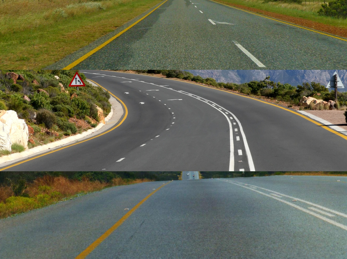
- Traffic keeps to the left-hand side
- The country-code domain is .za
- Homes often feature burglar bars (iron grilles)
- If edge lines are present they are usually orange and the center line is white
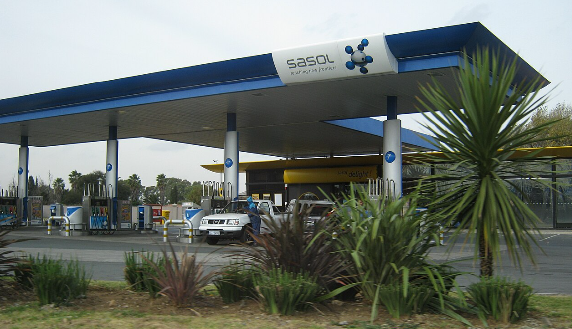
- Sasol is a South African energy and chemical company that operates fuel stations
- Road numbers such as “M1” also appear in Australia, but the font differs
- Place names frequently contain double vowels such as “oo” or “ee”
Signs you can find


.svg)


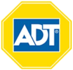
Security measures often include burglar bars (iron grilles) mounted on the inside or outside of windows, and fences frequently add barbed wire. Electric wires stretched across the top of fences are also common. Stickers from security companies such as “ADT” or “BLUE” are often posted near the entrance(References ADT Inc.). Even though the example below is low resolution, you can still make out the ADT sticker as well as the wire on the fence and the grilles inside the window.

By NJR ZA - Own work, CC BY-SA 3.0, Link

Traffic keeps to the left. Where edge lines are painted they tend to be orange on the outside and white down the center. Some stretches lack side markings altogether.
Sasol is a South African energy and chemical company(from Wikipedia 『Sasol』). It is the seventh-largest coal mining company in the world and also markets related chemical and petroleum products.
Green signs carry the route numbers, and the typeface differs from the Australian version—the sign on the left is South African, the one on the right is Australian. Place names with double vowels such as “oo” and “ee” are also common here.


.jpg#/media/File:South_Africa-N10-001_(cropped).jpg)
By NJR ZA - Own work, CC BY-SA 3.0, Link
Minibus-style taxis are a very common sight.
.jpg#/media/File:Wikimania_2018,_Cape_Town_(P1050535).jpg)
By Matti Blume - Own work, CC BY-SA 4.0, Link
The label P522 on this bollard is actually a route number, so don’t miss it.
From time to time you can spot poles that look similar to ones in Chile.
Narrow down state/region
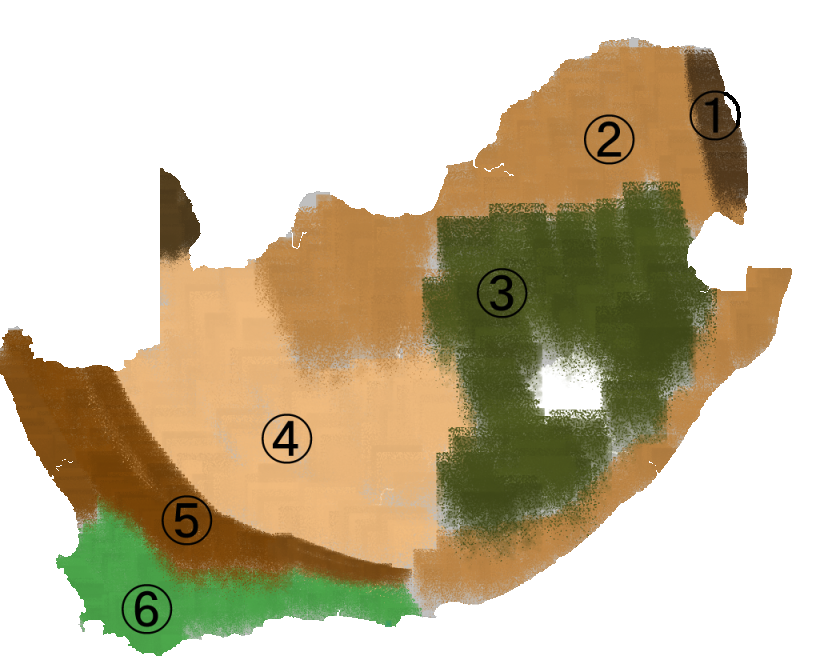
- Vegetation differs by region:
- 1. National parks
- 2. Savanna
- 3. Grassland biome dominated by grass(References SAMBI)
- 4. Nama Karoo, a shrubland where drought occurs frequently
- 5. Succulent Karoo, rich in succulent plants(References SAMBI)
- 6. Fynbos, a Mediterranean-type climate with many needle-like leaves(References Wikipedia \)
The map is roughly color coded by hand, so treat it as a reference guide only(References SAMBI).
Intersections often have distinctive stonework and lush surroundings.
Savannas appear both in the northern interior and along the coastline.
The grassland biome surrounds Lesotho; you may see flat-topped Drakensberg mountains in the distance.
The Nama Karoo is a harsh environment where drought is common and some locations barely have any grass.
Agriculture
- ■ Grapes: around Cape Town in the southwest
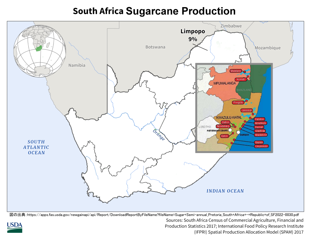
- ■ Sugarcane: along the east coast
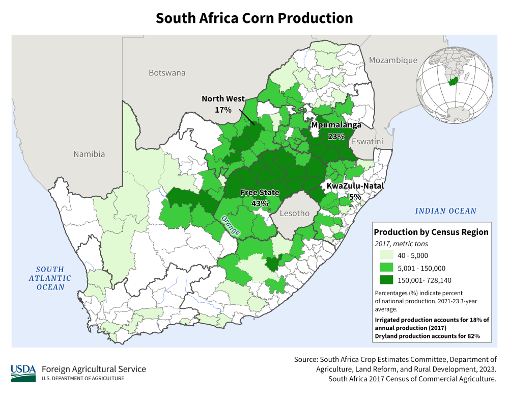
- ■ Corn: around the northern part of the Free State
- ■ Livestock such as sheep — regions where farming is difficult and vegetation is sparse
- (References Southern Africa - Crop Production Maps)
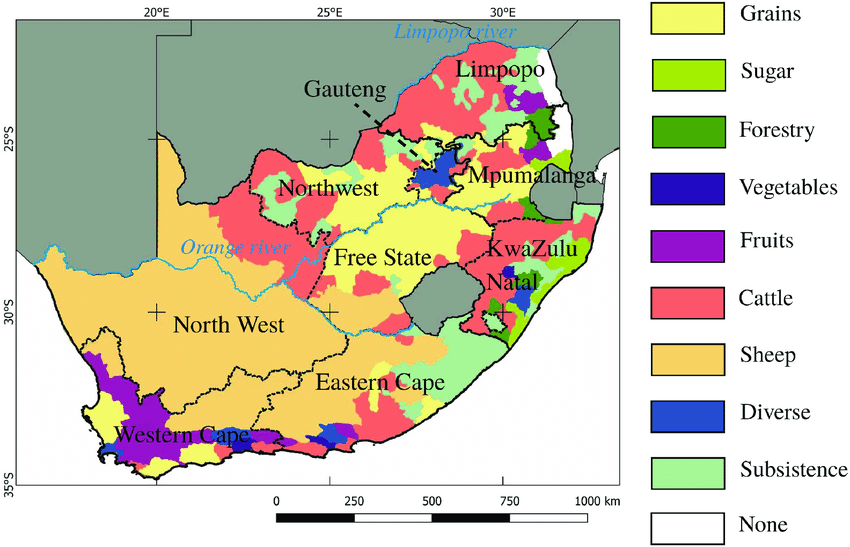
Purple “Fruit” areas indicate vineyards, while the light-green “Sugar” region in the east shows sugarcane.
- Landline area codes help pinpoint the region
- Several roads cut across the Drakensberg Mountains
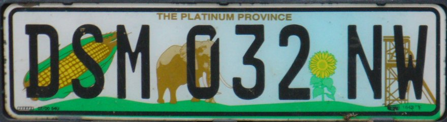
- License plates around Lesotho have a greenish tint(References Vehicle registration plates of South Africa)
Petite map des téléphones fixes d'Afrique du Sud que j'ai faite pour devenir meilleure à @geoguessr 😍 pic.twitter.com/A4DJEFwLMv
— Armire 🌸 (@Armire) March 28, 2023
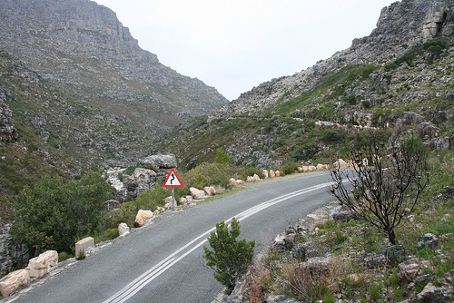
The photo is likely the R301, also called Bain’s Kloof Pass. Routes that cross the Drakensberg, such as the R301, R323, R324, R62, and N1, often have steep rock faces lining both sides.
Plates in North West Province, Free State Province, and Eastern Cape Province are green and depict grassland motifs.
Public Domain, Link
Narrow down city/town
- Street View also covers the island of Robben Island
Provinces of South Africa (9)
Try the quiz- Northern Cape
- KwaZulu-Natal
- Free State
- Eastern Cape
- Limpopo
- North West
- Mpumalanga
- Western Cape
- Gauteng首都プレトリア・最大都市ヨハネスブルグ
Representative Companies


| Company | Ticker | Description | Financials | Dividend History |
|---|---|---|---|---|
| Gold Fields | The eighth-largest gold producer in the world, operating mines not only in South Africa but also in countries such as Australia and Chile. | |||
| Harmony Gold Mining | Owns gold and silver mines in South Africa and operates the Hidden Valley open-pit gold and silver mine in Morobe Province, Papua New Guinea(References The Hidden Valley mine). |