Australia

clues 31Regions 12Updated 2023-04-20

Quiz ▾

LanguageEnglish
Driving sideDrives on the left
Domain.au
Camera gensGen 1–4Small Cam

Whole area6

Clues that work anywhere in this area

Plants & farming★★★

Eucalyptus trees are everywhere, and utility poles are often made from eucalyptus wood too. Besides the green wooden poles, some are made of steel to resist termites.

Examples1SourcesStobie pole
Bollard★★★

Bollards' red reflectors are basically only on one side, and the red area is small — unlike New Zealand, where they're wrapped fully around front and back.

Examples12345Sourcesplonkit
Open in Street View2
Three Australian bollards next to one New Zealand bollard
Signs★★★

If a GIVE WAY sign has black lettering, it's Australia. Red lettering means New Zealand.

Examples1Sourcesplonkit
Australia (black lettering)
New Zealand (red lettering)
Signs★★★

If the speed limit is shown on a narrow white plate, it's Australia.

Examples12
Australia
Australia
New Zealand
New Zealand
Road★★★

There's a road-number sign format like "M1." South Africa uses the same format, but with a different font.

Watch outSouth African place names often contain letter pairs like "oo" or "ee," and the signs tend to have squarer edges — once you're used to it, telling them apart is quick.
See alsoSouth Africa
South Africa
South Africa
Australia
Australia
Difficult place★★★

Christmas Island sometimes comes up. Google Car looks distinctive there, and yellow plates are common.

See alsoChristmas Island

Vegetation

Western AustraliaNorthern TerritorySouth AustraliaQueenslandNew South WalesJervis Bay TerritoryVictoriaTasmaniaMacquarie IslandAustralian Capital Territory
Western AustraliaNorthern TerritorySouth AustraliaQueenslandNew South WalesJervis Bay TerritoryVictoriaTasmaniaMacquarie IslandAustralian Capital TerritoryKimberley to Victoria River district
Western AustraliaNorthern TerritorySouth AustraliaQueenslandNew South WalesJervis Bay TerritoryVictoriaTasmaniaMacquarie IslandAustralian Capital TerritoryWet Tropics
Western AustraliaNorthern TerritorySouth AustraliaQueenslandNew South WalesJervis Bay TerritoryVictoriaTasmaniaMacquarie IslandAustralian Capital TerritoryDry interior
Western AustraliaNorthern TerritorySouth AustraliaQueenslandNew South WalesJervis Bay TerritoryVictoriaTasmaniaMacquarie IslandAustralian Capital TerritorySouthern Western AustraliaEyre Peninsula to Murray River basin

Where Vegetation clues apply4

Click an item to jump to its clueTap to show the range; tap again or → to jump to the clue

  1. boab
  2. rainforest
  3. spinifex
  4. mallee
Plants & farming★★★★★

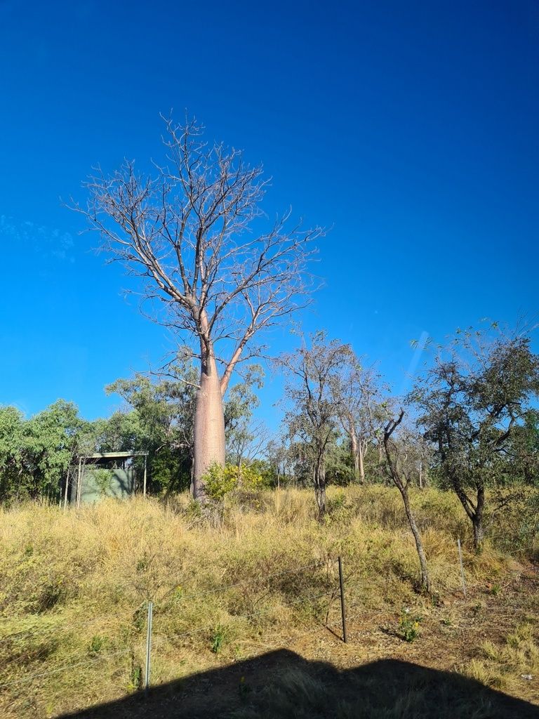
A tree whose trunk swells like a bottle at the base (boab). Its natural range is limited to the Kimberley region of Western Australia and eastward into the Northern Territory.
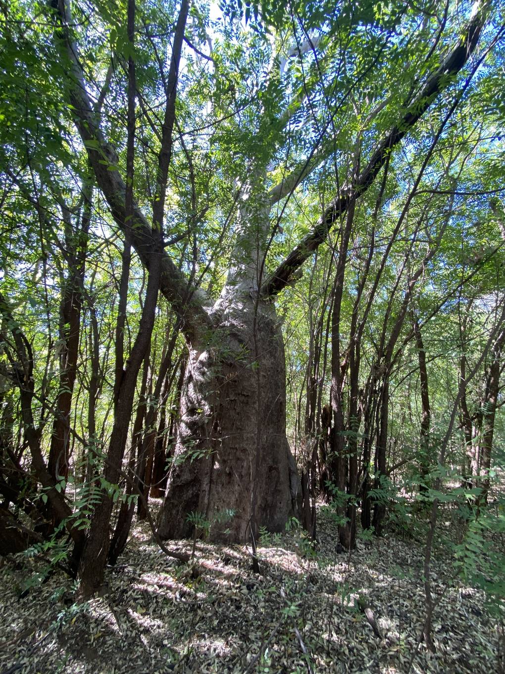
Examples12SourcesAdansonia gregorii - Wikipedia (distribution and form)
Where
Western AustraliaNorthern TerritorySouth AustraliaQueenslandNew South WalesJervis Bay TerritoryVictoriaTasmaniaMacquarie IslandAustralian Capital TerritoryKimberley to Victoria River district
A boab with a swollen trunk base (Northern Territory)
Simon Tonge / CC0
A thick, bottle-like boab trunk (Kununurra, Western Australia)
Richard Fuller / CC0
Plants & farming★★★★

Coastal rainforest thick with palms and dark-green foliage points to the Wet Tropics of northern Queensland.
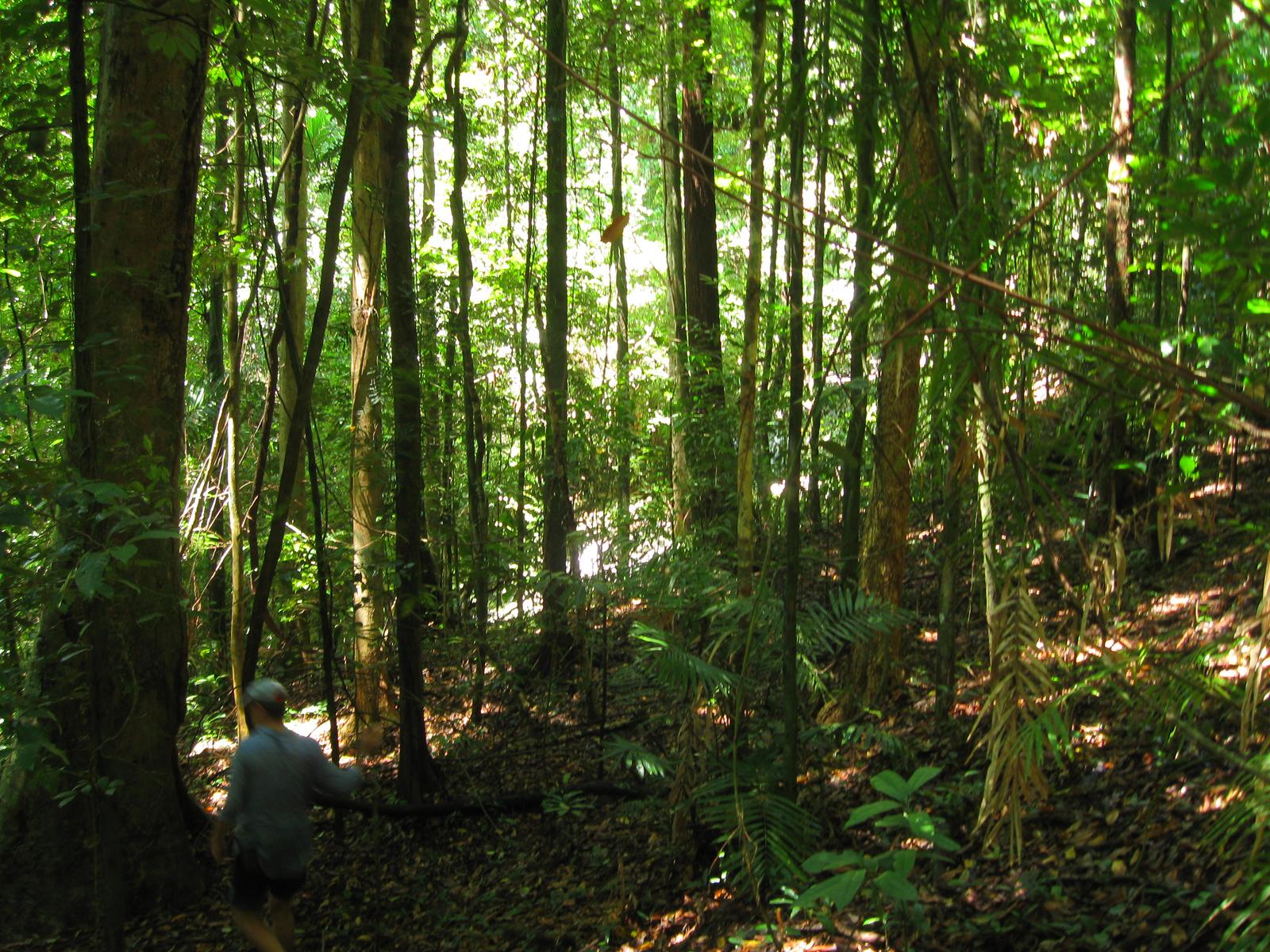
Examples12SourcesWet Tropics of Queensland - Wikipedia (extent, rainfall, vegetation)
Where
Western AustraliaNorthern TerritorySouth AustraliaQueenslandNew South WalesJervis Bay TerritoryVictoriaTasmaniaMacquarie IslandAustralian Capital TerritoryWet Tropics
Daintree rainforest, thick with palms and dark-green trees (northern Queensland)
Killerscene / CC0
Plants & farming★★★

A grass whose stiff, needle-like leaves form round tussocks dotted across the ground (spinifex). If you see round green tussocks dotting red soil, you're in the dry interior.
Examples12SourcesTriodia (plant) - Wikipedia (form and habitat)Pilbara - Wikipedia (vegetation of the Pilbara)
Where
Western AustraliaNorthern TerritorySouth AustraliaQueenslandNew South WalesJervis Bay TerritoryVictoriaTasmaniaMacquarie IslandAustralian Capital TerritoryDry interior
Spinifex forming round tussocks on red soil (Minnipa, South Australia)
Max Tibby / CC0
Plants & farming★★★

A eucalypt shrubland (mallee) where a single "tree" actually branches into multiple stems right at ground level, staying under 10m tall. Found in semi-arid areas with winter rainfall, across Western Australia, South Australia, New South Wales, and Victoria.
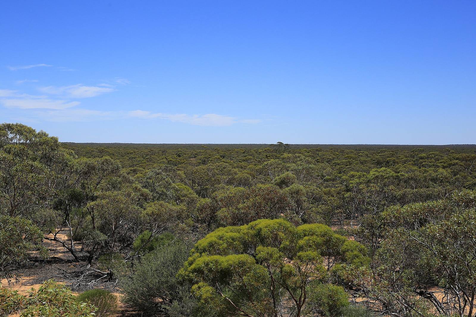
Examples12SourcesMallee (habit) - Wikipedia (form and distribution)
Where
Western AustraliaNorthern TerritorySouth AustraliaQueenslandNew South WalesJervis Bay TerritoryVictoriaTasmaniaMacquarie IslandAustralian Capital TerritorySouthern Western AustraliaEyre Peninsula to Murray River basin
Low, multi-stemmed eucalypts stretching to the horizon (Hattah, Victoria)
Donald Hobern from Copenhagen, Denmark / CC BY 2.0

Soil color

Western AustraliaNorthern TerritorySouth AustraliaQueenslandNew South WalesJervis Bay TerritoryVictoriaTasmaniaMacquarie IslandAustralian Capital Territory

Where Soil color clues apply3

Click an item to jump to its clueTap to show the range; tap again or → to jump to the clue

  1. red
  2. red soil
  3. inland center
Landscape★★★

Soil color can sometimes narrow down the region. The western coast has a lot of red soil, a semi-arid durisol.

Examples1Sourcesdurisol
Where
Western AustraliaNorthern TerritorySouth AustraliaQueenslandNew South WalesJervis Bay TerritoryVictoriaTasmaniaMacquarie IslandAustralian Capital Territory
Landscape★★★

Roads along the northwest coast tend to have especially red soil.

Examples12
Where
Western AustraliaNorthern TerritorySouth AustraliaQueenslandNew South WalesJervis Bay TerritoryVictoriaTasmaniaMacquarie IslandAustralian Capital Territory
Landscape★★★

In the inland center, the soil color is fairly close to the western coast, but the grasses seem different.

Examples1
Where
Western AustraliaNorthern TerritorySouth AustraliaQueenslandNew South WalesJervis Bay TerritoryVictoriaTasmaniaMacquarie IslandAustralian Capital Territory

Utility poles

Utility Pole★★★

Western Australia and Victoria have some utility poles shaped like a mountain.

Where
Western AustraliaNorthern TerritorySouth AustraliaQueenslandNew South WalesJervis Bay TerritoryVictoriaTasmaniaMacquarie IslandAustralian Capital Territory

Terrain

Western AustraliaNorthern TerritorySouth AustraliaQueenslandNew South WalesJervis Bay TerritoryVictoriaTasmaniaMacquarie IslandAustralian Capital Territory
Western AustraliaNorthern TerritorySouth AustraliaQueenslandNew South WalesJervis Bay TerritoryVictoriaTasmaniaMacquarie IslandAustralian Capital TerritoryNullarbor Plain
Western AustraliaNorthern TerritorySouth AustraliaQueenslandNew South WalesJervis Bay TerritoryVictoriaTasmaniaMacquarie IslandAustralian Capital TerritoryNorthern tropicsEspecially common (the Top End)
Western AustraliaNorthern TerritorySouth AustraliaQueenslandNew South WalesJervis Bay TerritoryVictoriaTasmaniaMacquarie IslandAustralian Capital TerritoryTasmania

Where Terrain clues apply3

Click an item to jump to its clueTap to show the range; tap again or → to jump to the clue

  1. Nullarbor
  2. termites
  3. Tasmania
Landscape★★★★★

A place that's completely flat to the horizon with not a single tree, just low, grayish saltbush stretching on — that's the Nullarbor Plain. It spans South Australia and Western Australia.
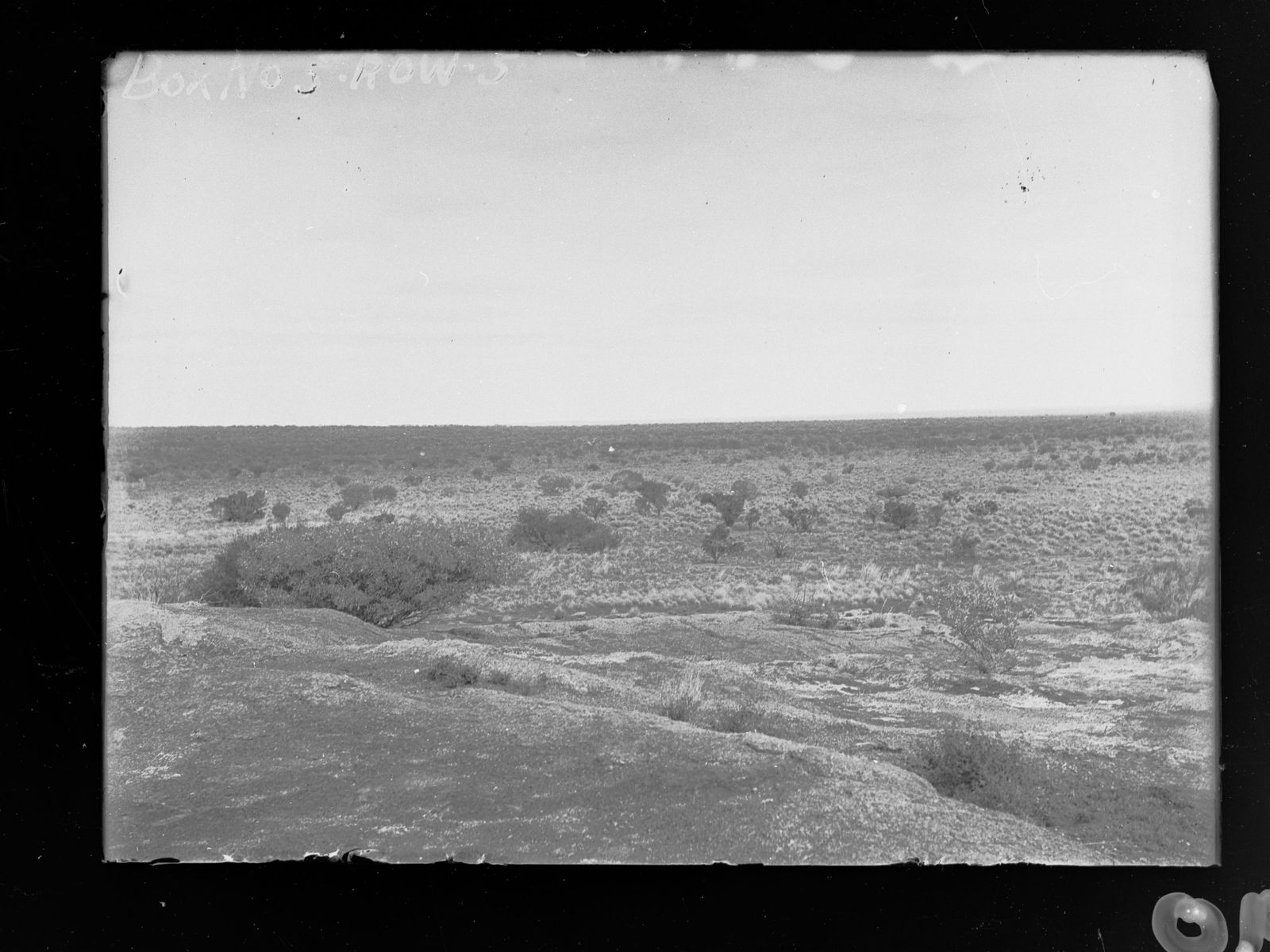
NoteThe name comes from Latin for "no trees." Vegetation is mostly saltbush (genus Atriplex) and bluebush (genus Maireana).
Examples12SourcesNullarbor Plain - Wikipedia (extent, geology, vegetation)
Where
Western AustraliaNorthern TerritorySouth AustraliaQueenslandNew South WalesJervis Bay TerritoryVictoriaTasmaniaMacquarie IslandAustralian Capital TerritoryNullarbor Plain
The Nullarbor Plain, treeless to the horizon (1900s, during the East-West Railway survey)
State Government Photographer / CC0
Landscape★★★★

Brown, spiky, tower-like mounds jutting up out of grassland are termite mounds. Cathedral-shaped mounds are common in the Northern Territory.
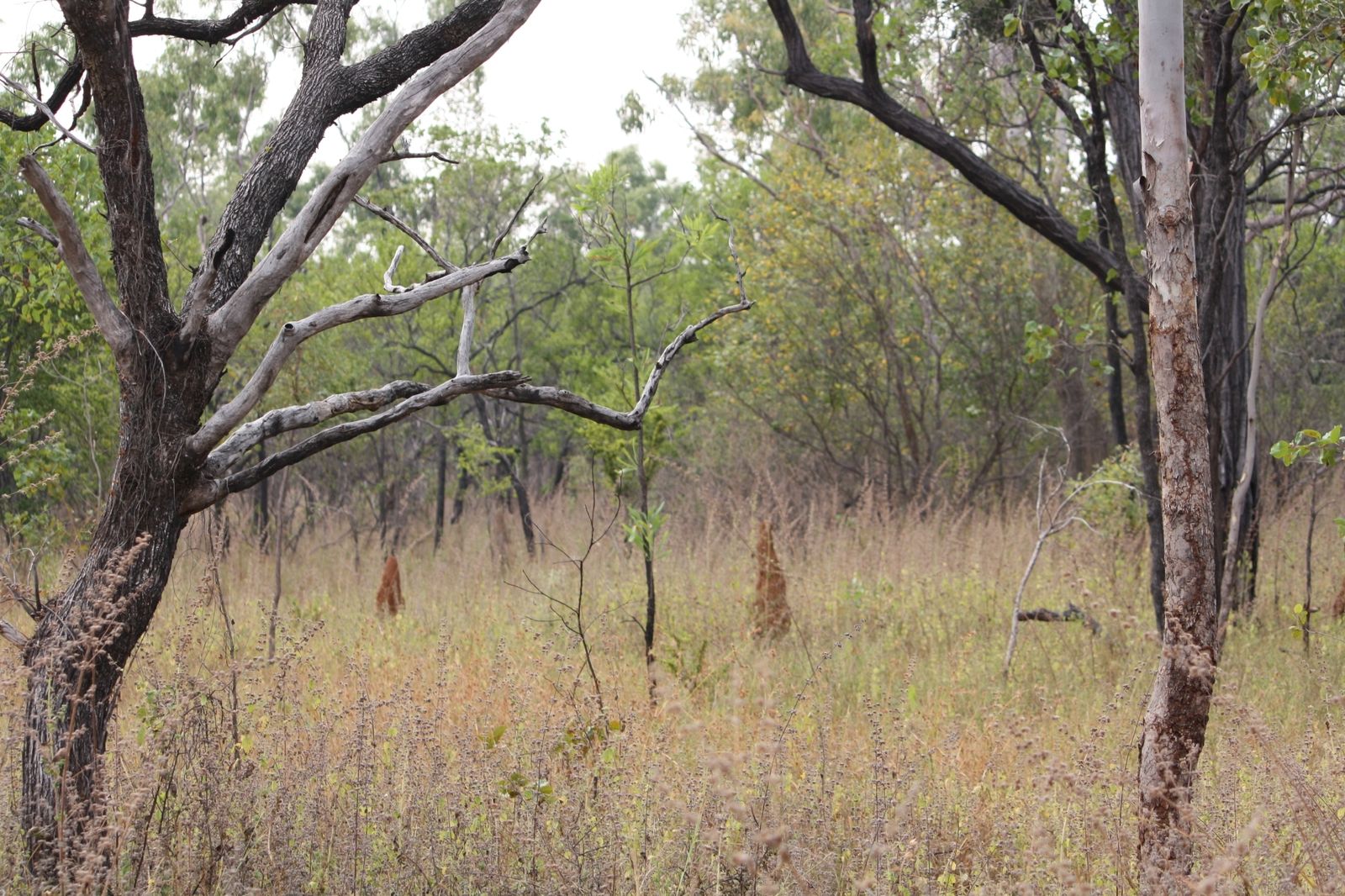
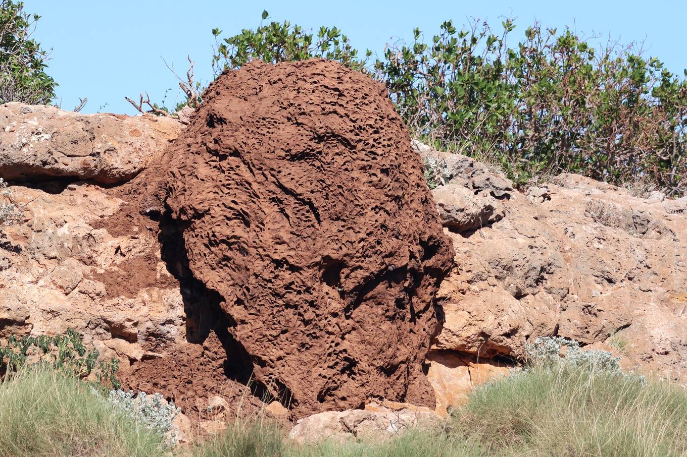
SourcesNasutitermes triodiae - Wikipedia (distribution and mound shape/size)
Where
Western AustraliaNorthern TerritorySouth AustraliaQueenslandNew South WalesJervis Bay TerritoryVictoriaTasmaniaMacquarie IslandAustralian Capital TerritoryNorthern tropicsEspecially common (the Top End)
  • Especially common (the Top End)
  • Northern tropics
Termite mounds jutting up out of grassland (Mareeba, Queensland)
georgiasteel / CC0
A large termite mound made of red soil (Cape Range, Western Australia)
Astrid Osborne / CC0
Landscape★★★

If lush, rolling green pastures or dark, mossy forest feel unusually cool for the mainland, it's Tasmania. The west gets a lot of rain and still has temperate rainforest.
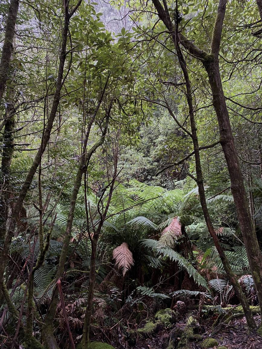
Examples12SourcesTasmania - Wikipedia (climate, terrain, agriculture)
Where
Western AustraliaNorthern TerritorySouth AustraliaQueenslandNew South WalesJervis Bay TerritoryVictoriaTasmaniaMacquarie IslandAustralian Capital TerritoryTasmania
Damp forest thick with moss and ferns (Wellington Park, Tasmania)
Elkeandeve / CC0

Agriculture

Western AustraliaNorthern TerritorySouth AustraliaQueenslandNew South WalesJervis Bay TerritoryVictoriaTasmaniaMacquarie IslandAustralian Capital Territory
Western AustraliaNorthern TerritorySouth AustraliaQueenslandNew South WalesJervis Bay TerritoryVictoriaTasmaniaMacquarie IslandAustralian Capital TerritoryMain producing area (around Townsville)CommonCommonLess common
Western AustraliaNorthern TerritorySouth AustraliaQueenslandNew South WalesJervis Bay TerritoryVictoriaTasmaniaMacquarie IslandAustralian Capital TerritoryThe Wheatbelt properSimilar fields continue
Western AustraliaNorthern TerritorySouth AustraliaQueenslandNew South WalesJervis Bay TerritoryVictoriaTasmaniaMacquarie IslandAustralian Capital TerritoryVolume center (irrigated land along the Murray)Famous-by-name regions

Where Agriculture clues apply3

Click an item to jump to its clueTap to show the range; tap again or → to jump to the clue

  1. sugarcane
  2. Wheatbelt
  3. vineyards
Plants & farming★★★★

Tall sugarcane fields stretching along the coast point to Queensland.
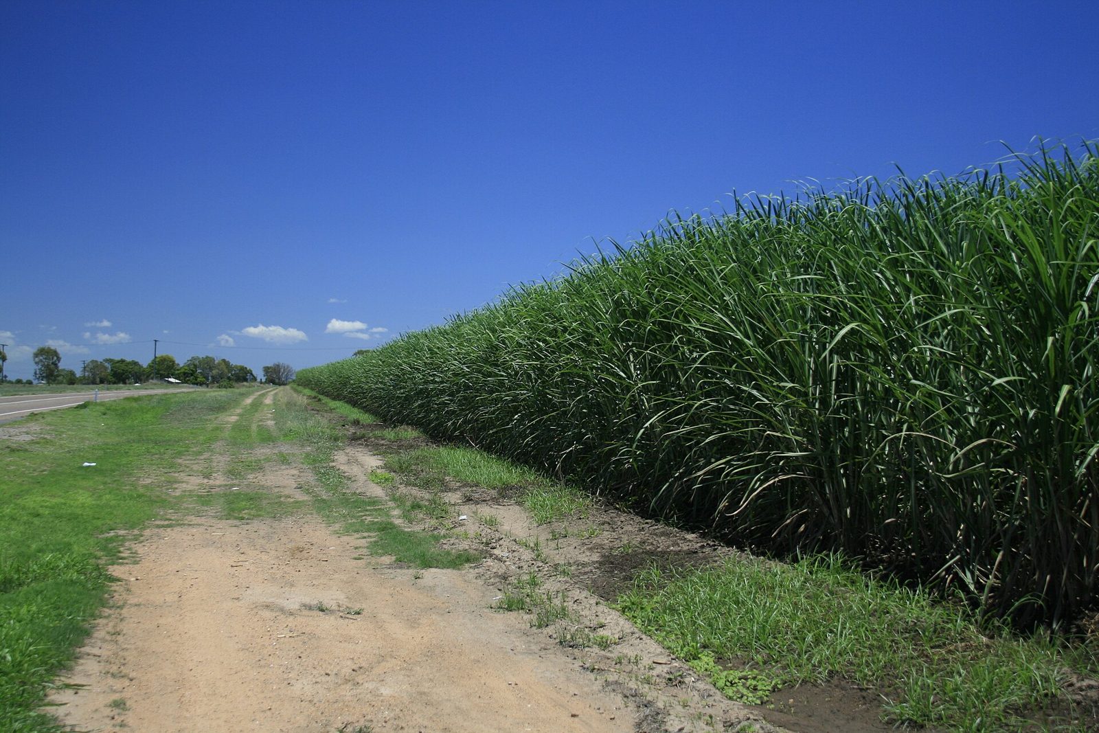
Examples12SourcesSugarcane, experimental regional estimates - Australian Bureau of Statistics (harvest by region)
Where
Western AustraliaNorthern TerritorySouth AustraliaQueenslandNew South WalesJervis Bay TerritoryVictoriaTasmaniaMacquarie IslandAustralian Capital TerritoryMain producing area (around Townsville)CommonCommonLess common
  • Main producing area (around Townsville)
  • Common
  • Less common
Sugarcane standing like a wall along the road (north Queensland)
Phil / CC BY 2.0
Plants & farming★★★

The Wheatbelt north and east of Perth is a vast stretch of wheat fields and sheep pasture with the trees almost entirely cleared away. It grows drier and more pasture-focused toward its eastern edge.
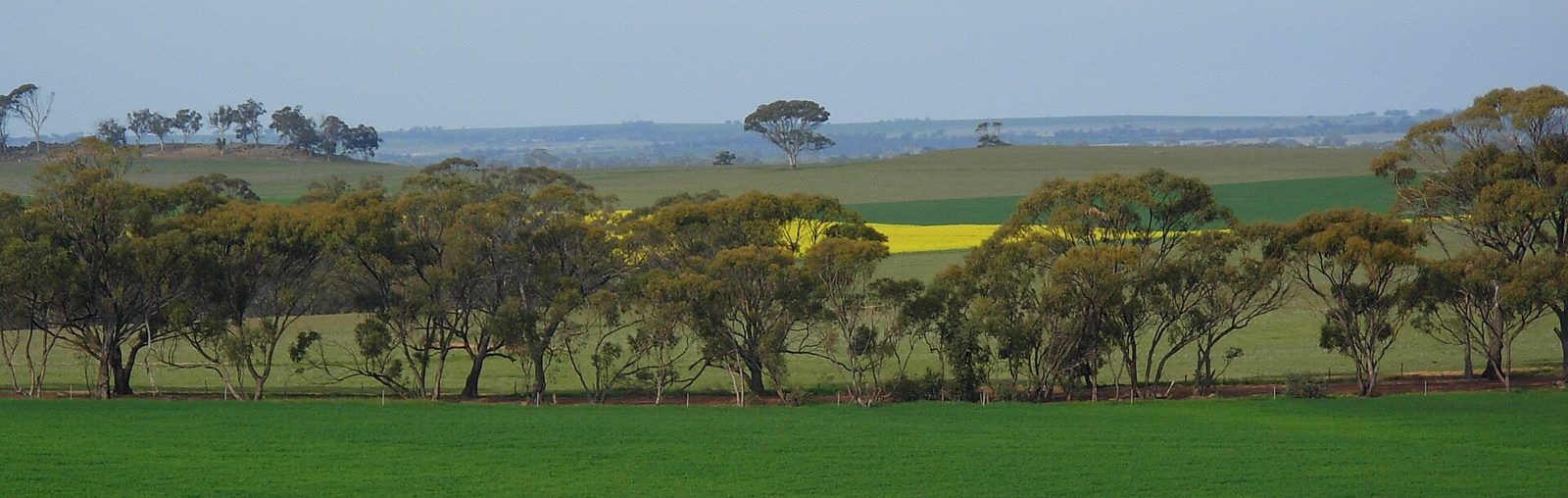
Examples12SourcesWheatbelt (Western Australia) - Wikipedia (extent, area, produce)
Where
Western AustraliaNorthern TerritorySouth AustraliaQueenslandNew South WalesJervis Bay TerritoryVictoriaTasmaniaMacquarie IslandAustralian Capital TerritoryThe Wheatbelt properSimilar fields continue
  • The Wheatbelt proper
  • Similar fields continue
Wheat and canola fields with leftover eucalypts (near Northam, Western Australia)
JarrahTree / CC BY 2.5 au
Plants & farming★★

Neatly trellised vineyards mean a wine region. South Australia accounts for over half of national production.
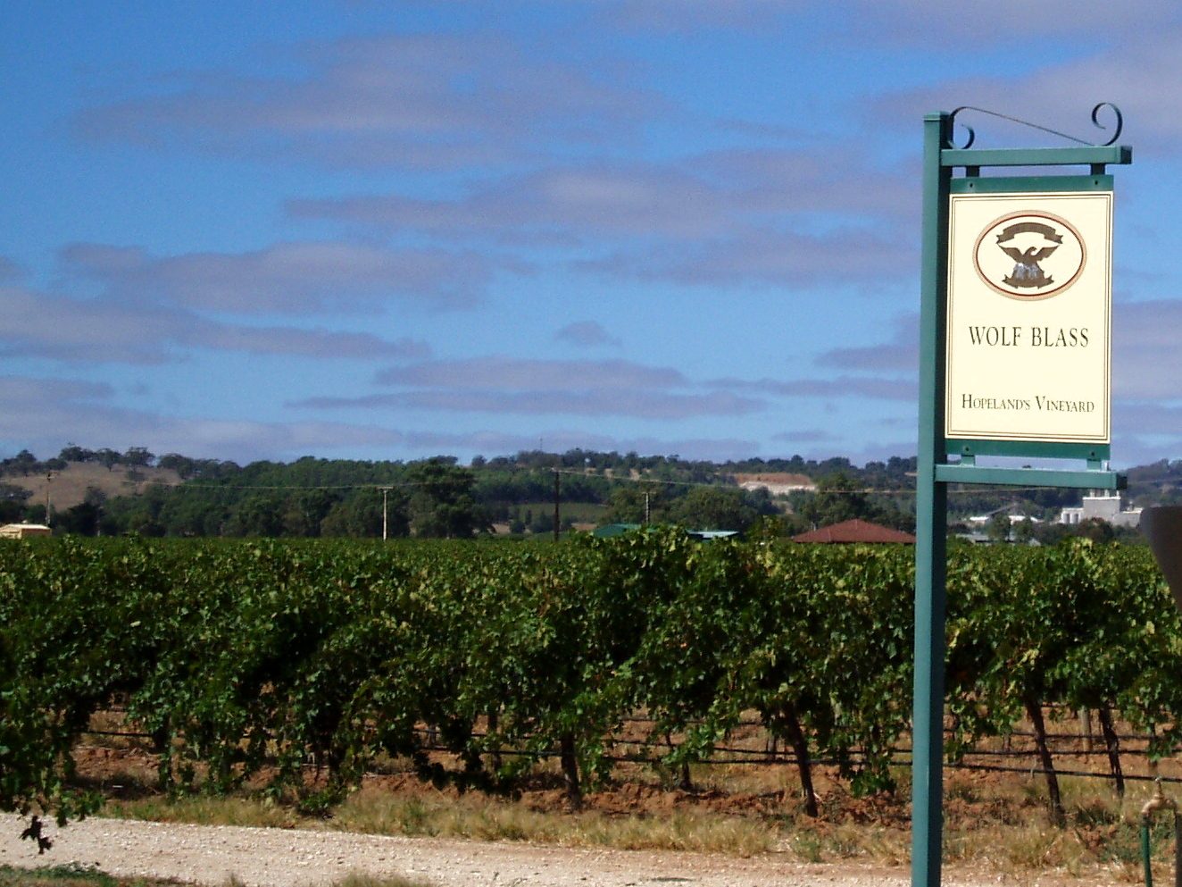
Examples12SourcesAustralian wine - Wikipedia (state shares and main regions)
Where
Western AustraliaNorthern TerritorySouth AustraliaQueenslandNew South WalesJervis Bay TerritoryVictoriaTasmaniaMacquarie IslandAustralian Capital TerritoryVolume center (irrigated land along the Murray)Famous-by-name regions
  • Volume center (irrigated land along the Murray)
  • Famous-by-name regions
Vineyards lining gentle hills (Barossa Valley, South Australia)
Amanda Slater / CC BY-SA 2.0

Industry & Resources

Western AustraliaNorthern TerritorySouth AustraliaQueenslandNew South WalesJervis Bay TerritoryVictoriaTasmaniaMacquarie IslandAustralian Capital Territory
Western AustraliaNorthern TerritorySouth AustraliaQueenslandNew South WalesJervis Bay TerritoryVictoriaTasmaniaMacquarie IslandAustralian Capital TerritoryThe PilbaraMining concentrated here (Tom Price to Newman)
Western AustraliaNorthern TerritorySouth AustraliaQueenslandNew South WalesJervis Bay TerritoryVictoriaTasmaniaMacquarie IslandAustralian Capital TerritoryBowen BasinHunter Valley
Western AustraliaNorthern TerritorySouth AustraliaQueenslandNew South WalesJervis Bay TerritoryVictoriaTasmaniaMacquarie IslandAustralian Capital TerritoryEastern GoldfieldsAround Kalgoorlie

Where Industry & Resources clues apply3

Click an item to jump to its clueTap to show the range; tap again or → to jump to the clue

  1. Pilbara
  2. coal
  3. gold mine
Landscape★★★★

Reddish-brown rocky hills, blazing red soil, and a long single-track iron-ore railway point to the Pilbara in northern Western Australia.
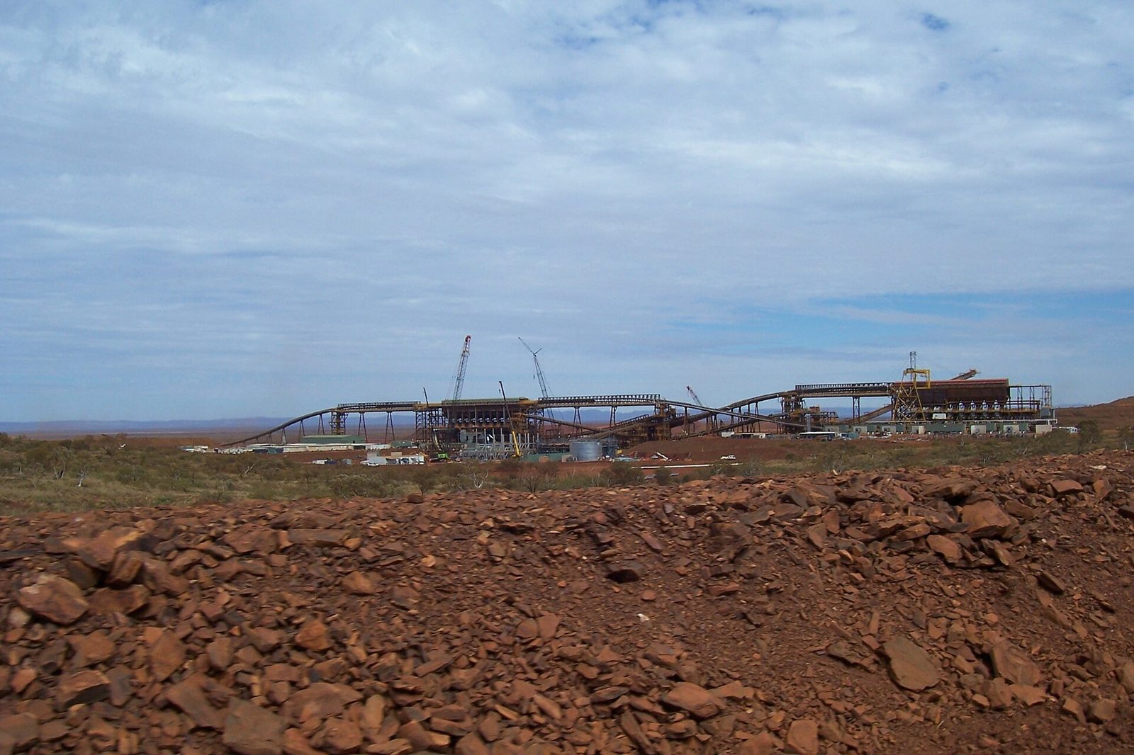
Examples1SourcesPilbara - Wikipedia (location, mining, landscape)
Where
Western AustraliaNorthern TerritorySouth AustraliaQueenslandNew South WalesJervis Bay TerritoryVictoriaTasmaniaMacquarie IslandAustralian Capital TerritoryThe PilbaraMining concentrated here (Tom Price to Newman)
  • Mining concentrated here (Tom Price to Newman)
  • The Pilbara
Red soil and iron-ore loading facilities (Pilbara, Western Australia)
Geez-oz / CC BY-SA 3.0
Landscape★★★

Black terraced open-cut slopes, long trains loaded with coal, and black coal stockpiles point to a coalfield. The main ones are the Bowen Basin in central Queensland and the Hunter Valley in New South Wales.

SourcesBowen Basin - Wikipedia (extent, reserves, mines)Hunter Valley - Wikipedia (open-cut mining and the Port of Newcastle)Coal in Australia - Wikipedia (production by state)
Where
Western AustraliaNorthern TerritorySouth AustraliaQueenslandNew South WalesJervis Bay TerritoryVictoriaTasmaniaMacquarie IslandAustralian Capital TerritoryBowen BasinHunter Valley
  • Bowen Basin
  • Hunter Valley
Landscape★★

Mining equipment and heaped waste rock amid red soil and sparse eucalypts points to Western Australia's Eastern Goldfields (around Kalgoorlie and others).

Examples12SourcesFimiston Open Pit - Wikipedia (Super Pit location and size)Gold mining in Western Australia - Wikipedia (state share and main producing areas)
Where
Western AustraliaNorthern TerritorySouth AustraliaQueenslandNew South WalesJervis Bay TerritoryVictoriaTasmaniaMacquarie IslandAustralian Capital TerritoryEastern GoldfieldsAround Kalgoorlie
  • Around Kalgoorlie
  • Eastern Goldfields

License plates

Tasmania

Utility Pole★★★

Tasmania's (TAS) utility poles have something green wrapped around them. The same thing turns up on the Furneaux Islands and King Island.

Examples12

Queensland

Utility Pole★★★

Queensland's (QLD) utility poles sometimes have a round blue marker. Black-painted numbers and horizontal insulators tilted slightly upward are also characteristic of Queensland.

SourcesplonkitDaigo (@Daig_O)'s utility-pole tips

South Australia

Utility Pole★★★

South Australia's (SA) utility poles look like they're sandwiched between boards.

Examples1

Northern Territory

Utility Pole★★★

The Northern Territory's (NT) utility poles are made of steel, with a distinctive ladder-like lattice.

Sourcesplonkit

Western Australia

Signs★★★

In Western Australia, road signs use yellow posts.

Victoria

Signs★★★

If a sticker near a traffic signal box or sign reads "VicRoads," it may be Victoria.

SourcesVicRoads
Open in Street View2

Regions

Hover a region on the map to see its name
Western Australia Northern Territory South Australia Queensland New South Wales Jervis Bay Territory Victoria Tasmania Macquarie Island Australian Capital Territory

Hover a region on the map to see its name

Nearby areas

A page of play notes and identification clues for GeoGuessr.