 Tunisia
LanguageArabic, French
Driving sideDrives on the right
Domain.tn
Easily confused with:JordanQuizzes for this area:Tunisia State Quiz, Tunisia City Quiz, Area code quiz (Tunisia)
Whole area6
Clues that work anywhere in this area


Language & Script★★★
Arabic is the official language, but French is also widely used.

License Plate★★★
There are black license plates, alongside a fair number of other colors too.

Landscape★
You'll often see light-blue bags, or maybe plastic tape (?), discarded by the roadside.
Narrowing down the region6
Once you know the area: which part of it
Area Code
Phone area codes narrow down the region
Phone area codes are assigned by region. When a number shows up on a sign, an advert or a van, its leading digits narrow the location down to a part of the country.
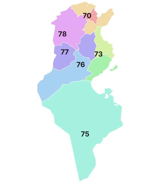 Coloured by leading digit
Agriculture
Where Agriculture clues apply4
Click an item to jump to its clueTap to show the range; tap again or → to jump to the clue
Plants & farming★★★★★
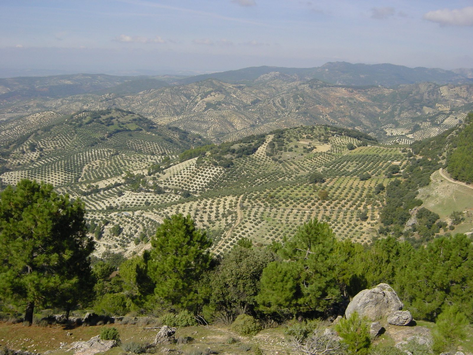
If you see flat, sandy fields with short olive trees spaced wide apart in a grid pattern, stretching to the horizon, that's olive — especially common around Sfax and along the central coast (the Sahel).
NoteThere are olives in the north too, but mixed with wheat fields and other fruit trees. Endless rows of nothing but olives point to the central to southeast.
Examples1SourcesSfax: pôle agricole - Sfax International (Sfax governorate's olive-grove area and national share)Politique - Tunisie 2012 - Conseil oléicole international (share of olive farmers by region)
Plants & farming★★★★
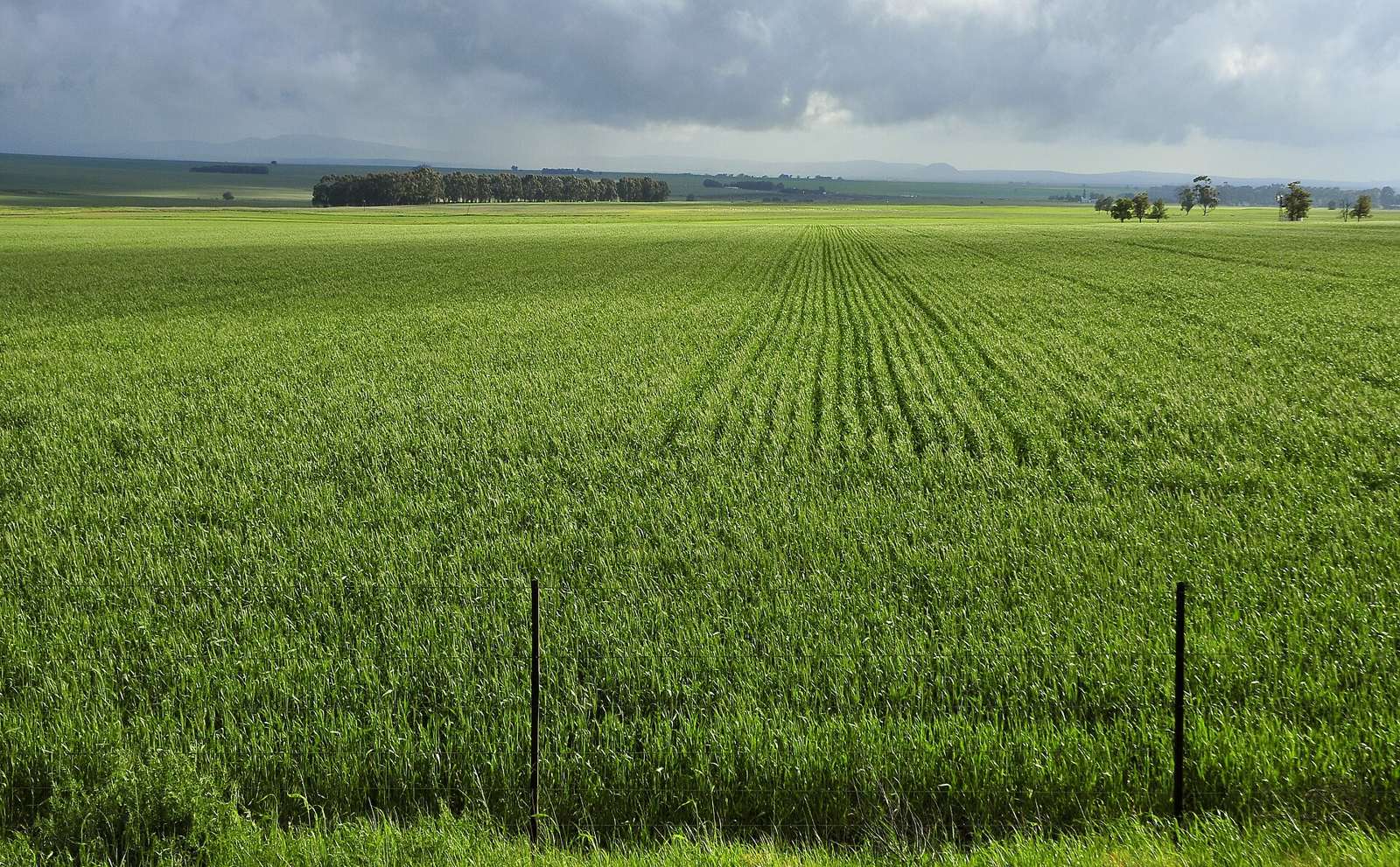
Rolling hills covered edge-to-edge in wheat fields — green in spring, golden in early summer, and reduced to stubble and brown soil after the summer harvest — mean the northern wheat belt. Olive trees thin out here.
Plants & farming★★★★
If a dense, dark-green stand of tightly planted date palms suddenly appears amid dry sand and rock, with mud walls or irrigation channels visible beneath the palms, that's an oasis in the southwest.

Plants & farming★★★
Waist-high cacti made of stacked, flat oval pads, planted in many rows as fields, mean prickly pear — common on the dry central-west plateau.
TipA single row planted as a hedge turns up anywhere, including the north. Many rows together as a field are the central-west's signature.
SourcesInsect infestation ravages North African prickly pear - Phys.org (area and Kasserine governorate)Land Degradation and Resilience Pathways: The Role of Opuntia Ficus-Indica in Semi-Arid Tunisia - Remote Sensing (change in area in Zelfen, Kasserine)
Photo coming soonPlants & farming
Vegetation
Plants & farming★★★★
If both sides of a mountain road are filled with deep forest, the trees showing reddish-brown bark stripped from their trunks, that's the cork-oak forest of the Kroumirie Mountains in the northwest.
Photo coming soonPlants & farming
Terrain
Landscape★★★
A plain of sand and gravel with almost no grass or trees, or sand dunes pressing right up against the road, mean desert — the south, beyond Chott el Djerid.
Photo coming soonLandscape
No clues for this category and place yet.
Regions
Hover a region on the map to see its nameHover a region on the map to see its name
Nearby areas
A page of play notes and identification clues for GeoGuessr.