
How to Distinguish
- Language is English
- Cars drive on the right
- The domain is .ng
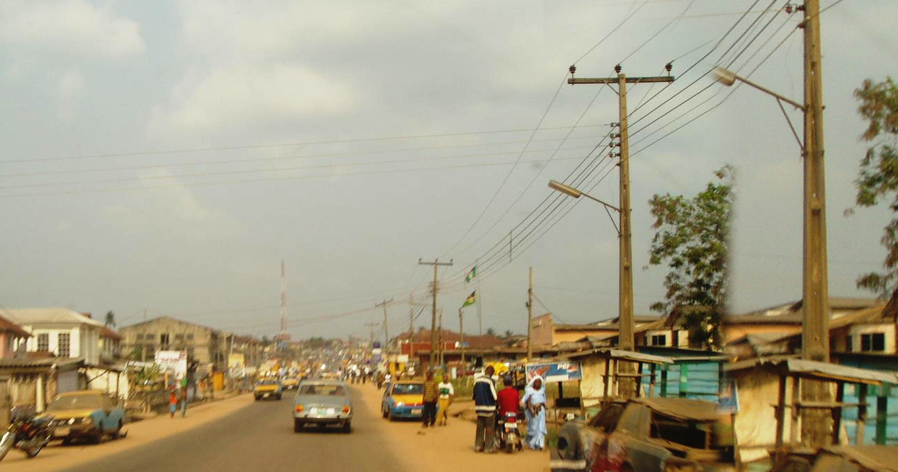
- Small yellow taxis are common in towns
- Police cars often follow along(by Geotips )
- The Google car is often visible(by Geotips )
- About 50% of the population is Muslim
Signs you can find


Segmented utility poles appear. Note that São Tomé and Príncipe also has segmented poles.
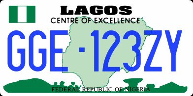
Nigeria drives on the right. License plates vary; they can look faintly green or blue(References Vehicle registration plates of Nigeria).
By Pharm Ede Moses - Own work, CC BY-SA 4.0, Link
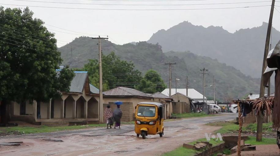
Small taxis called Keke-napep run in towns. Signs are written in English. Many Keke-napep are yellow, but some towns use other colors.

Perhaps due to security concerns, a police car often follows. In more recent captures, the police car may be missing, so be careful.
Seven Up seems to be popular(References JETRO-IDE Nigeria - Africa Growth Company File)

Nigeria in 56 Chapters (Area Studies)
Nigeria in West Africa has a population of over 200 million and the largest GDP in Africa. Despite complex regional conflict and political instability since independence, it has not fully realized its potential, but its presence as the 'giant of Africa' is set to grow in the global economy.
Amazonで見るNarrow down state/region
Vegetation and elevation
- Vegetation varies by location
- Coast: in swamp forests along the coast, there are few roads outside city areas
- Southeast: you may see oil palm plantations
- Southwest
- Central: more grass and low shrubs
- Far north: outside the cities, there is almost no grass
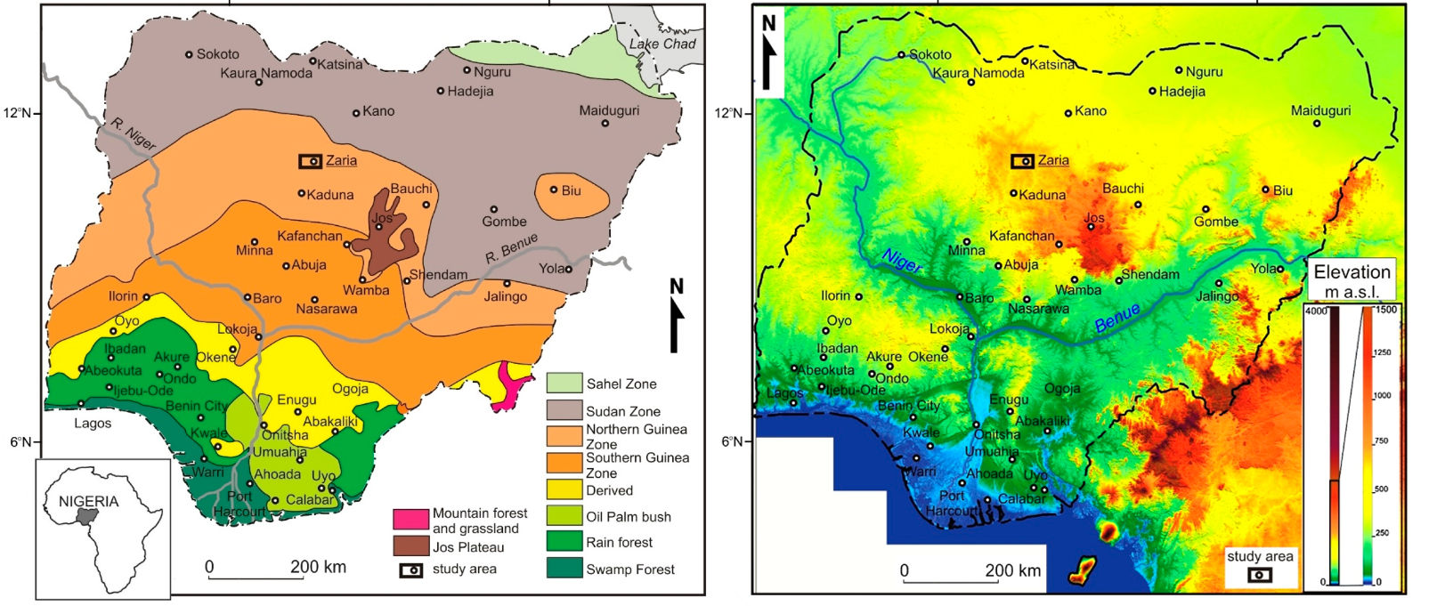
In general it gets drier and has fewer trees toward the north. Plateaus are distributed northeast of Abuja and around Jos(References Kurowska, Ewa E., Andrzej Czerniak, and Muhammad Lawal Garba. ‘Afforestation of transformed savanna and resulting land cover change: a case study of Zaria (Nigeria).’ Sustainability 14.3 (2022): 1160.).
Compared to the north, there are more trees and you often cannot see far.
Oil palms are widespread. The light green area in the figure (between Uyo and Onitsha) also appears to have plantations in rural areas.
The Southern Guinea Zone (orange) is covered with grass.
The Sudan Zone (gray) has almost no grass.

Agricultural distribution
- Agriculture varies by location
- Oil palms are common along the coast, especially in the southeast
- In the north, millet fields are common, especially around Kaduna
- Data source: U.S. Department of Agriculture (USDA). Map images were edited to align sizes.
- It is said the color of the police car lights can help narrow the region(by Geotips ), but it may not be reliable. The surrounding landscape is probably more trustworthy.
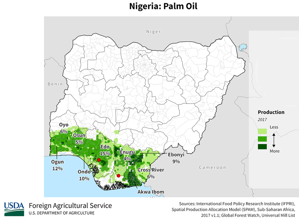
Oil palms are only found in coastal areas
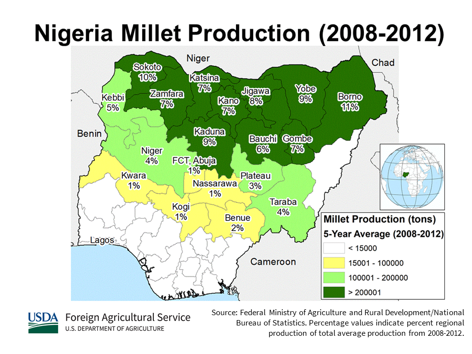
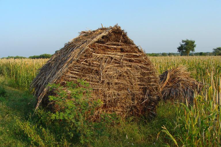
Millet is easier to identify at higher image quality. Since Sokoto and Borno have almost no roads, Kaduna (central north) is more likely. In regions with heavy millet production, you may also see dry millet fodder (see image below).
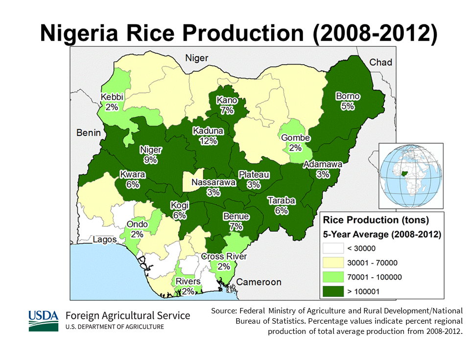
Rice is common in the central area
It is common from central to northern areas, but could appear anywhere away from the coast
.jpg#/media/File:The_incredible_rock._Zuma_Rock_(cropped).jpg)
By Fatima - Own work, CC BY-SA 4.0, Link
States of Nigeria (37)
Try the quiz- Kebbi
- Niger
- Kwara
- Ogun
- Oyo
- Lagos最大都市
- Borno
- Adamawa
- Taraba
- Benue
- Cross River
- Sokoto
- Zamfara
- Yobe
- Katsina
- Jigawa
- Ondo
- Delta
- Bayelsa
- Rivers
- Akwa Ibom
- Abia
- Ebonyi
- Anambra
- Edo
- Bauchi
- Plateau
- Nasarawa
- Gombe
- Enugu
- Kogi
- Osun
- Imo
- Ekiti
- Kaduna
- Kano
- Federal Capital Territory首都アブジャ