
How to Distinguish
- The domain is .pe
- language is Spain word
- The sign stick black and white stripes There are many times when
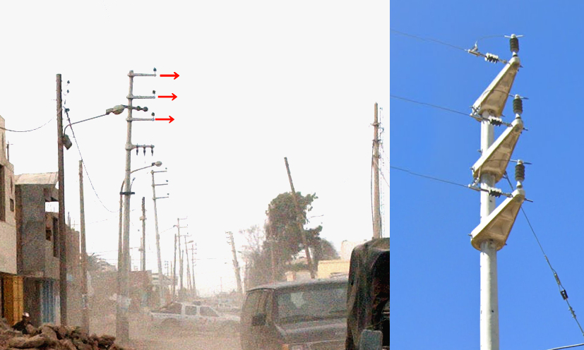
- The telephone pole is same in the direction 3 The main stick is sticking out(from 『[geoguessr strategy] Thorough explanation of telephone poles in Central and South America that can be used to contact countries!by Masamune』)
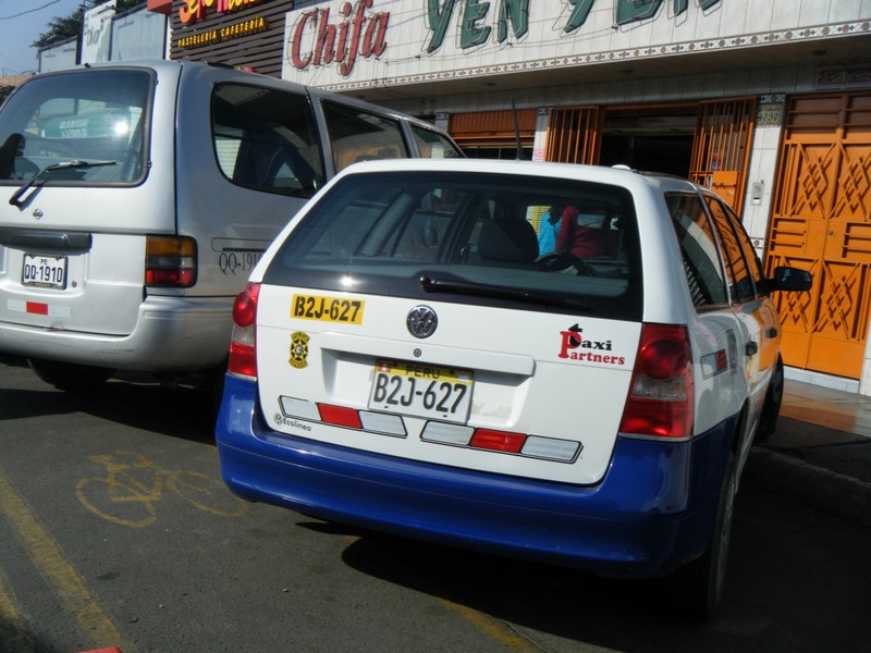
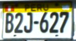
- Taxi and truck license plates Almost fluorescent yellow Sometimes it's color
- Google Car black Sometimes it's color.Elsewhere in South AmericaArgentinaandUruguayalso uses a Google Car of the same color.(References Cameras and Cars - Metagame Guide).
- The bollard is yellow often colored
- Orange and black stripes are painted diagonally on the guardrails and curbs of sharp curves.
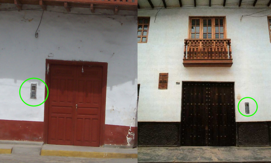
- A long, narrow box built into the wall of a house or attached to the outside.
Signs you can find


Representative Companies ▾ 詳細
The sign stick black and white stripesThere are many times whenThe bollard is a triangular prism and the top part is yellow It is often painted in color or red..


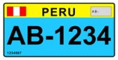
Is it Peru that has a color other than blue on the top of the license plate?ecuadorThere is a high possibility thatThe bus is green color or orange, taxis and trucks yellow fluorescence color・(References Vehicle registration plates of Peru).
CC0
Vehicles that look like motorcycles or tuk-tuks have license plates.water colorThere is a thing(References Vehicle registration plates of Peru).

By Bernard Gagnon - own work, CC BY-SA 3.0, Link
By <a href=“//commons.wikimedia.org/wiki/User:Zcarstvnz” title=“User:Zcarstvnz”>Zcarstvnz - own work, CC BY-SA 4.0, Link
The telephone pole is The sticks are sticking out in the same direction. There is something(from 『[geoguessr strategy] Thorough explanation of telephone poles in Central and South America that can be used to contact countries!by Masamune』)
There is a black and white bollard on the roadside.Road numbers may be written on the black part, but be careful as they are difficult to read.This is the path of “08B”.

By Pitxiquin- own work, CC BY-SA 4.0, Link
on the other handecuadorhas many double guardrails

Guardrail pattern
Although there are several variations of bollards, the white with yellow paint design is rarely seen outside of Peru.
You can see black and white Google Cars.However, since black Google Cars are also used in Asia, it can be confusing to fly to South America based on the color alone.The one on the right is Indonesia, not Peru.
Narrow down state/region
- The vegetation is divided into eight natural regions, some of which are widely distributed north and south.(References Life zones of Peru)
- Janca: Snowy mountains can be seen in areas with very steep mountains.Inland people of Ancash Governorate etc..
- Chala: A desert region along the northernmost coast, with a few shrubs growing on the whitish sand.
- Omagua: Area with jungle to the east
- Puna: High-altitude grasslands that spread to the south
- Arequipa has rice fields only along the river.(References USDA Country Summary - Peru)

By Maulucioni - own work, CC BY-SA 4.0, Link
The same vegetation is widely distributed from north to south, so it may be difficult to pinpoint the exact location just by looking at the surrounding atmosphere.
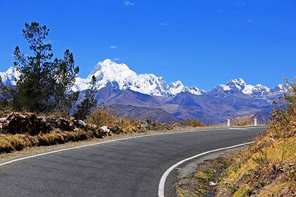
There are several places with very high mountains, the first being in the interior of Ancash Governorate.Huascaran is the highest mountain in the tropics on earth.(References Huascaran).Despite the tropical atmosphere, snowy mountains can sometimes be seen..
There is a whitish desert area along the northernmost coast.photo’s(References Tambo Grande area)is inland and has some trees.However, there are many places along the coast where there are no trees at all..By the way, if there is something like an oil pipeline, it might be a good idea to attack quite a bit higher up.(References Location of Peruvian crude oil (red), outcrop (green) and seep (blue)).

By Pitxiquin - own work, CC BY-SA 4.0, Link
To the northeast, there is a street view on the road between Iquitos and Nauta.According to Wiki, a tree that looks like a palm tree grows there.
An area where there is little except shrubs and grass that spreads out on the plateau to the south.There is light green or yellowish short grass growing on the ground, and you can hardly see the trees..

By Max Berger - own work, CC BY-SA 4.0, Link
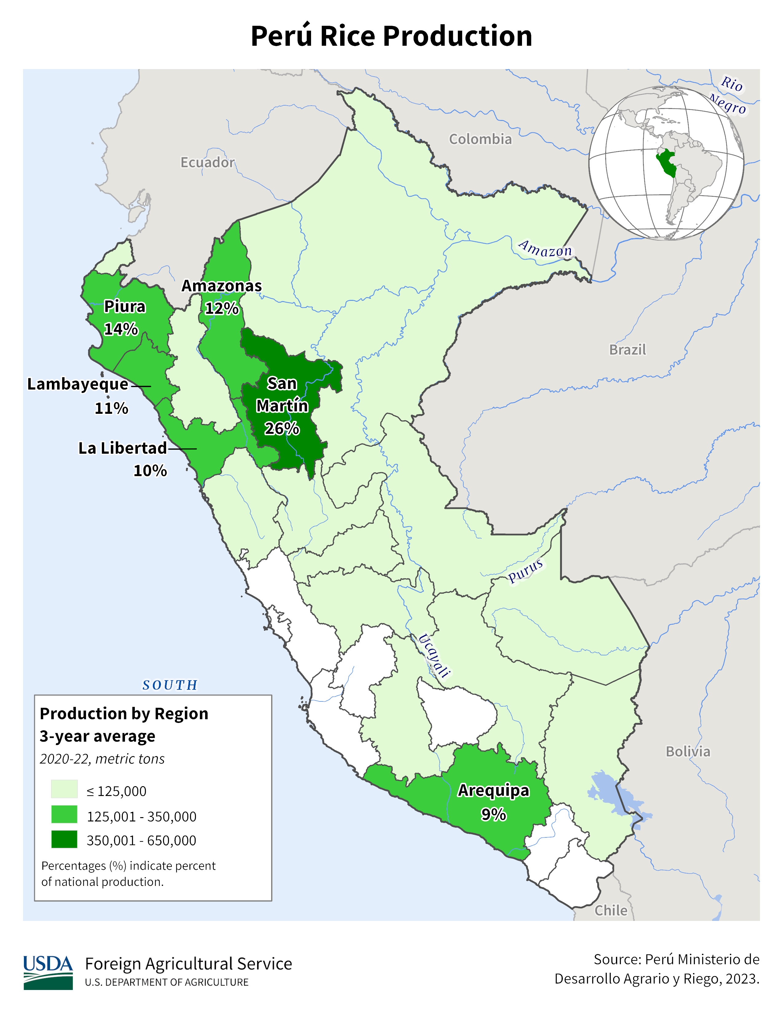
Although the diagram shows that rice is produced throughout Arequipa, in reality, rice fields only exist in areas along rivers where water is available.It has a very distinctive appearance and is easy to understand.
Narrow down city/town
- At the southernmost tip, there is a commercial city called Tacna surrounded by desert.(References Tacuna)
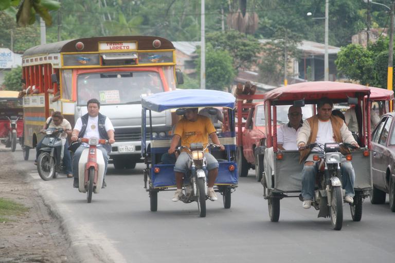
- IquitosorPucallpaThe main means of transportation is rickshaws.
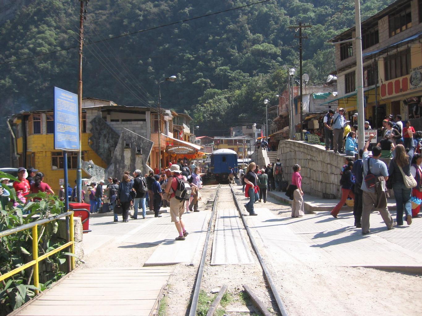
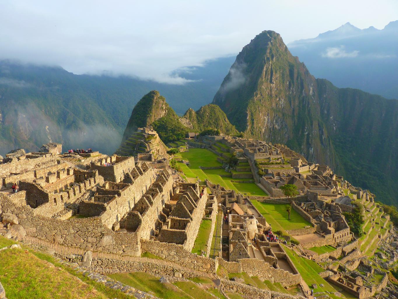
- Google Car may be visible near Machu Picchu(References machu picchu)

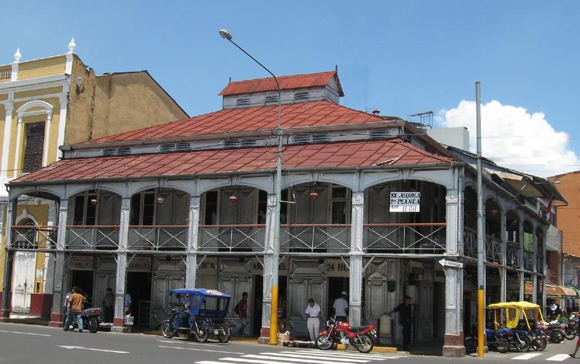
Iquitosis a city that cannot be directly accessed by road from outside.(References Iquitos).Iquitos andPucallpaAutorickshaws (locally known as mototaxi) are running in places far from urban areas, such as in the area, and there are relatively few cars.Iquitos also has a lot of European-style architecture.Examples of cities that cannot be accessed by land are:Livingston in Guatemalaetc.
Description of representative companies
| Company name | code | explanation | settlement of accounts | Dividend history |
|---|---|---|---|---|
| Cementos Pacasmayo | The largest cement company in northern Peru. |