How to Distinguish
- The domain is .co
- language is Spain word
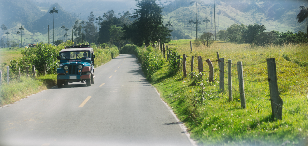
- The roadside strip white And the central line is yellow
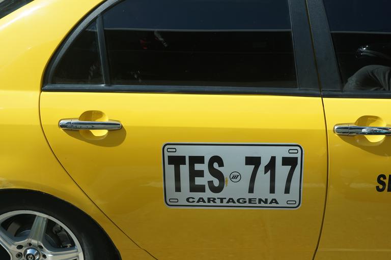
- The license plate is Both front and back are yellow
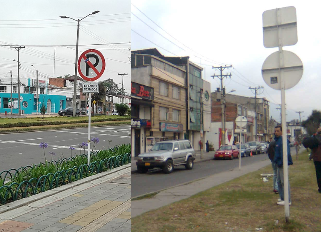
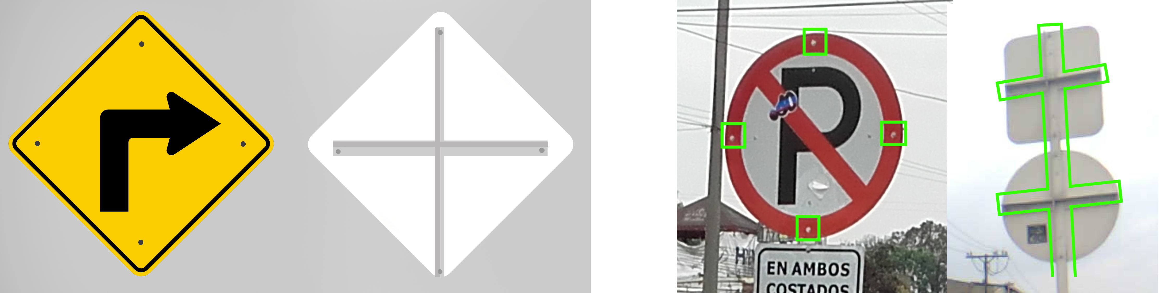
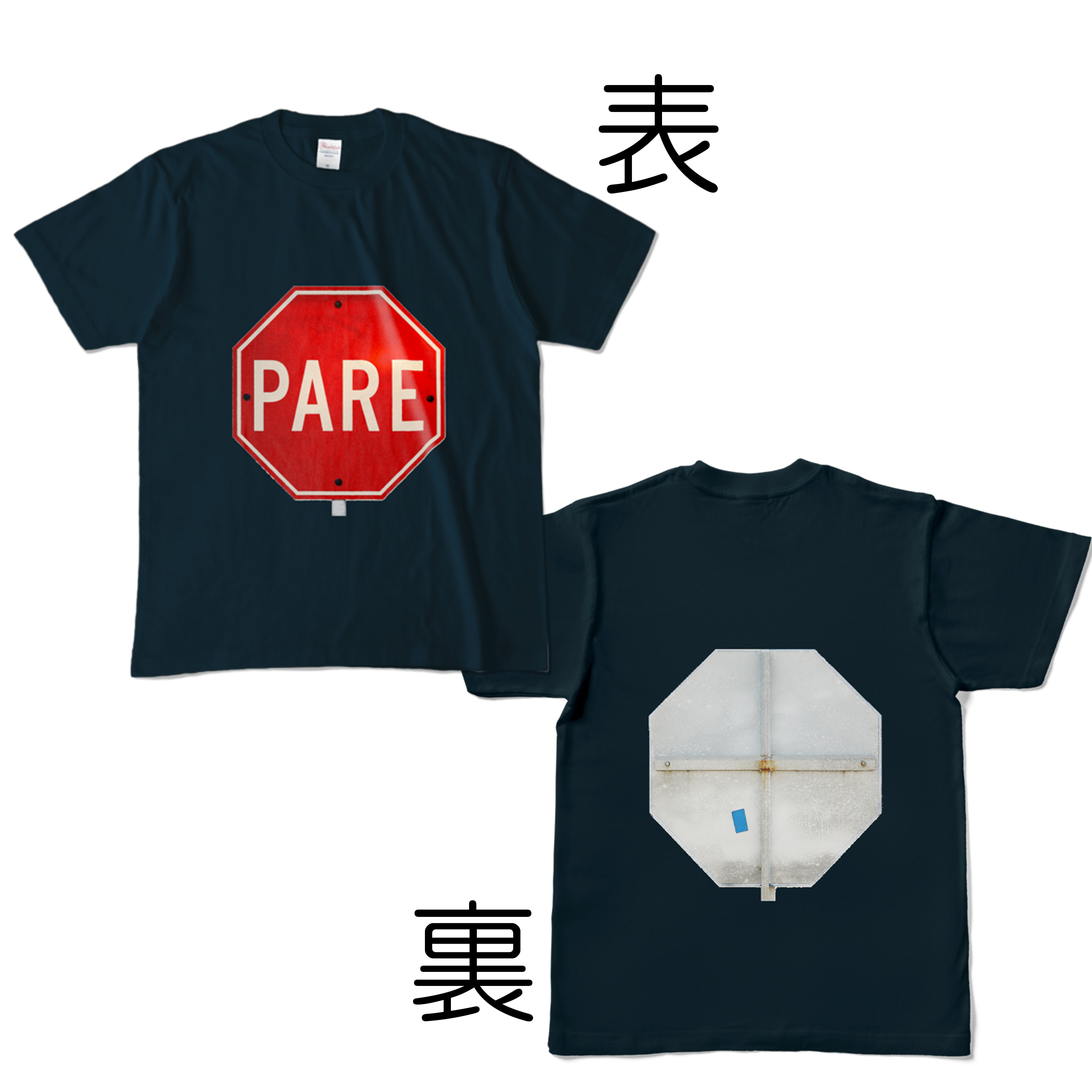
- On the back of the sign cross exists(by Geotips )
Signs you can find


.svg)


.svg)
On the back of the sign Cross (so-called Colombian cross) exists.When you look from behind, you can clearly see the cross., you can see four screws when looking from the front.Image Source.The pole and back side seem to be mostly white.
MexicoIt may be useful someday to remember that there is a cross on the signboard for the state of Chihuahua.(Chihuahua cross?).
The license plate is Both front and back are yellowOr white.The bike is also behind yellow has a number on it.PeruThere is also a yellow color, but Colombian is a little closer to orange.

self-made
Columbia related goods
Narrow down state/region
- Vegetation distribution
- Meta River basin - southeast area■As we get closer to the Amazon, the soil turns red.
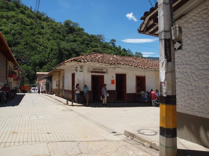
- northeast inland■The soil north of the Meta River is poor in nutrients.(References Meta River).The area is generally flat, with some areas resembling savanna.tall trees don't grow.
- northernmost coast■area with desert
- north coast■White sand may be visible or sand may accumulate on the corners of roads in the city.
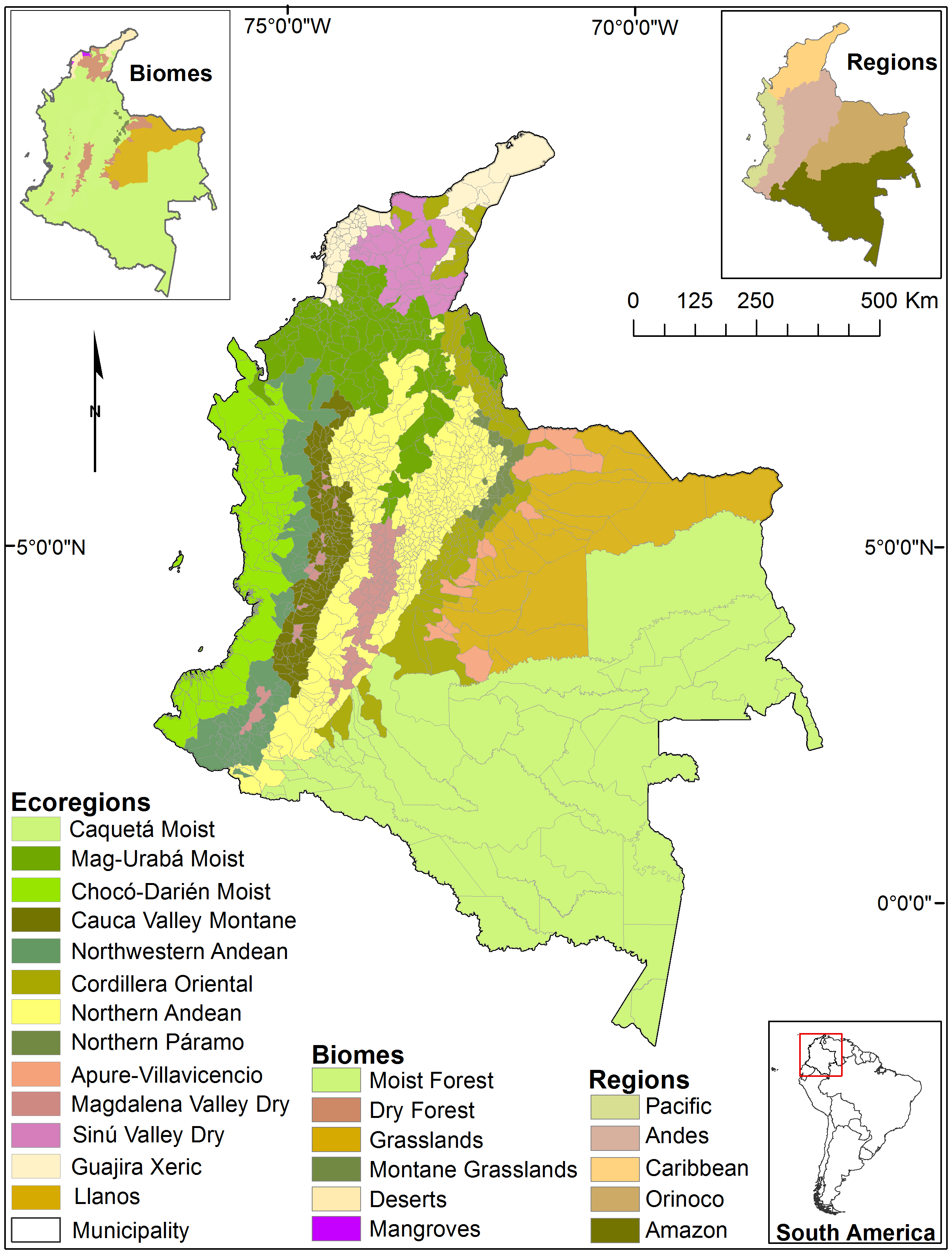
East side of the Andes Mountains.The land is flat, and along the Meta River, the soil is low in nutrients and there are few plants.
Pointing to the flat area to the east of the image below
.svg#/media/File:Mapa_de_Colombia_(relieve).svg)
By Milenioscuro - own workDemisInstituto Geografico Agustin Codazzi - Map of ColombiaU.S. Department of State - Limits in the SeasBiblioteca Luis Ángel Arango - La territorialización del Mar CaribeArmada Nacional de Colombia - Tratados Limítrofes Marítimos de la República de Colombia, CC BY-SA 3.0, Link
The soil is similar to that of a desert.
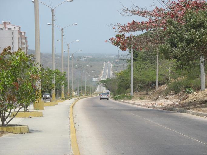
The photo is probably a road around Barranquilla.(References Barranquilla).
agriculture
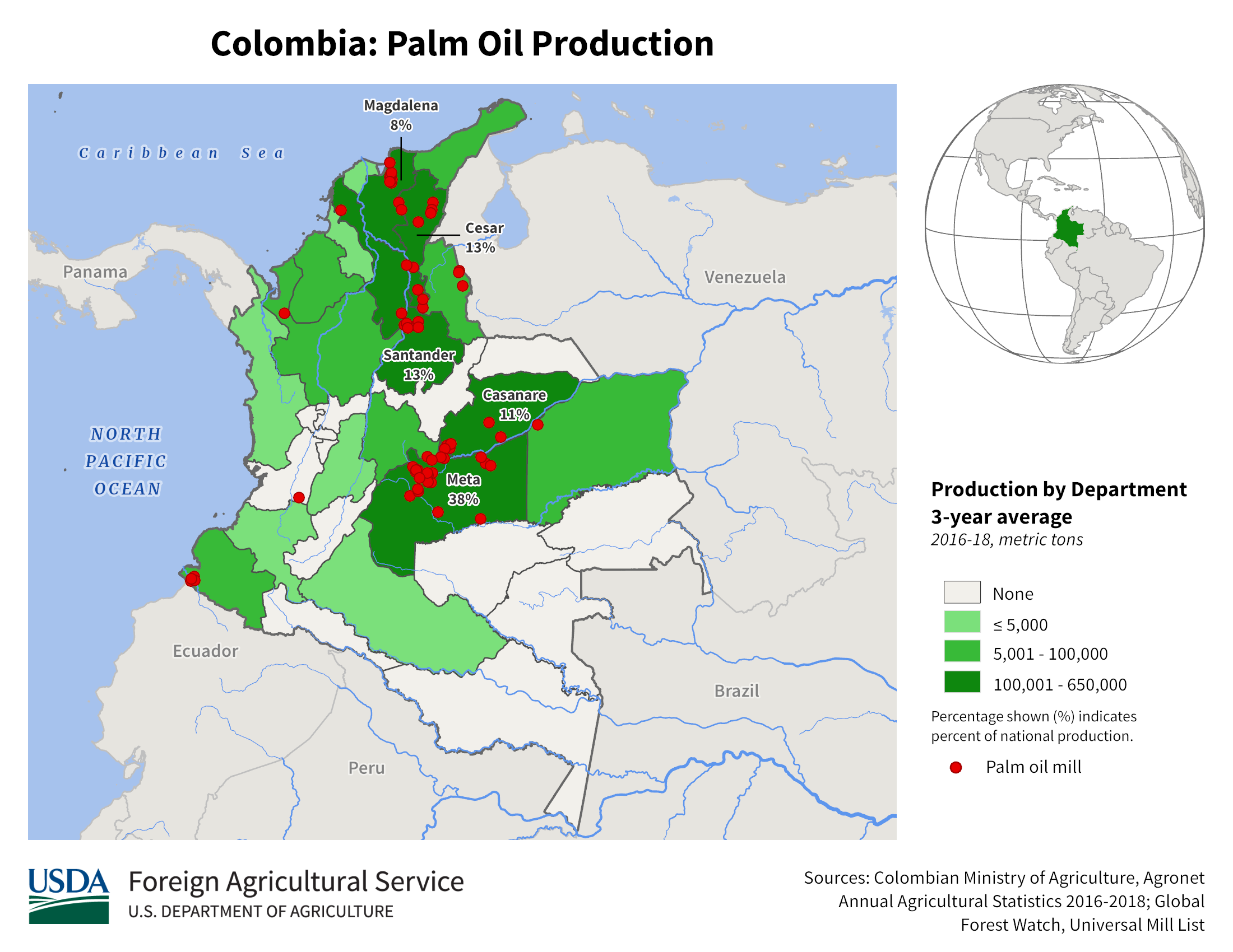
- If it's a flat area, you can farm, but since there aren't many flat areas, there aren't that many times when it's useful.(References USDA - Northern South America - Crop Production Maps)
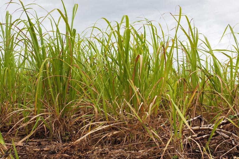
Flat areas around the Valle del Cauca department.Colombia is famous for producing bioethanol using sugarcane, with 80% of the sugarcane coming from the Valle del Cauca province.(References Colombia’s cane industry efficient but potentially damaging).
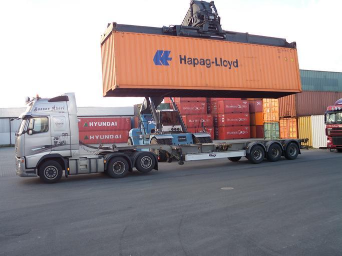
- Many trucks loaded with containers can be seen on the road to Buenaventura.
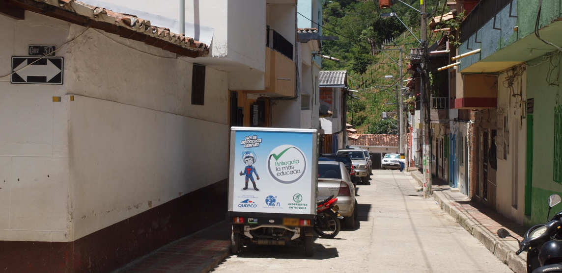
- There are yellow and black lines on the telephone pole.Antiquia Maybe the prefecture
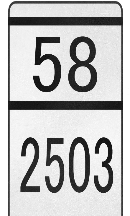
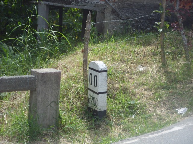
- The road number is written on the bollard.(References [GeoGuessr] Reading hard-to-notice road numbers - Fox Shrine - GeoGuessr and others)
- San Andres Providencia and Santa Catarina Islandsis characterized by Google Car
Buenaventura is Colombia’s main port and accounts for approximately 60% of Colombia’s seaborne imports and exports.Therefore, the road leading to the port gives the impression that there are many trucks loaded with containers..ONEYou can also find containers for.
The road number is written on the bollard.(References [GeoGuessr] Reading hard-to-notice road numbers - Fox Shrine - GeoGuessr and others).

Narrow down city/town
- Taxis and trucks have side plates on the roof or sides.City name is written
- Walking through the town of Bocachica on Tierra Bomba island
- BrazilandPeruThere is a town called Leticia near the border and you can see Google Car.(References plonkit)
- Walking on Gorgona Island
- There is a small street view in the town of Santa Rosalía, which is located far away from other towns.
_02.jpg#/media/File:Fuerte_de_San_Fernando_Cartagena_(2009)_02.jpg)
By Zandcee - own work, CC BY-SA 4.0, Link
Strong economic ties with Brazil’s Tabatinga, which is connected by land route(References Leticia).You can see utility poles with partitions like those in Brazil..It is a thriving tourist destination and you can find many taxis and tourists.You can see the distinctive Google Car.

By Sascha Grabow www.saschagrabow.com - own work, CC BY-SA 3.0, Link
Original image source
- ◆Both are processed/only the sign part is cut out
- By EEIM - own work, CC BY-SA 3.0, Link
- By hfb21, CC BY 3.0, Link
Departments of Colombia (34)
Try the quiz- Nariño
- Putumayo
- Chocó
- La Guajira
- Vaupés
- Amazonas
- La Guajira
- Cesar
- Norte de Santander
- Arauca
- Boyacá
- Vichada
- Cauca
- Valle del Cauca
- Antioquia
- Córdoba
- Sucre
- Bolívar
- Atlántico
- Magdalena
- San Andrés
- null
- Caquetá
- Huila
- Guaviare
- Caldas
- Casanare
- Meta
- Cundinamarca
- Santander
- Tolima
- Quindío
- Cundinamarca
- Risaralda
Description of representative companies