ecuador

clues 15Regions 23Updated 2023-07-01

Quiz ▾Basics ▾

LanguageSpanish
Driving sideDrives on the right
Domain.ec
Easily confused with:Peru, Columbia, IndiaQuizzes for this area:ecuador State Quiz, ecuador City Quiz, Area code quiz (ecuador)

Whole area7

Clues that work anywhere in this area

Language & Script★★★

The language is Spanish.

Examples12
Signs★★★

The backs of signs are often flat, without ridges. They're mounted on plain square or round steel poles, or on steel poles with a dent in them.

Watch outIn Colombia the poles are white with a cross on the back, and in Peru they're usually thick posts with black-and-white stripes. Bolivia uses thick sawn timber.
Examples12345678See alsoColombiaPeruBolivia
Road★★★

Guardrails are often doubled up, one on top of the other.

Examples12
Open in Street View2
By Paulo JC Nogueira, CC BY-SA 3.0, image edited
Bollard★★★

Bollards come in many different styles with no real consistency. Ones wrapped with two reflector bands, or with two reflectors attached, or with an unusual round shape, could point to Ecuador.

Examples1234
By DIOHER_PAVAL, CC BY 3.0
Utility Pole★★★

Utility poles come in many styles. Poles with small partitions or holes running along them are rarely seen anywhere else in South America outside Ecuador.

Examples123456

Narrowing down the region7

Once you know the area: which part of it

Agriculture

EsmeraldasCarchiSucumbiosOrellanaPastazaMorona SantiagoZamora ChinchipeLojaEl OroGuayasSanta ElenaManabiAzuayCañarNapoTungurahuaChimborazoBolivarImbaburaCotopaxiLos RiosPichinchaSanto Domingo de los Tsáchilas
EsmeraldasCarchiSucumbiosOrellanaPastazaMorona SantiagoZamora ChinchipeLojaEl OroGuayasSanta ElenaManabiAzuayCañarNapoTungurahuaChimborazoBolivarImbaburaCotopaxiLos RiosPichinchaSanto Domingo de los TsáchilasGalápagos IslandsGalápagos Islands

Where Agriculture clues apply6

Click an item to jump to its clueTap to show the range; tap again or → to jump to the clue

  1. roses
  2. shrimp
  3. oil palm
  4. rice paddies
  5. banana
  6. Galápagos Islands
Plants & farming★★★★★

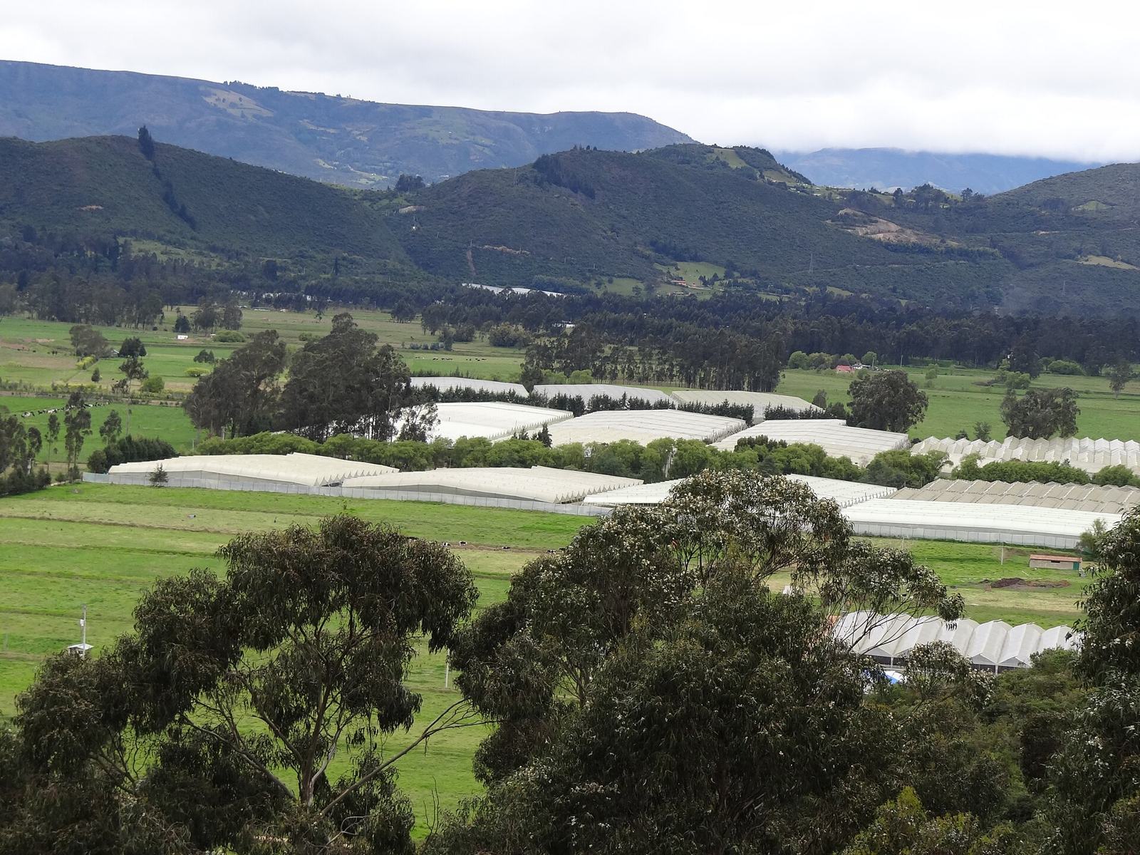
On highlands above 2,500m, long, narrow greenhouses covered in translucent white plastic filling a valley from end to end mean a cut-flower (rose) farm — often set against snow-capped volcanoes in the background, with a foreground that's wall-to-wall greenhouses.
Examples123SourcesGreenhouses of Cayambe Valley - NASA Earth ObservatorySee alsoColombia
Where
EsmeraldasCarchiSucumbiosOrellanaPastazaMorona SantiagoZamora ChinchipeLojaEl OroGuayasSanta ElenaManabiAzuayCañarNapoTungurahuaChimborazoBolivarImbaburaCotopaxiLos RiosPichinchaSanto Domingo de los Tsáchilas
Greenhouses lining the floor of a basin (photo from Cundinamarca, Colombia)
Petruss / CC BY-SA 3.0
Plants & farming★★★★

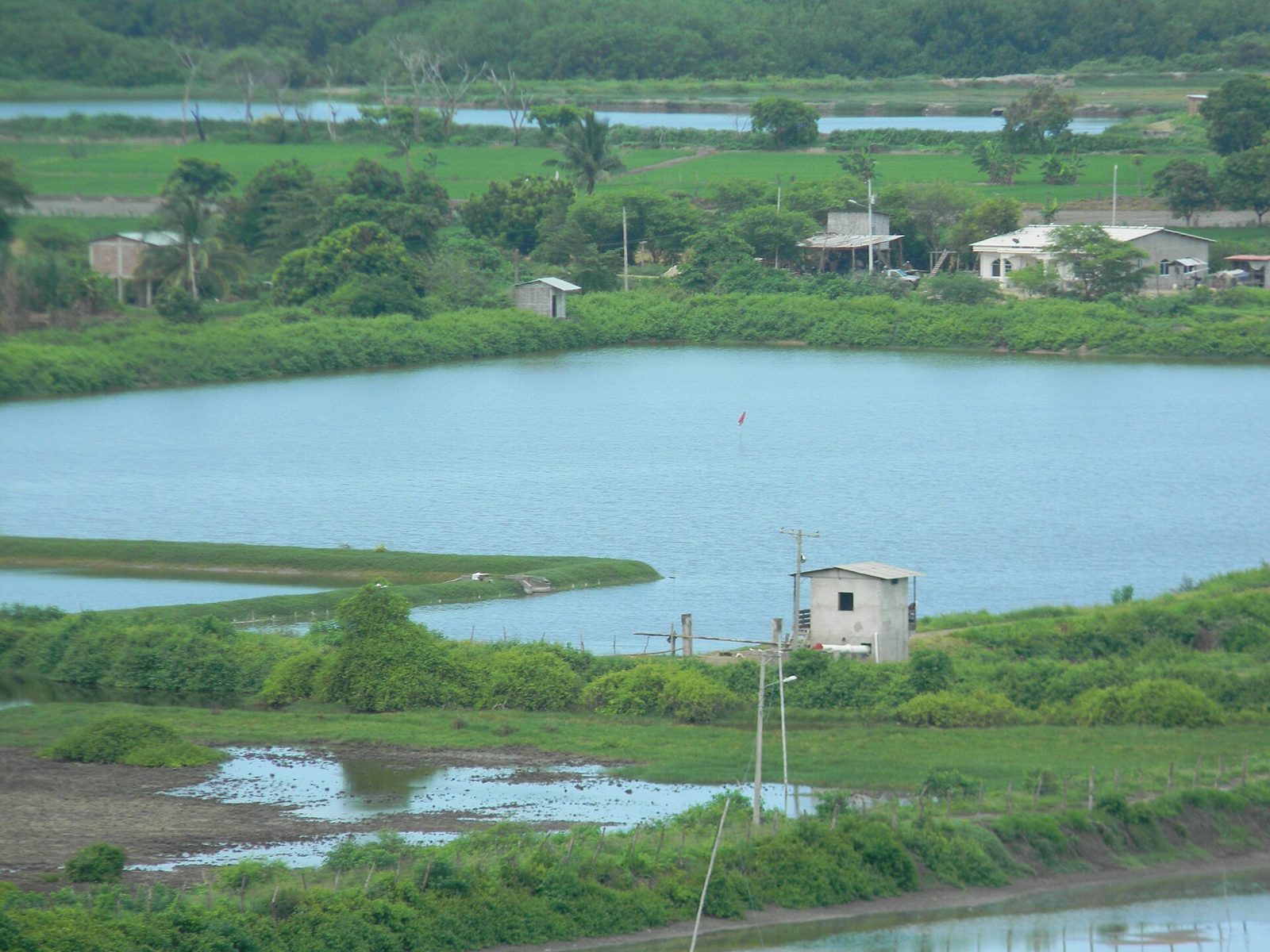
On low-lying land near a river mouth or the coast, a grid of shallow square ponds divided by low dikes means shrimp farming. Look for waterwheel-style aerators spinning at the pond edges and scraps of mangrove left standing nearby.
SourcesWarmwater shrimp social risk profile — Ecuador 2025 - Seafood Watch (share by province)
Where
EsmeraldasCarchiSucumbiosOrellanaPastazaMorona SantiagoZamora ChinchipeLojaEl OroGuayasSanta ElenaManabiAzuayCañarNapoTungurahuaChimborazoBolivarImbaburaCotopaxiLos RiosPichinchaSanto Domingo de los Tsáchilas
Shrimp ponds laid out in a grid (coastal Ecuador)
Luis albert255 / CC BY-SA 4.0
Plants & farming★★★

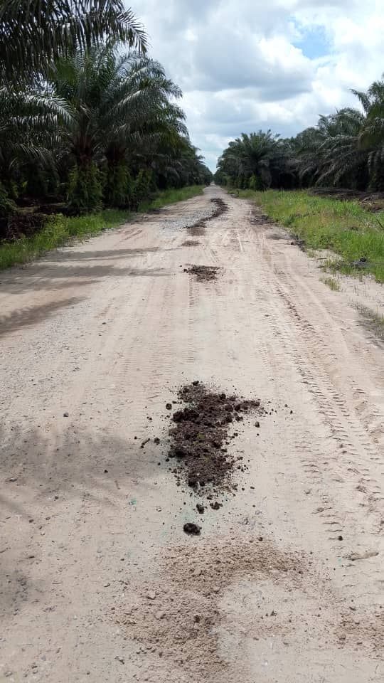
Oil palm plantations are common in the northern province of Esmeraldas and the central province of Los Ríos, and are also found in the eastern province of Sucumbíos and elsewhere. Roads near the Colombian border and along the E20 highway are especially tree-lined.

Examples1234SourcesUSDA - International Production Assessment Division ReportsINEC - ESPAC 2023 Boletín técnico (provincial share by crop)
Where
EsmeraldasCarchiSucumbiosOrellanaPastazaMorona SantiagoZamora ChinchipeLojaEl OroGuayasSanta ElenaManabiAzuayCañarNapoTungurahuaChimborazoBolivarImbaburaCotopaxiLos RiosPichinchaSanto Domingo de los Tsáchilas
Rows of uniformly tall oil palms (photo from Indonesia)
Nengrevi / CC0
Plants & farming★★★

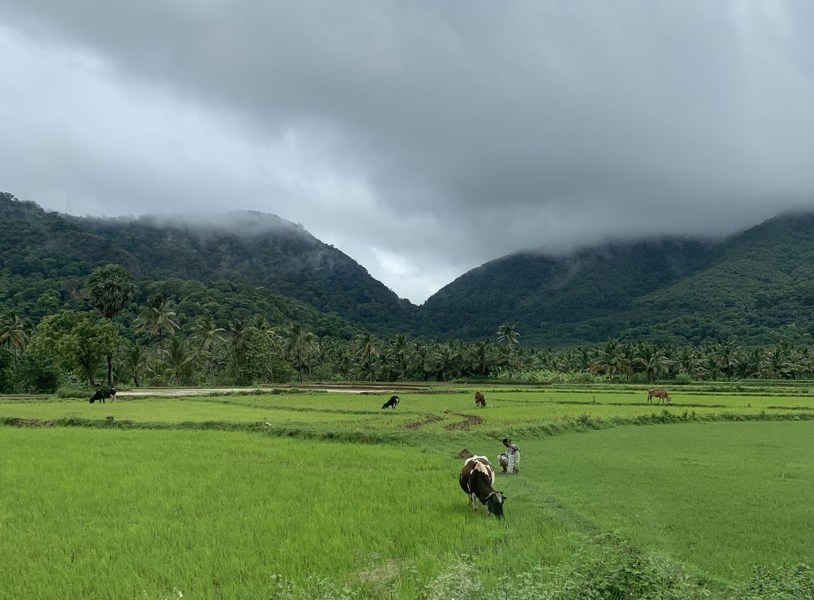
Rice paddies are common in river basins such as the Babahoyo River, which flows into Guayaquil.

Examples1234SourcesCosts to Ecuador's rice sector during the first decade of an apple snail invasion and policy recommendations for regions at riskUSDA - International Production Assessment Division ReportsINEC - ESPAC 2023 Boletín técnico (rice share by province)
Where
EsmeraldasCarchiSucumbiosOrellanaPastazaMorona SantiagoZamora ChinchipeLojaEl OroGuayasSanta ElenaManabiAzuayCañarNapoTungurahuaChimborazoBolivarImbaburaCotopaxiLos RiosPichinchaSanto Domingo de los Tsáchilas
Lush green rice paddies (photo from Tamil Nadu, India)
Planemad / CC0
Plants & farming★★★

Banana plantations turn up in areas with a lot of flat land, especially Los Ríos, Guayas, and El Oro.

Examples12SourcesEcuadoriaN BananA RegionSINEC - ESPAC 2023 Boletín técnico (banana share by province)
Where
EsmeraldasCarchiSucumbiosOrellanaPastazaMorona SantiagoZamora ChinchipeLojaEl OroGuayasSanta ElenaManabiAzuayCañarNapoTungurahuaChimborazoBolivarImbaburaCotopaxiLos RiosPichinchaSanto Domingo de los Tsáchilas
Other★★★

The Galápagos Islands sometimes show up.

Examples1See alsoGalápagos Islands
Where
EsmeraldasCarchiSucumbiosOrellanaPastazaMorona SantiagoZamora ChinchipeLojaEl OroGuayasSanta ElenaManabiAzuayCañarNapoTungurahuaChimborazoBolivarImbaburaCotopaxiLos RiosPichinchaSanto Domingo de los TsáchilasGalápagos IslandsGalápagos Islands

Terrain

Landscape★★★★

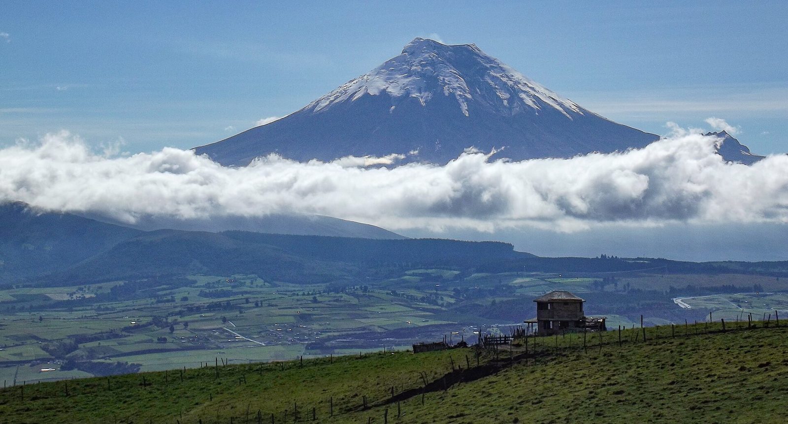
A road running straight north-south through a wide basin flanked by high mountain ranges, with snow-capped conical volcanoes on either side, points to the Sierra (the central Andes). The biggest clue is seeing a snow line despite being right on the equator.
SourcesGeography of Ecuador - Wikipedia (mountain ranges and major volcanoes)
Where
EsmeraldasCarchiSucumbiosOrellanaPastazaMorona SantiagoZamora ChinchipeLojaEl OroGuayasSanta ElenaManabiAzuayCañarNapoTungurahuaChimborazoBolivarImbaburaCotopaxiLos RiosPichinchaSanto Domingo de los Tsáchilas
A conical volcano towering over farmland (Cotopaxi)
David Ceballos from Quito, España / CC BY 2.0

Narrowing down the city1

Once you know the region: which city or town

Cayambe volcano

Other★★★

Northeast of Quito, there's a road up to Cayambe, one of the tallest mountains in Ecuador. Trees stop growing as the elevation rises.

Examples12345
Where
EsmeraldasCarchiSucumbiosOrellanaPastazaMorona SantiagoZamora ChinchipeLojaEl OroGuayasSanta ElenaManabiAzuayCañarNapoTungurahuaChimborazoBolivarImbaburaCotopaxiLos RiosPichinchaSanto Domingo de los TsáchilasCayambe volcanoCayambe volcano

Regions

Hover a region on the map to see its name
Esmeraldas Carchi Sucumbios Orellana Pastaza Morona Santiago Zamora Chinchipe Loja El Oro Guayas Santa Elena Manabi Azuay Cañar Napo Tungurahua Chimborazo Bolivar Imbabura Cotopaxi Los Rios Pichincha Santo Domingo de los Tsáchilas

Hover a region on the map to see its name

Basics

General facts about this place
  • The name means "equator" in Spanish, and the equator crosses the country[ref]
  • One of the world's leading exporters of bananas, with oil also a major export[ref]

Nearby areas

A page of play notes and identification clues for GeoGuessr.