
 Philippines
LanguageFilipino, English
Driving sideDrives on the right
Domain.ph
Easily confused with:Indonesia, Thailand, VietnamQuizzes for this area:Philippines State Quiz, Philippines City Quiz
Whole area8
Clues that work anywhere in this area
Commercial Facilities★★★
Look for signs of Jollibee, the Philippines' biggest fast-food chain.

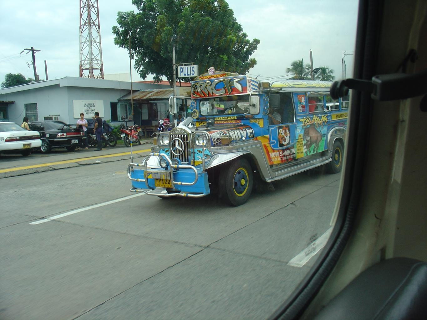
Vehicle★★★
A vehicle called a tricycle — a motorbike fused with a sidecar/seat — is used in place of taxis. There's also a pedicab, the same idea built on a bicycle instead of a motorbike.

License Plate★★★
Public transport like jeepneys and buses carries yellow plates, while private cars are usually white or pale green. Right-hand driving with distinctive vehicles and yellow/white/pale-green plates points to the Philippines.
Examples1


Narrowing down the region15
Once you know the area: which part of it
Language
Language & Script★★★
Tagalog speakers are concentrated in southern Luzon and around Manila.

Sign numbers
License Plate★★★
On newer motorbikes, the plate's color stripe can sometimes reveal the region.
Watch outThis only shows up in areas likely photographed from around 2020 onward, so it's not that important a clue.
Tricycles
Where Tricycles clues apply4
Click an item to jump to its clueTap to show the range; tap again or → to jump to the clue
Vehicle★★★
A tricycle with a stepped roof means the north.

Vehicle★★★
A tricycle with no step in the roof means the south. Sometimes it's completely flat.
Examples123SourcesMost common tuk-tuk roofs by AeroGelo#5412

Vehicle★★★
A motorela has seating in the back and can carry more passengers than a regular tricycle. It's common in northern Mindanao — per Wikipedia, especially around Cagayan de Oro and Bukidnon.
Examples12SourcesMotorized tricycle

Agriculture
Where Agriculture clues apply6
Click an item to jump to its clueTap to show the range; tap again or → to jump to the clue
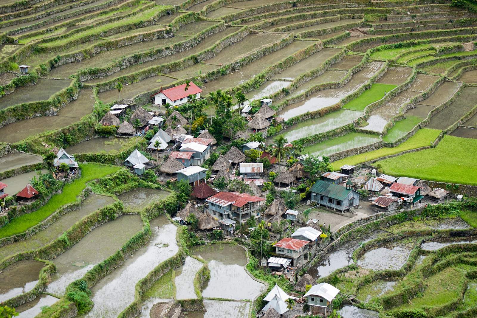
Plants & farming★★★★★
The Cordillera range in northern Luzon. Some areas apparently have rice terraces that are tourist attractions, but there's not much Street View.
Examples12SourcesBanaue Rice Terraces - Wikipedia (location and elevation)
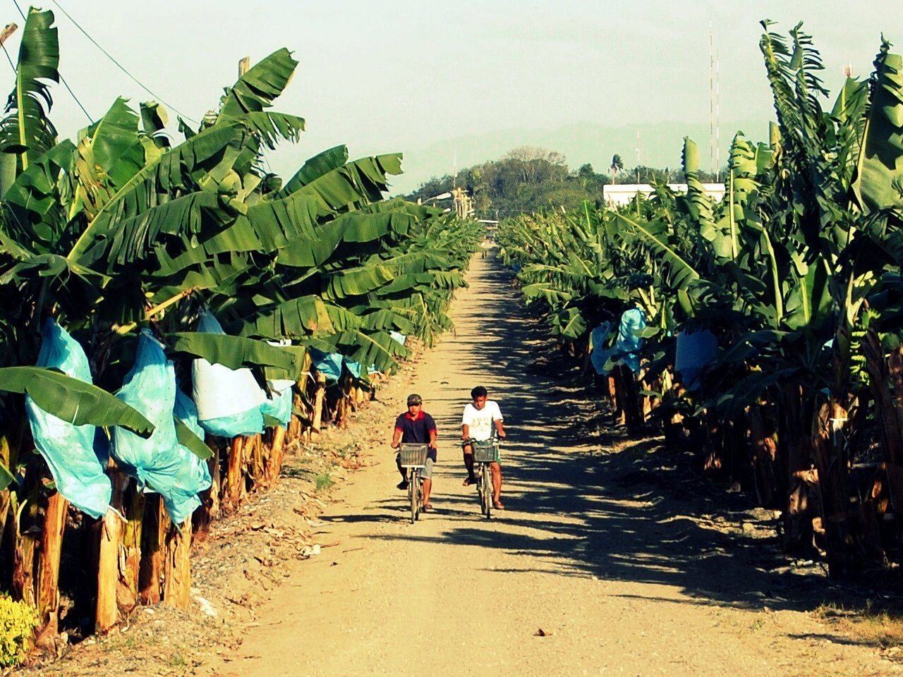
Plants & farming★★★★
If large-scale plantations of bananas at even spacing in neat rows go on and on, it's southern Mindanao.
Plants & farming★★★★
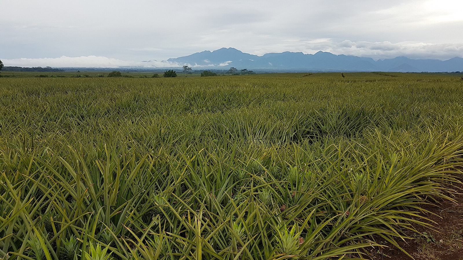
If spiky leaves line up over reddish-brown soil, it's a pineapple plantation. There are huge plantations in Bukidnon and South Cotabato.
Plants & farming★★★★
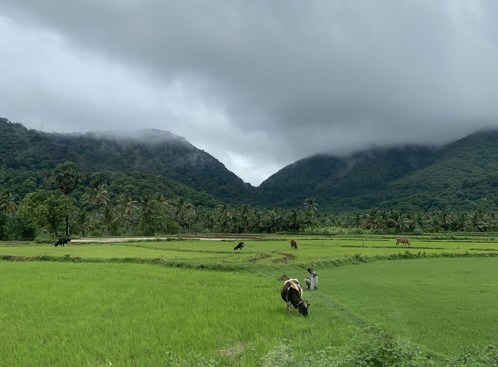
If rice paddies stretch to the horizon across land so flat that no mountains are visible, it's the central Luzon plain or the Cagayan Valley to the north.
SourcesC. Luzon remains PH's top palay producer in Q1 - Philippine News Agency (palay production share by region and province)Commodity Fact Sheets 2023 - Philippine Statistics Authority (palay production by province)
Plants & farming★★★
Crop distribution differs by region. Oil palm is concentrated on the southern islands; sugar cane centers on Negros Island.
Examples12SourcesU.S. Philippines Production Country Summary (U.S. Department of Agriculture)See alsoNegros Island

Plants & farming★★★
Corn fields are common in the Cagayan Valley in northeastern Luzon and in Bukidnon in central Mindanao, among other places.

Terrain
Landscape★★★★★
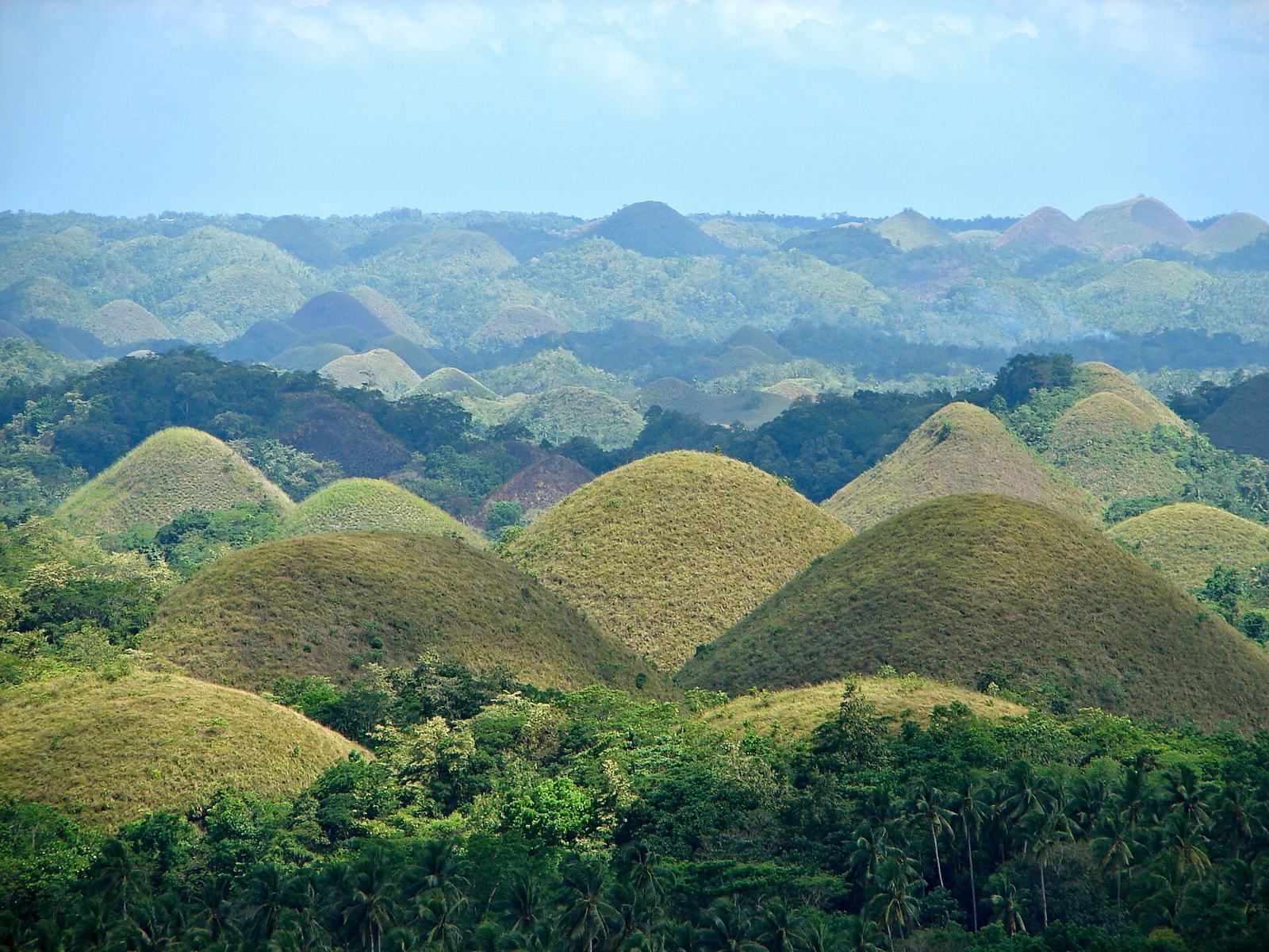
A distinctive landscape of over 1,000 dome-shaped limestone hills of nearly the same size: the Chocolate Hills of Bohol Island.
Benguet
Utility Pole★★★
In the mountains of northern Luzon you'll find "Chile poles." It feels like about 80% of them are in the mountains around Baguio.
Palawan

Narrowing down the city6
Once you know the region: which city or town
Other★★★
Knowing the names and locations of the regions and provinces helps pin down a location.

Signs★★★
Construction signs are common and often spell out the city name directly.


Batanes

Corregidor Island
Other★★★
On Corregidor Island, WWII-era barracks and tunnels remain as ruins. The Google Car is visible.
Examples12SourcesCorregidor Island

Mount Pinatubo
Landscape★
There's a road up to Mount Pinatubo, which erupted violently in 1991. Getting a 5K here is nearly impossible, so it probably won't come up often.
Examples123SourcesMount Pinatubo

No clues for this category and place yet.
Regions
Hover a region on the map to see its nameHover a region on the map to see its name
Nearby areas
A page of play notes and identification clues for GeoGuessr.