Cambodia

clues 16Regions 24Updated 2023-07-01

Quiz ▾Basics ▾Videos ▾

LanguageKhmer
Driving sideDrives on the right
Domain.kh

Whole area7

Clues that work anywhere in this area

Building★★★

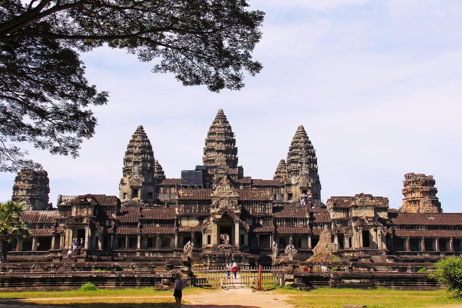
Most people are Buddhist, so Buddhism-related architecture is common.

Commercial Facilities★★★

Parasols and signs carry the logos of well-known local companies — Beeline for telecom, Coca-Cola for soft drinks, and LEO, Kingdom, or Angkor for beer. In the countryside, bottled drinks are often sold under a parasol.

NoteThe Angkor logo features Angkor Wat.
Examples123SourcesThe state of beer in Cambodia
Open in Street View1
cambodian beer
okalbum / All Rights Reserved
Language & Script★★★

Khmer (ភាសាខ្មែរ) is the official language and is widely used.

Japanese日本料理レストラン
Sinhalaජපන් අවන්හල
Assameseজাপানীজ ৰেষ্টুৰেণ্ট
Kannadaಜಪಾನೀಸ್ ರೆಸ್ಟೋರೆಂಟ್
Gujaratiજાપાનીઝ રેસ્ટોરન્ટ
Tamilஜப்பானிய உணவகம்
Teluguజపనీస్ రెస్టారెంట్
Bengaliজাপানি রেস্তোরা
Hindiजापानी रेस्टोरेंट
Khmerភោជនីយដ្ឋានជប៉ុន
Laoຮ້ານອາຫານຍີ່ປຸ່ນ
Thaiร้านอาหารญี่ปุ่น
Examples1234

Agriculture

Plants & farming★★★

Palmyra-palm-like trees appear here. Similar-looking trees grow widely across warm regions, but in Asia, Cambodia has especially many.
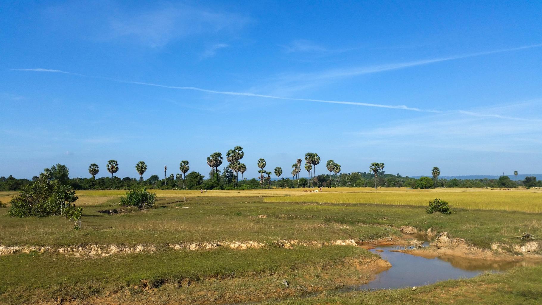
Watch outSimilar-looking trees also grow in places like Brazil.
NoteBy tree count, Kampong Thom, east of Tonlé Sap, accounts for a quarter, followed by Kampong Chhnang, Prey Veng, and Kampong Speu (2010). They're rarer in the northeastern highlands and along the coast.
TipThe soil color is also distinctive.1
Examples12SourcesPalmyra palmMen, R., "Improving the Cambodian Palm Sugar Industry," Table 2 (palmyra palm count by province, DPS-MAFF 2010)See alsoBrazil
Where
RôtânôkiriMôndól KiriKrâchéhKâmpóng ChamSvay RiengPrey VêngKândalTakêvKâmpôtOtdar Mean CheyPreah VihéarSiemréabBântéay MéancheyKaôh KongPouthisatBatdâmbângKrong PailinStœng TrêngKrong Preah SihanoukKepKâmpóng ChhnangKâmpóng ThumKâmpóng SpœPhnom Penh

Narrowing down the region4

Once you know the area: which part of it

Agriculture

RôtânôkiriMôndól KiriKrâchéhKâmpóng ChamSvay RiengPrey VêngKândalTakêvKâmpôtOtdar Mean CheyPreah VihéarSiemréabBântéay MéancheyKaôh KongPouthisatBatdâmbângKrong PailinStœng TrêngKrong Preah SihanoukKepKâmpóng ChhnangKâmpóng ThumKâmpóng SpœPhnom Penh

Where Agriculture clues apply3

Click an item to jump to its clueTap to show the range; tap again or → to jump to the clue

  1. paddy
  2. rubber
  3. cassava
Plants & farming★★★

Rice paddies are common around Tonlé Sap Lake and in the plains south to southeast of Phnom Penh (Prey Veng, Takéo, and similar). They're almost absent in the northeast, east of Route 7. They're sparse along the coast, but present around Kampot.
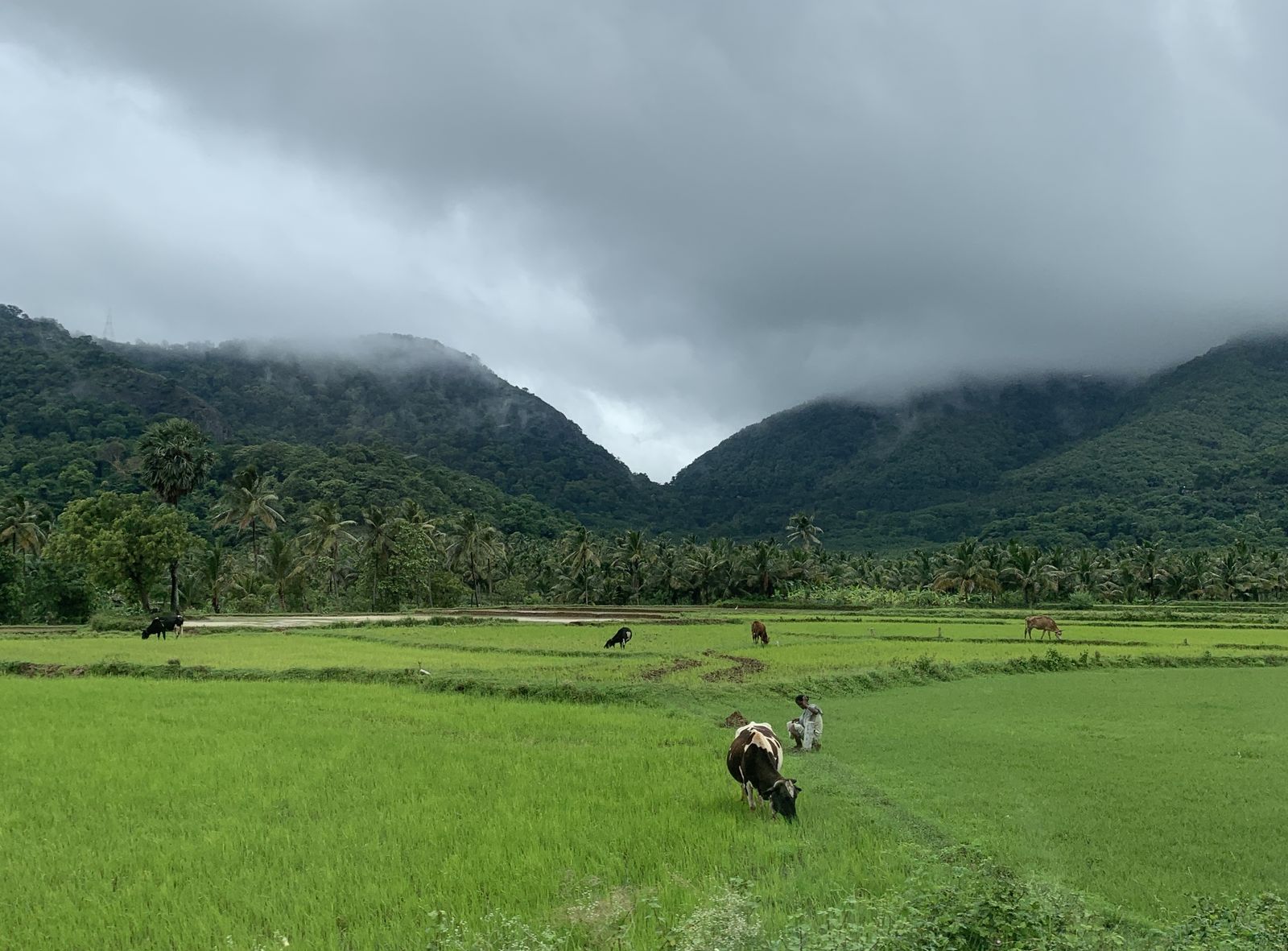
NoteRice production is led by Prey Veng (13%), Battambang (11%), Takéo (11%), Banteay Meanchey (9%), and Kampong Thom (8%) (USDA, 2019-2020).
Examples12345SourcesUSDA Cambodia Production
Where
RôtânôkiriMôndól KiriKrâchéhKâmpóng ChamSvay RiengPrey VêngKândalTakêvKâmpôtOtdar Mean CheyPreah VihéarSiemréabBântéay MéancheyKaôh KongPouthisatBatdâmbângKrong PailinStœng TrêngKrong Preah SihanoukKepKâmpóng ChhnangKâmpóng ThumKâmpóng SpœPhnom Penh
Lush green paddy fields (photo shows Tamil Nadu, India)
Planemad / CC0
Plants & farming★★

Rubber trees planted in straight rows are common in the red-soil area east of the Mekong (Kampong Cham, Tbong Khmum) and in the northeastern Ratanak Kiri. They're rare in the rice-heavy south or around Tonlé Sap Lake.

SourcesCambodian Smallholder Rubber Sector, 2000 to 2021 (Forest Trends, Figure 8, share by province)
Where
RôtânôkiriMôndól KiriKrâchéhKâmpóng ChamSvay RiengPrey VêngKândalTakêvKâmpôtOtdar Mean CheyPreah VihéarSiemréabBântéay MéancheyKaôh KongPouthisatBatdâmbângKrong PailinStœng TrêngKrong Preah SihanoukKepKâmpóng ChhnangKâmpóng ThumKâmpóng SpœPhnom Penh
Evenly spaced rubber (Pará rubber) trees in a plantation
Dinkum / CC0
Plants & farming★

Cassava fields, filled with knee-to-waist-high, palm-shaped leaves, are common around Tbong Khmum east of the Mekong, and in the northwestern provinces near the Thai border (Battambang, Pailin, Banteay Meanchey, Oddar Meanchey).

SourcesCambodia: Cassava Cultivation Situation (ASEAN Cassava Centre)Cassava (Open Development Cambodia)Nith, K. & Kanayama, Y., "Cambodian Cassava and COVID-19" (top 5 producing provinces)
Where
RôtânôkiriMôndól KiriKrâchéhKâmpóng ChamSvay RiengPrey VêngKândalTakêvKâmpôtOtdar Mean CheyPreah VihéarSiemréabBântéay MéancheyKaôh KongPouthisatBatdâmbângKrong PailinStœng TrêngKrong Preah SihanoukKepKâmpóng ChhnangKâmpóng ThumKâmpóng SpœPhnom Penh
A cassava field with palm-shaped leaves
Peculiar grace / CC0

Bollards

Bollard★★★

The side of a bollard shows the road number, and both faces show distances to towns. If you spot the road number and a town name, you can narrow the region down from the distance ratios.

TipIf you're lucky enough to find one, it can narrow things down quite a lot.
Examples1

Narrowing down the city5

Once you know the region: which city or town

Landscape★★★

Street View also covers Tonlé Sap Lake. Floating villages of boathouses sit on the water, with distinctive architecture.
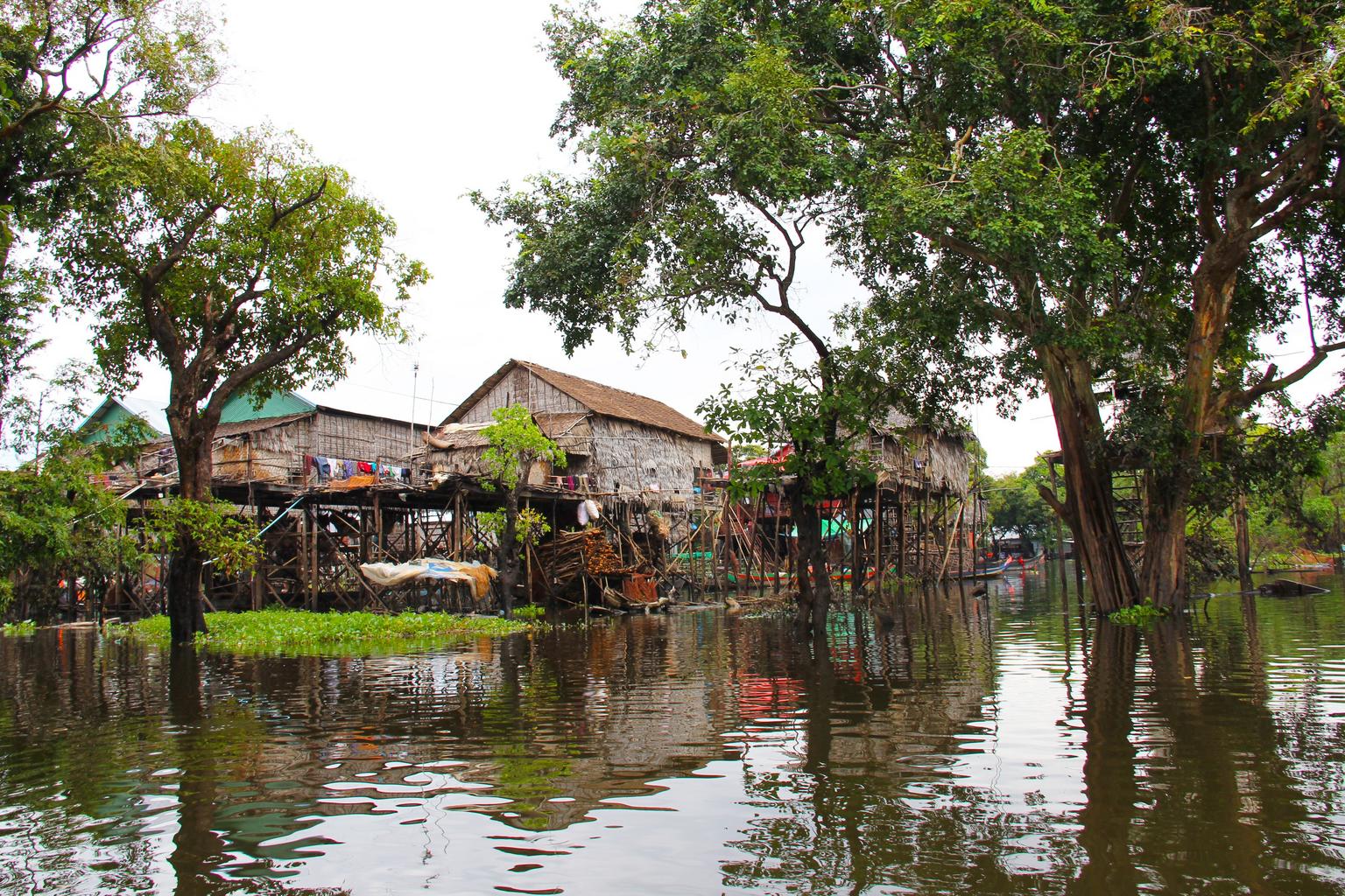
Examples123Sourcesបឹងទន្លេសាប
Where
RôtânôkiriMôndól KiriKrâchéhKâmpóng ChamSvay RiengPrey VêngKândalTakêvKâmpôtOtdar Mean CheyPreah VihéarSiemréabBântéay MéancheyKaôh KongPouthisatBatdâmbângKrong PailinStœng TrêngKrong Preah SihanoukKepKâmpóng ChhnangKâmpóng ThumKâmpóng SpœPhnom PenhTonlé Sap LakeTonlé Sap Lake

Battambang

Landscape★★★

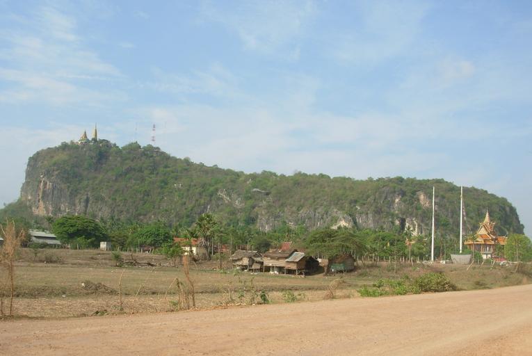
On roads near the Thai border west of Battambang, you may see rugged rocky hills. Where fields give way west of Battambang, rocky terrain becomes common.

Examples1234See alsoThailand
Where
RôtânôkiriMôndól KiriKrâchéhKâmpóng ChamSvay RiengPrey VêngKândalTakêvKâmpôtOtdar Mean CheyPreah VihéarSiemréabBântéay MéancheyKaôh KongPouthisatBatdâmbângKrong PailinStœng TrêngKrong Preah SihanoukKepKâmpóng ChhnangKâmpóng ThumKâmpóng SpœPhnom PenhBattambang

Kampot

Building★★★

French colonial-era architecture is common in Cambodian cities. In Kampot, an important port town, especially many European-style buildings remain in the old quarter.

Examples12SourcesKampotSee alsoFrance
Where
RôtânôkiriMôndól KiriKrâchéhKâmpóng ChamSvay RiengPrey VêngKândalTakêvKâmpôtOtdar Mean CheyPreah VihéarSiemréabBântéay MéancheyKaôh KongPouthisatBatdâmbângKrong PailinStœng TrêngKrong Preah SihanoukKepKâmpóng ChhnangKâmpóng ThumKâmpóng SpœPhnom PenhKampot
By Hans A. Rosbach - Own work, CC BY-SA 3.0

Siem Reap

Other★★★

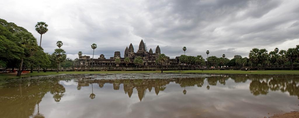
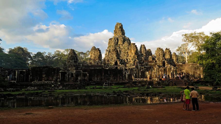
Siem Reap is home to Angkor Wat and the Bayon temple.

Examples12
Where
RôtânôkiriMôndól KiriKrâchéhKâmpóng ChamSvay RiengPrey VêngKândalTakêvKâmpôtOtdar Mean CheyPreah VihéarSiemréabBântéay MéancheyKaôh KongPouthisatBatdâmbângKrong PailinStœng TrêngKrong Preah SihanoukKepKâmpóng ChhnangKâmpóng ThumKâmpóng SpœPhnom PenhSiem Reap
Angkor Wat
Angkor Wat
Bayon temple
Bayon temple

Preah Sihanouk

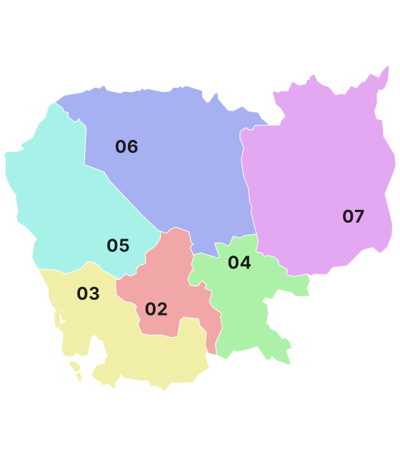
Regions

Hover a region on the map to see its name
Rôtânôkiri Môndól Kiri Krâchéh Kâmpóng Cham Svay Rieng Prey Vêng Kândal Takêv Kâmpôt Otdar Mean Chey Preah Vihéar Siemréab Bântéay Méanchey Kaôh Kong Pouthisat Batdâmbâng Krong Pailin Stœng Trêng Krong Preah Sihanouk Kep Kâmpóng Chhnang Kâmpóng Thum Kâmpóng Spœ Phnom Penh

Hover a region on the map to see its name

Basics

General facts about this place
  • The Angkor temple complex, including Angkor Wat, is a World Heritage Site[ref]
  • The Mekong River runs through central Cambodia, and Tonle Sap Lake is the largest lake in Southeast Asia[ref]

Nearby areas

Videos

Related videos

  • Which country drinks the most beer in Asia?

A page of play notes and identification clues for GeoGuessr.