
 Malaysia
Easily confused with:Indonesia, SingaporeQuizzes for this area:Malaysia State Quiz, Malaysia City Quiz, Area code quiz (Malaysia)
Whole area12
Clues that work anywhere in this area
Signs★★★
Route numbers are shown in a yellow hexagon. The Public Works Department of Malaysia's logo uses the same yellow hexagon and often appears on signs too.
Examples12SourcesJabatan Kerja Raya Malaysia
Utility Pole★★★
Signs and signboards are mounted on black-and-white striped poles.


Utility Pole★★★
Utility poles with a black label are likely to be on the peninsular side rather than the Borneo side.
Watch outSince 2026, poles with black labels have also been found on the Borneo side.


Road★★★
Roads are usually asphalt rather than concrete. Concrete roads are rare outside extreme cases like remote islands.


Commercial Facilities★★★
"SDN BHD" (BHD) in a company name is Malaysian for "private company" or "public company."
Commercial Facilities★
Petronas, the state-owned oil and gas giant, runs gas stations that often show the location on their signage.
Examples12SourcesPETRONAS Gas Berhad (PGB)

Narrowing down the region6
Once you know the area: which part of it
Area Code
Phone area codes narrow down the region
Phone area codes are assigned by region. When a number shows up on a sign, an advert or a van, its leading digits narrow the location down to a part of the country.
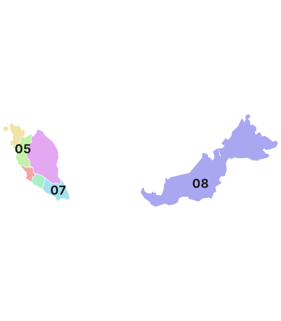 Coloured by leading digit
Language
Language & Script★★★
Jawi script on street names or supermarket signs points to either the northern peninsula (Terengganu, Kelantan, Kedah, Perlis) or the southern peninsula (Johor). A yellow sign is likely Johor.
Watch outIndonesia's Riau province and Riau Islands also use Jawi script.
Examples1SourcesJawi scriptThe Malaysia Doc by zi8gzag

Agriculture
Where Agriculture clues apply4
Click an item to jump to its clueTap to show the range; tap again or → to jump to the clue
Plants & farming★★★★★
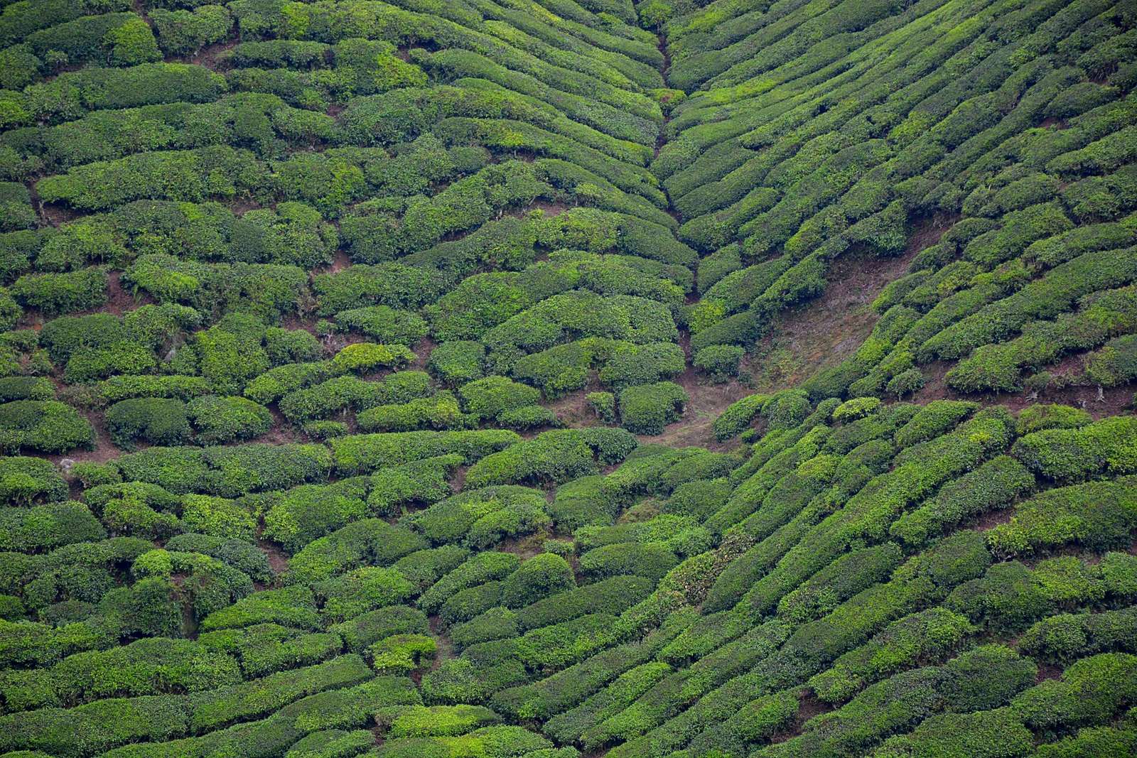
A cool-looking mountainside, unusual for tropical Malaysia, filled with trimmed green tea plantations and long, narrow vegetable greenhouses covered in white plastic means the Cameron Highlands.
Examples12SourcesCameron Highlands - Wikipedia (location, elevation, agriculture)Sabah Tea - Wikipedia (the Ranau, Sabah tea estate)BOH Plantations - Wikipedia (estate locations and share of Malaysian production)
Plants & farming★★★★★
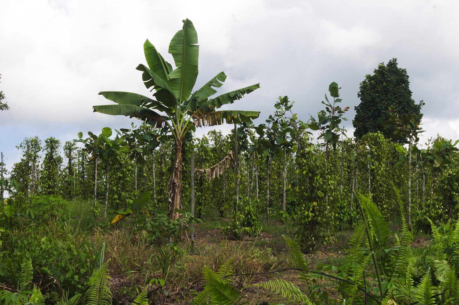
Thin poles taller than a person, standing straight at even intervals, each wrapped thickly in vines to form a cylindrical green column, mean a pepper field. Almost 98% of it is in Sarawak.
Plants & farming★★★
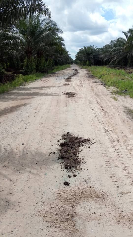
Oil palm plantations are found almost nationwide on low-lying land. As a share of state area, Johor, Malacca, and Negeri Sembilan are highest. By total planted area, Sabah and Sarawak are the largest. Perlis has almost none. Large-scale plantations often spread around a palm oil mill.
TipCentral Sarawak has few roads, so if you see a large-scale plantation, lean toward eastern Sabah instead.
Watch outPerlis has only 0.02% of national planted area, so oil palm is rarely seen there.
Examples12SourcesU.S. Malaysia Production Country Summary (U.S. Department of Agriculture)Oil Palm Planted Area 2023 - MPOB (planted area by state)
Open in Street View1
Plants & farming★★★
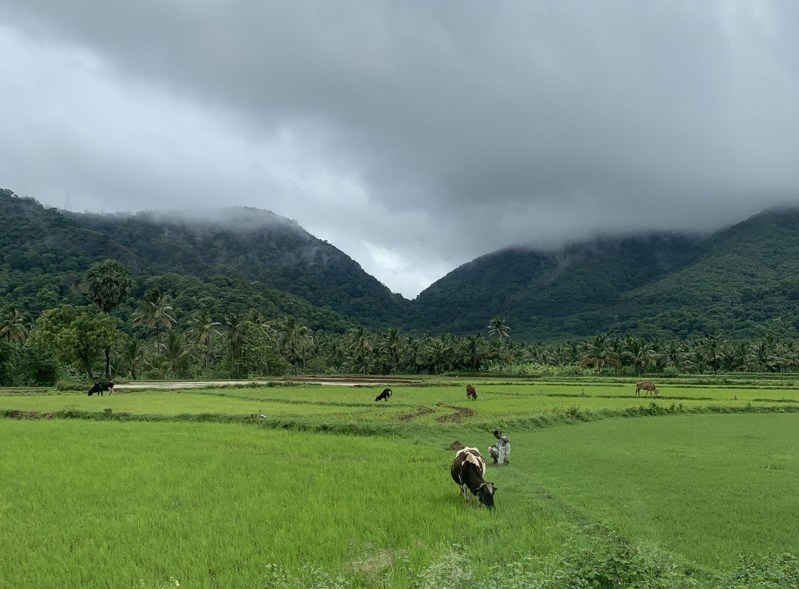
If you see rice paddies, it's usually in the far north of the peninsula.
TipThree-quarters of Perlis's land is rice paddies, followed by Kedah and Penang (the mainland side, Seberang Perai). These three states cluster in the northwestern tip of the Malay Peninsula, so paddies stretching to the horizon almost always mean this area.
Watch outJohor, Negeri Sembilan, and Pahang have almost no rice paddies (all under 0.4% of state area).
Examples12SourcesU.S. Malaysia Production Country Summary (U.S. Department of Agriculture)Crop Area and Production by State - OpenDOSM (planted area by state, 2022)
Open in Street View1
Terrain
Landscape★★★★
Several oddly shaped ponds or pools sitting side by side on flat land, ringed by mounds of pale sand, mean former tin mining sites. Unlike natural lakes, the banks are straight-edged.
Photo coming soonLandscape
Narrowing down the city3
Once you know the region: which city or town
Mabul Island

Tioman Island
Google Car★★★
On Tioman Island, the hand of the Google car driver is visible.
Photo coming soonGoogle Car
Road★★★
Tioman Island has concrete roads, which are very rare in Malaysia. Remote islands and hilly places tend to have more concrete roads.
No clues for this category and place yet.
Regions
Hover a region on the map to see its nameHover a region on the map to see its name
Nearby areas
A page of play notes and identification clues for GeoGuessr.