Kazakhstan

clues 12Regions 16Updated 2024-03-23

Quiz ▾Basics ▾

LanguageKazakh, Russian
Driving sideDrives on the right
Domain.kz
Easily confused with:OmanQuizzes for this area:Kazakhstan State Quiz, Kazakhstan City Quiz

Whole area3

Clues that work anywhere in this area

Language & Script★★★

Kazakh and Russian are both used.

Examples1
Google Car★★★

The Google Car is visible.

Examples123
License Plate★★★

You can sometimes spot a light-blue flag on the left side of the license plate.

Narrowing down the region9

Once you know the area: which part of it

Agriculture

East KazakhstanAlmatyZhambylSouth KazakhstanMangghystauQyzylordaAqtöbeNorth KazakhstanQostanayPavlodarWest KazakhstanAtyrauAqmolaQaraghandyAlmaty CityAstana
East KazakhstanAlmatyZhambylSouth KazakhstanMangghystauQyzylordaAqtöbeNorth KazakhstanQostanayPavlodarWest KazakhstanAtyrauAqmolaQaraghandyAlmaty CityAstanaMain producing area (Kyzylorda region)Upstream (Turkistan region)
East KazakhstanAlmatyZhambylSouth KazakhstanMangghystauQyzylordaAqtöbeNorth KazakhstanQostanayPavlodarWest KazakhstanAtyrauAqmolaQaraghandyAlmaty CityAstana

Where Agriculture clues apply4

Click an item to jump to its clueTap to show the range; tap again or → to jump to the clue

  1. wheat
  2. rice
  3. sunflower
  4. cotton
Plants & farming★★★★★

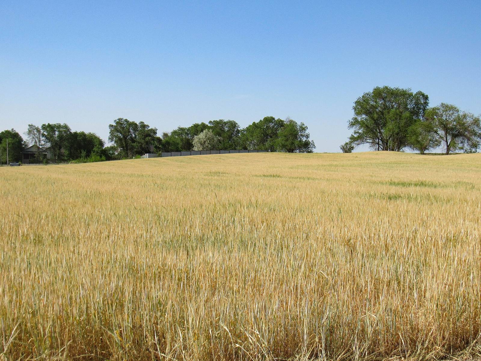
Nearly flat land with enormous, unbroken fields stretching to the horizon, interrupted only by thin windbreak strips, means the northern wheat belt (Kostanay region and others).

NoteIt's spring wheat, sown in mid-May and harvested from late August to October. Outside summer, the fields are either brown or snow-covered.
Examples1SourcesKazakhstan: Grain and Feed Annual KZ2025-0004 - USDA FAS (3 provinces produce about 80% of wheat)
Where
East KazakhstanAlmatyZhambylSouth KazakhstanMangghystauQyzylordaAqtöbeNorth KazakhstanQostanayPavlodarWest KazakhstanAtyrauAqmolaQaraghandyAlmaty CityAstana
Broad wheat fields with windbreaks (Kazakhstan)
Nikolai Bulykin / CC BY-SA 4.0
Plants & farming★★★★★

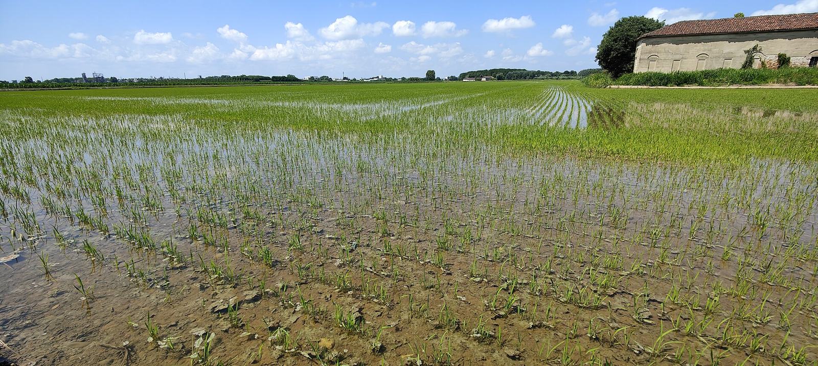
Flooded, square rice paddies with earthen dikes spread only along a narrow strip beside a river, right in the middle of the desert, mean Kyzylorda region. Along the lower Syr Darya River, nearly all of the country's rice is grown here.

SourcesEnvironmental Impact Assessment of Rice Growing in the Kyzylorda Region - IJDNE 18(4)
Where
East KazakhstanAlmatyZhambylSouth KazakhstanMangghystauQyzylordaAqtöbeNorth KazakhstanQostanayPavlodarWest KazakhstanAtyrauAqmolaQaraghandyAlmaty CityAstanaMain producing area (Kyzylorda region)Upstream (Turkistan region)
  • Main producing area (Kyzylorda region)
  • Upstream (Turkistan region)
Flooded, flat rice paddies (photo shows Vercelli, Italy)
Al*from*Lig / CC BY-SA 4.0
Plants & farming★★★★

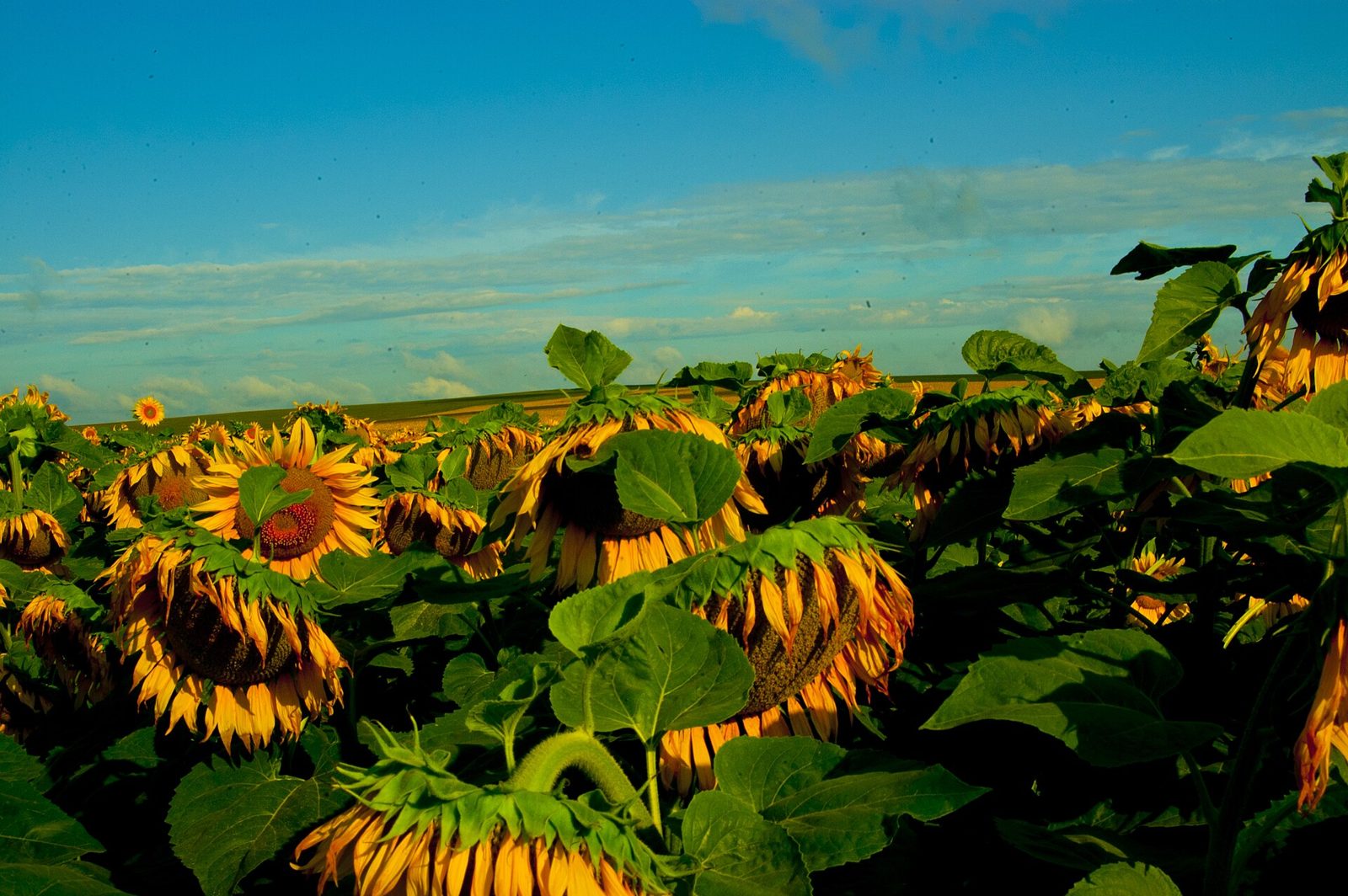
A sunflower field covered in yellow blooms in summer (July-August), and rows of bowed brown heads in autumn, means the east (Pavlodar region and others).

Sourcesagroinfo.kz, "Рынок подсолнечника в Казахстане" (planted area by region, 2019)Kazakhstan: Grain and Feed Annual KZ2025-0004 - USDA FAS (East Kazakhstan region as the sunflower center)
Where
East KazakhstanAlmatyZhambylSouth KazakhstanMangghystauQyzylordaAqtöbeNorth KazakhstanQostanayPavlodarWest KazakhstanAtyrauAqmolaQaraghandyAlmaty CityAstana
A sunflower field stretching to the horizon (photo shows Ukraine)
Eugenereed1984 / CC BY-SA 3.0
Plants & farming★★★★

Flat fields divided by irrigation channels, planted with knee-to-waist-high, dark green plants that burst into white cotton bolls in autumn, mean the irrigated cotton fields of Turkistan region at the southern tip.
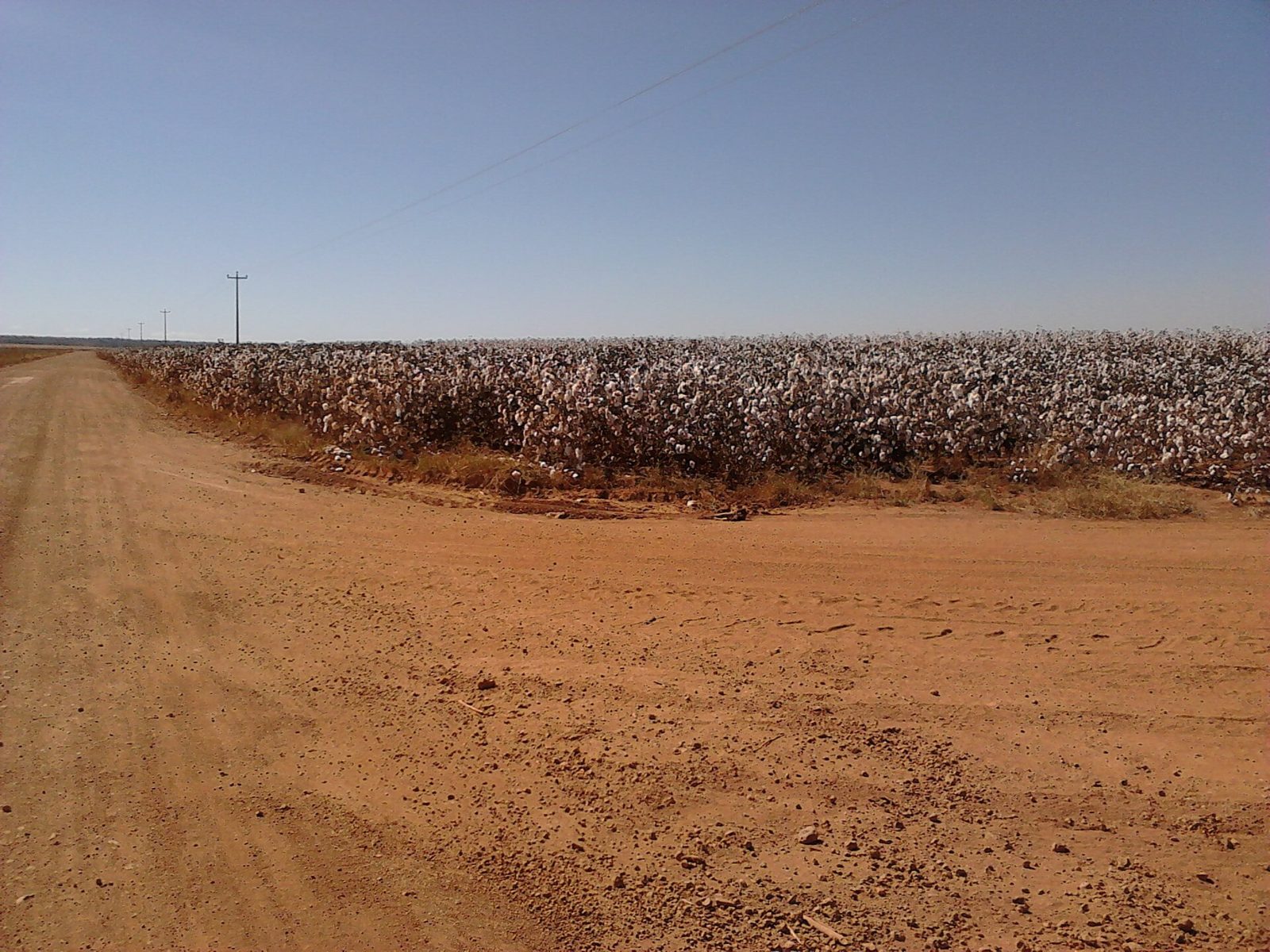
SourcesICAC, "Cotton Production, Breeding and Biotechnology Research in Kazakhstan" (growing areas and planted area)
Where
East KazakhstanAlmatyZhambylSouth KazakhstanMangghystauQyzylordaAqtöbeNorth KazakhstanQostanayPavlodarWest KazakhstanAtyrauAqmolaQaraghandyAlmaty CityAstana
A cotton field with white bolls (photo shows Brazil)
Darliton / CC BY-SA 3.0

Terrain

East KazakhstanAlmatyZhambylSouth KazakhstanMangghystauQyzylordaAqtöbeNorth KazakhstanQostanayPavlodarWest KazakhstanAtyrauAqmolaQaraghandyAlmaty CityAstana

Where Terrain clues apply2

Click an item to jump to its clueTap to show the range; tap again or → to jump to the clue

  1. desert
  2. Tian Shan
Landscape★★★★

An endless sandy-to-gray plain with only sparse grass and not a single tree in sight means the desert or semi-desert of the west or south.

NoteThe north (steppe, 26% of the country) is green grassland and farmland, so trees and fields point north, and their absence points west or south.
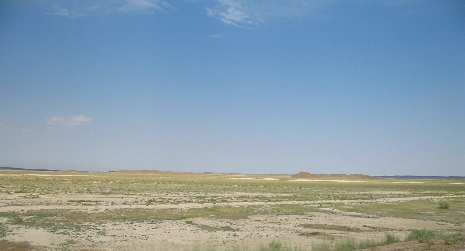
Examples12SourcesGeography of Kazakhstan - Wikipedia (shares of steppe, semi-desert, and desert)
Where
East KazakhstanAlmatyZhambylSouth KazakhstanMangghystauQyzylordaAqtöbeNorth KazakhstanQostanayPavlodarWest KazakhstanAtyrauAqmolaQaraghandyAlmaty CityAstana
A sand-colored plain without a single tree (Betpak-Dala Desert)
Nikolay Yushnikov / Public domain
Landscape★★★★

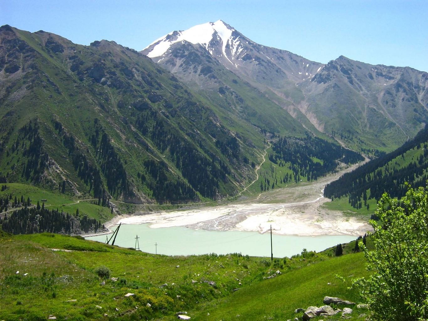
If a wall of high, permanently snow-capped mountains rises on the southern side of a flat, dry landscape, that's the southeast (around Almaty).

SourcesGeography of Kazakhstan - Wikipedia (mountain locations)
Where
East KazakhstanAlmatyZhambylSouth KazakhstanMangghystauQyzylordaAqtöbeNorth KazakhstanQostanayPavlodarWest KazakhstanAtyrauAqmolaQaraghandyAlmaty CityAstana
Snow-capped mountains rising beyond the flatland (Zailiysky Alatau, near Almaty)
Сергей Марцынюк / CC BY-SA 3.0

Vegetation

East KazakhstanAlmatyZhambylSouth KazakhstanMangghystauQyzylordaAqtöbeNorth KazakhstanQostanayPavlodarWest KazakhstanAtyrauAqmolaQaraghandyAlmaty CityAstana

Where Vegetation clues apply2

Click an item to jump to its clueTap to show the range; tap again or → to jump to the clue

  1. birch
  2. steppe
Plants & farming★★★★★

Small, round clumps of white-trunked birch groves (kolki) scattered like islands amid fields or grassland mean the forest steppe at the far north.

SourcesKazakh forest steppe - Wikipedia (extent and vegetation)
Where
East KazakhstanAlmatyZhambylSouth KazakhstanMangghystauQyzylordaAqtöbeNorth KazakhstanQostanayPavlodarWest KazakhstanAtyrauAqmolaQaraghandyAlmaty CityAstana
Plants & farming★★★★

A treeless, gently rolling plain covered edge-to-edge in silvery, thin feather grass and grayish-green wormwood means the northern-to-central steppe. The tell versus the semi-desert and desert to the south is whether the ground is filled in with grass.

SourcesKazakh Steppe - Wikipedia (extent and vegetation)Geography of Kazakhstan - Wikipedia (share of steppe)
Where
East KazakhstanAlmatyZhambylSouth KazakhstanMangghystauQyzylordaAqtöbeNorth KazakhstanQostanayPavlodarWest KazakhstanAtyrauAqmolaQaraghandyAlmaty CityAstana

Industry & Resources

Landscape★★★★

A stark-white, salt-crusted flat with pumpjacks, flare stacks, and pipelines dotted across it means the oilfield belt on the northeastern shore of the Caspian Sea.

SourcesTengiz Field - Wikipedia (location and scale)
Where
East KazakhstanAlmatyZhambylSouth KazakhstanMangghystauQyzylordaAqtöbeNorth KazakhstanQostanayPavlodarWest KazakhstanAtyrauAqmolaQaraghandyAlmaty CityAstana

Regions

Hover a region on the map to see its name
East Kazakhstan Almaty Zhambyl South Kazakhstan Mangghystau Qyzylorda Aqtöbe North Kazakhstan Qostanay Pavlodar West Kazakhstan Atyrau Aqmola Qaraghandy Almaty City Astana

Hover a region on the map to see its name

Basics

General facts about this place
  • The world's largest landlocked country and the 9th largest by area[ref]
  • In 2019 the capital was renamed from Nur-Sultan back to Astana[ref]

Nearby areas

A page of play notes and identification clues for GeoGuessr.