
How to Distinguish
- The domain is .mx
- Language is Spanish
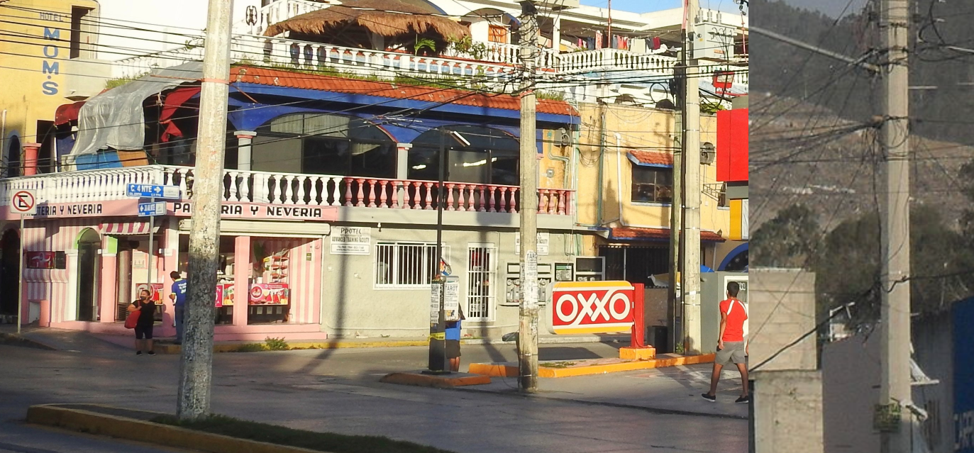
- OXXO is a major convenience store chain
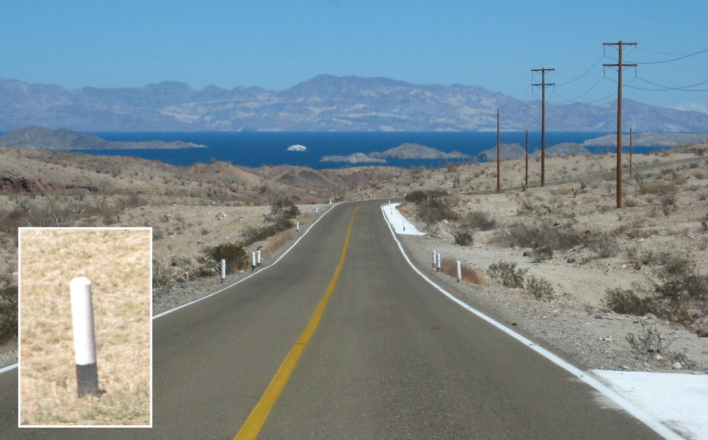
- Many utility poles are octagonal
- Major companies often end with -MEX or -MX (PEMEX, CEMEX, CINEMEX)
- White-and-orange bollards are common
- You can spot a blue VeTV antenna on houses
- Stop signs often say ALTO (also seen in Guatemala, Panama, and Costa Rica)
Signs you can find

.svg)
.svg)


Many major Mexican companies end with -MEX (PEMEX, CEMEX, CINEMEX). OXXO is a major Mexican convenience store, though it also appears in Chile.


Octagonal utility poles are distinctive. Colombia can have similar poles, so double-check other clues.
ALTO stop signs appear in Mexico, Guatemala, Panama, and Costa Rica. Mexico also uses white/orange directional arrows in some regions.

By Cdw1952 at English Wikipedia, CC BY-SA 3.0, Link
You can often spot a blue VeTV antenna attached to houses.
Many Mexican companies have MEX at the end of their names.
Mexican music for the road.
Narrow down state/region
- State names and highway shields help narrow the region
- The first digit of phone area codes hints at region: 2-9; even numbers trend north, odd numbers trend south
- Key area codes:
- Areas near the US sometimes show 000-000-0000 style numbers(by now_and_jenn )
Area code map for Mexico.

By XIC123 - Own work, CC BY-SA 4.0, Link
- Wind power is concentrated along the Isthmus of Tehuantepec (Oaxaca)
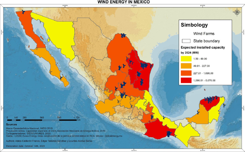
Wind farms cluster along Oaxaca’s coast(References Alonso-Serna, Lourdes, and Edgar Talledos-Sanchez. Fossilizing renewable energy: The case of wind power in the Isthmus of Tehuantepec, Mexico. (2023).).
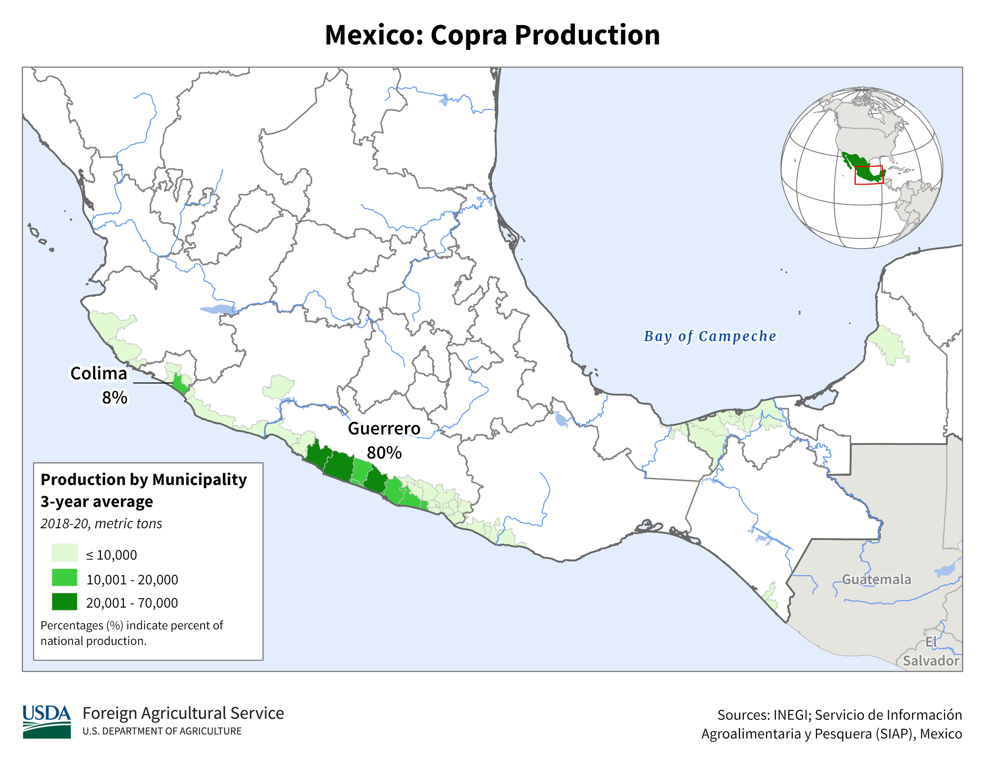
- Coconut palm plantations exist along the coast of Guerrero
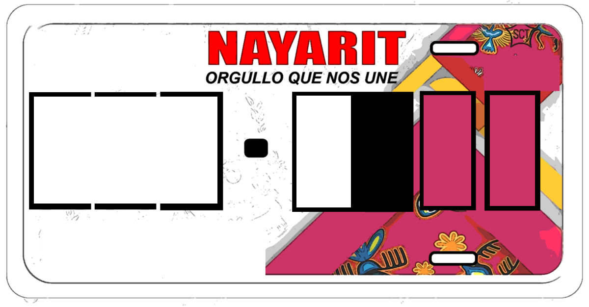
- Sometimes you can tell a town by the color of the license plate.
Public Domain
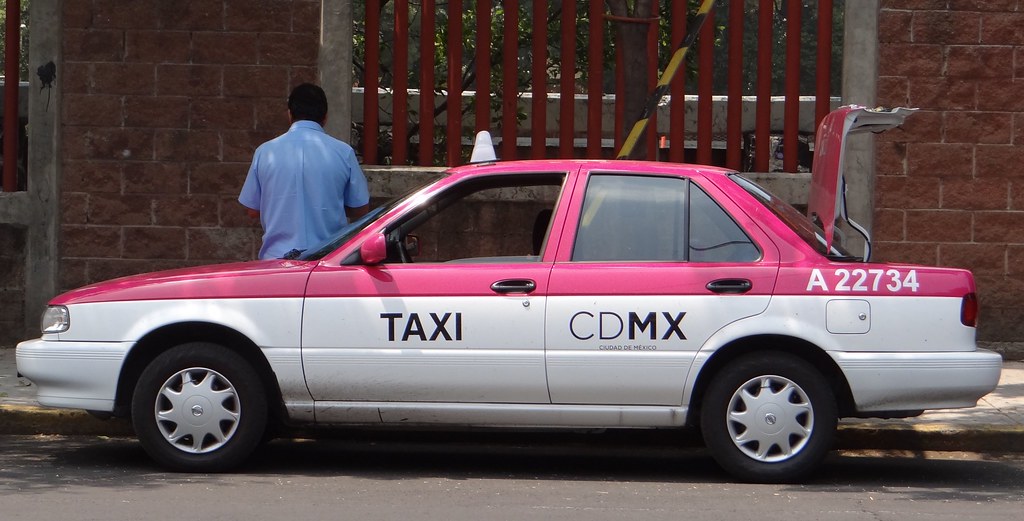
- There's a clue in the color of the cab.
- Cabs in Mexico City are pink.
- Sonora cabs are white with SONOLA written on the side.
- Cabs in Monterrey are yellow.
The area around this town is likely to be written in English because Americans come here by plane for sightseeing. The surrounding trees are distinctive.
States of Mexico (33)
Try the quiz- Sonora
- Baja California
- Chihuahua
- Coahuila
- Tamaulipas
- Nuevo León
- Quintana Roo
- Campeche
- Tabasco
- Chiapas
- Colima
- Nayarit
- Baja California Sur
- Sinaloa
- Yucatán
- Veracruz
- Jalisco
- Michoacán
- Guerrero
- Oaxaca
- null
- México
- Puebla
- Morelos
- Querétaro
- Hidalgo
- Guanajuato
- San Luis Potosí
- Zacatecas
- Aguascalientes
- Durango
- Tlaxcala
- Mexico City首都