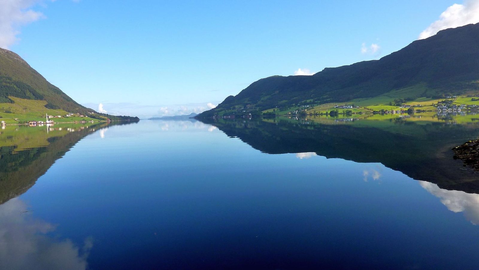

 Norway
LanguageNorwegian
Driving sideDrives on the right
Domain.no
Easily confused with:Finland, Sweden, Svalbard, northern englandQuizzes for this area:Norway State Quiz, Norway City Quiz
Whole area8
Clues that work anywhere in this area


Road★★★
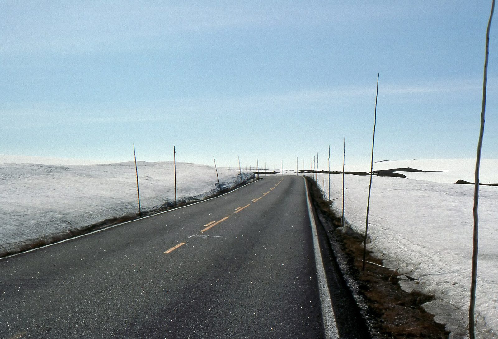
Snow poles show up along the roadside too.
Photo coming soonRoad


Road★★★
Road edge-line dashes are longer than Sweden's. The line even changes clearly right at the Norway-Sweden border.
Examples1234567SourcesHighlight reel: World Map beginner's course + Q&A | Citizen JohnSee alsoNordic edge lines


Signs★★★
Street name signs often have an orange background.

Narrowing down the region9
Once you know the area: which part of it
Vegetation
Plants & farming★★★★
A forest of dark green, densely packed conical Norway spruce points to the east or Trøndelag. Along the western coast and in the north it's limited to plantations.
SourcesGran - NIBIO (spruce distribution and plantations)granskog - Store norske leksikon (extent of natural spruce forest)
Photo coming soonPlants & farming
Plants & farming★★★
A forest of nothing but low, white-trunked, twisted mountain birch, extending all the way down to flat ground or the coast, means the north (Troms, Finnmark).
Photo coming soonPlants & farming
Plants & farming★★★
The same vegetation is spread broadly north to south, so narrowing down the region by vegetation is difficult. Broadly speaking, it breaks into the following zones.
| #899FAB | the far-north zone where mountains or bare rock are visible |
|---|---|
| #899FAB | the southern zone where mountains or bare rock are visible |
| #009243 | the southernmost zone, with lots of broadleaf trees |
| #7C7640/#5C460E | a zone with a high share of conifers, where the roadside may be covered in short grass |
| #8CC63E | a zone with farmland and pasture, where tall hedges and maple trees can appear around houses |

Industry & Resources
Where Industry & Resources clues apply2
Click an item to jump to its clueTap to show the range; tap again or → to jump to the clue
Landscape★★★★
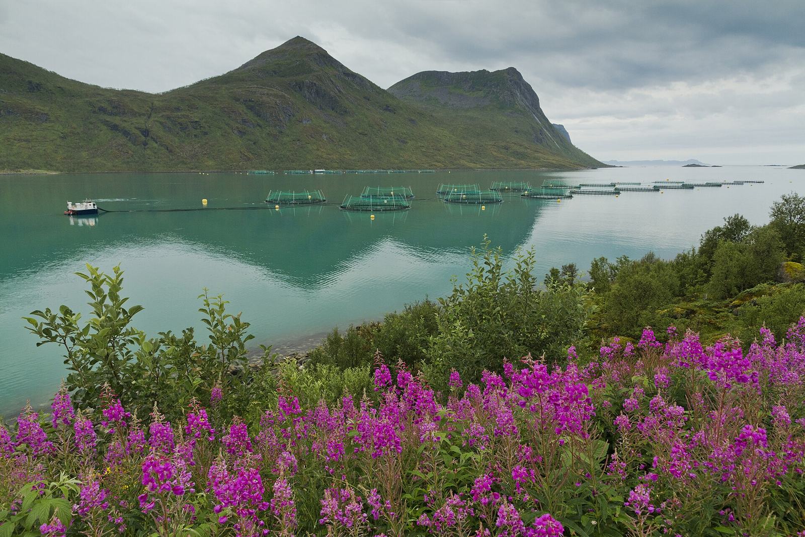
Black ring-shaped floats spaced evenly across the calm water of a sheltered fjord or lee of an island, with a square work boat (a feed barge) nearby, mean a salmon farm. There are almost none in the south (Agder).
Landscape★★★★
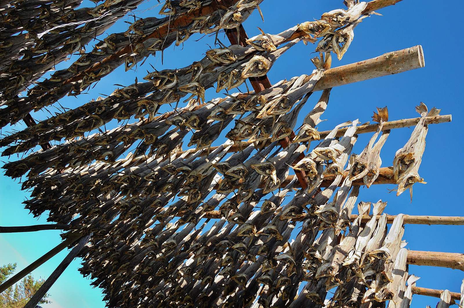
Rows of roofless, wall-less wooden frames along the coast, hung upside-down with cod, mean stockfish drying racks (hjell). The north (Lofoten Islands, etc.) is the heartland, and they're used from February to May; outside that window, only the bare frames remain.
Examples12SourcesStockfish - Wikipedia (drying racks and timing)
Terrain
Where Terrain clues apply2
Click an item to jump to its clueTap to show the range; tap again or → to jump to the clue
Landscape★★★★★
A flat coastal stretch with none of Norway's typical mountains, forests, or fjords — just green pasture and low stone walls — means Jæren in Rogaland county. The coast is mostly sandy beach.
Photo coming soonLandscape
Landscape★★★★★
Beyond where the road clears the treeline, a gently rolling, entirely treeless plateau scattered with ponds and streams stretching on and on means Hardangervidda.
Examples12SourcesHardangervidda - Wikipedia (extent, elevation, landscape)
Agriculture
Where Agriculture clues apply2
Click an item to jump to its clueTap to show the range; tap again or → to jump to the clue
Plants & farming★★★★
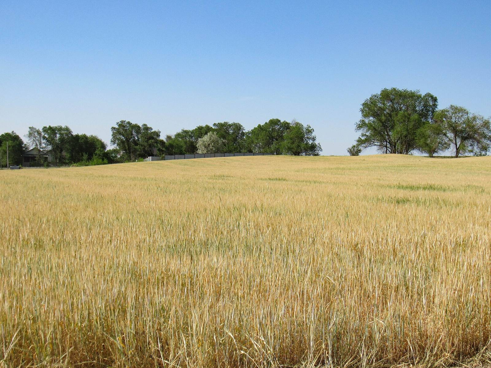
Golden-ripe grain fields (barley, oats, wheat) in late summer point to the east (around Oslo to Hedmark) or Trøndelag. Farmland in the west and north is mostly pasture.
Examples12SourcesJordbruksarealet held seg stabilt - SSB (88% of grain area in three counties)Dyrkingsomfang og avling i kornproduksjonen (2023) - Norsk Landbruksrådgiving (grain area by county)
Plants & farming★★★
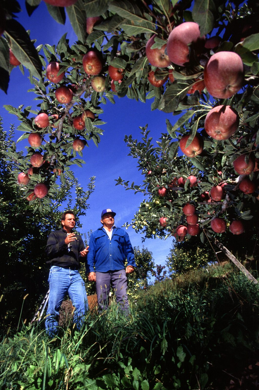
Orchards of evenly spaced, low apple or cherry trees stretching along steep fjord slopes point to the Hardangerfjord area (Vestland).
Examples12SourcesHardanger - Wikipedia (about 40% of fruit production)Apple Growing in Norway—Ecologic Factors, Current Fertilization Practices and Fruit Quality - Horticulturae (main apple-growing municipalities)
No clues for this category and place yet.
Regions
Hover a region on the map to see its nameHover a region on the map to see its name
Basics
General facts about this placeCompanies
Companies with ties to this region. However, this does not necessarily mean they can be used on GeoGuessr.Logos you may spot


- Equinor
It is a national energy company and has the largest sales and market capitalization in Norway.Operates oil and gas fields in the North Sea, including the Troll gas field, which is one of the largest oil fields in the North Sea..
Official site (IR)The Troll field and the Troll A, B and C platforms
- Golden Ocean Group
A dry bulk shipping company independent from Frontline.It owns a number of large dry bulk vessels.
Nearby areas
A page of play notes and identification clues for GeoGuessr.