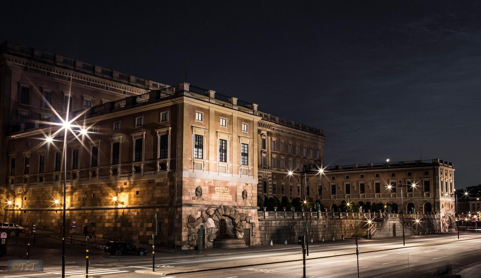

 Sweden
LanguageSwedish
Driving sideDrives on the right
Domain.se
Easily confused with:Norway, Finland, Denmark, Åland Islands, EstoniaQuizzes for this area:Sweden State Quiz, Sweden City Quiz, Area code quiz (Sweden)
Whole area8
Clues that work anywhere in this area
Road★★★
The dashes in the road's edge line are short. The line even changes clearly right at the Norway-Sweden border.
Watch outEstonia has similar short dashes too, so on flat terrain check other clues besides the road.12345
Examples1234SourcesHighlight reel: World Map beginner's course + Q&A | Citizen JohnSee alsoNordic edge linesEstonia


Signs★★★
The pedestrian warning sign shows four crosswalk stripes.


Signs★★★
The arrow on directional signs has a distinctive shape — it's not a clean ▷.

Signs★★★
Chevron signs sometimes use colors close to the national flag.
Watch outNorway's and Finland's chevrons are yellow on a black background, which makes them easy to tell apart.
Signs★★★
In the Nordics, a warning sign with an orange background and no thin yellow border likely means Sweden.
Examples1

Language & Script★★★
Street names end in gatan (street) or vägen (road).

Language & Script★★★
The letter "ø" is not used in Sweden.
| Japanese | ここは一方通行のゾーンです |
|---|---|
| English | This is a one-way zone. |
| Swedish | Det här är en enkelriktad zon. |
| Norwegian | Dette er en enveiskjøringssone. |
| Danish | Dette er en ensrettet zone. |
| Finnish | Tämä on yksisuuntainen alue. |

Narrowing down the region8
Once you know the area: which part of it
Area Code
Phone area codes narrow down the region
Phone area codes are assigned by region. When a number shows up on a sign, an advert or a van, its leading digits narrow the location down to a part of the country.
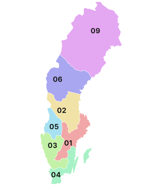 Coloured by leading digit
Signs★★★
The number on a sign is a road number. Two-digit numbers run from 9-99 south to north; three-digit numbers run roughly 100-400 south to north.

Plants & farming★★★
Vegetation and soil color vary by region.
- Far south (#00FF02): flat, with farmland
- Southern conifer belt (#025D00/#005E00): conifers dominate, but round-topped broadleaf trees like beech and oak also grow here
- North (#427D85): conifers dominate heavily, with fewer broadleaf trees
- Northern border area (#7D827C): bare rock or snow cover

Terrain
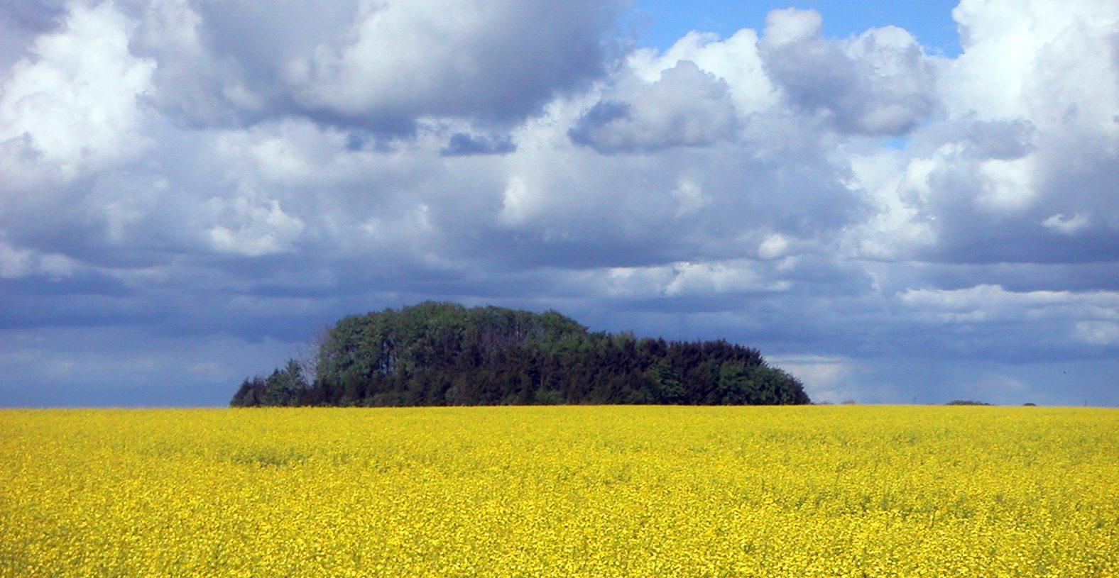
Landscape★★★★★
If the forest breaks and gently rolling large fields stretch to the horizon, with clear sightlines between houses, that's Skåne County (the southern tip).
NoteOpen farmland also appears in Östergötland, Västra Götaland, and around Lake Mälaren (Uppsala, Västmanland, Södermanland).
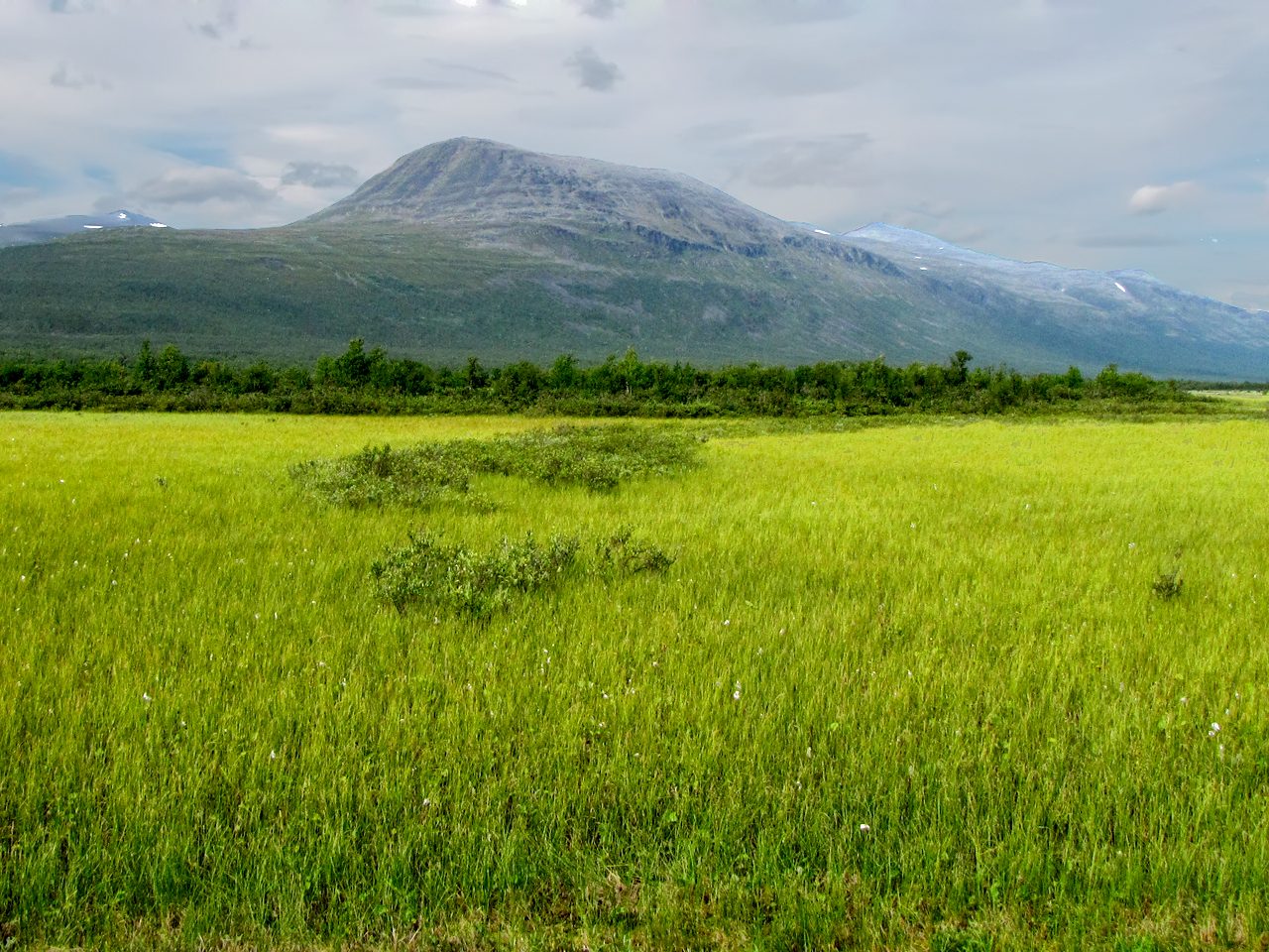
Landscape★★★★★
Once the spruce and pine forest ends and gives way to a belt of low, twisted birch, and then to bare, rounded mountains above that, you're in the fjäll (mountains) along the Norwegian border.
Examples123SourcesScandinavian Mountains - Wikipedia (extent and elevation)Scandinavian montane birch forest and grasslands - Wikipedia (birch treeline)
Landscape★★★★★
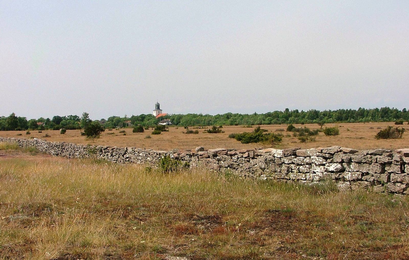
A plain with almost no trees or shrubs, where flat limestone slabs are exposed at the surface under a thin skin of grass, means an alvar (a limestone plain with almost no soil) on Öland or Gotland.
Examples123SourcesAlvar - Wikipedia (distribution and landscape)
Vegetation
Where Vegetation clues apply2
Click an item to jump to its clueTap to show the range; tap again or → to jump to the clue
Plants & farming★★★★
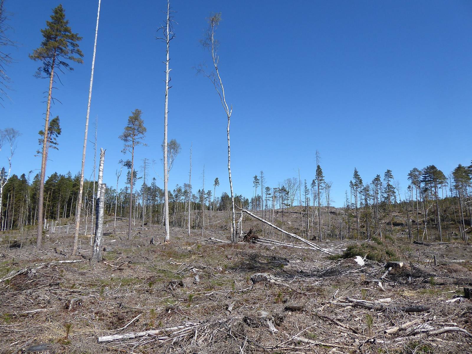
If both sides of the road stay walled in by spruce and pine forest, occasionally broken by clearcuts or blocks of even-height saplings planted close together, that means forestry country centered on Norrland (the northern half).
Examples12SourcesLand use in Sweden - SCB (forest cover by county)
Plants & farming★★★★
Round-topped broadleaf trees (beech, oak) standing out in forests or tree-lined roads point to the south. Beech forests dominate in Skåne County and on the west coast (Halland County).
Photo coming soonPlants & farming
Industry & Resources
Landscape★★★★
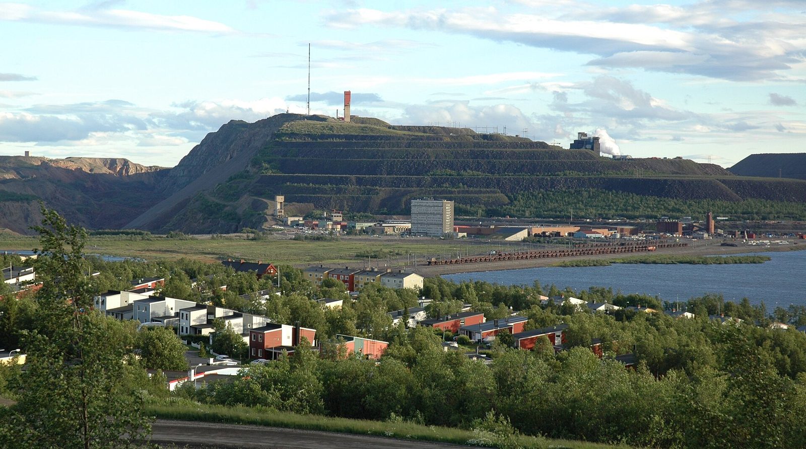
In the far north, where there's usually nothing but forest and lakes, a sudden view of a massive terraced open-pit mine carved into a mountain, reddish-brown waste rock piles, and long ore trains means the iron mining district of Norrbotten County (Kiruna and others).
No clues for this category and place yet.
Regions
Hover a region on the map to see its nameHover a region on the map to see its name
Basics
General facts about this placeNearby areas
A page of play notes and identification clues for GeoGuessr.