ニュージーランド

手がかり 23地域 16更新 2023-04-20

クイズ ▾基本情報 ▾

言語英語・マオリ語
通行方向左側通行
ドメイン.nz

全域7

この地域のどこでも使える手がかり

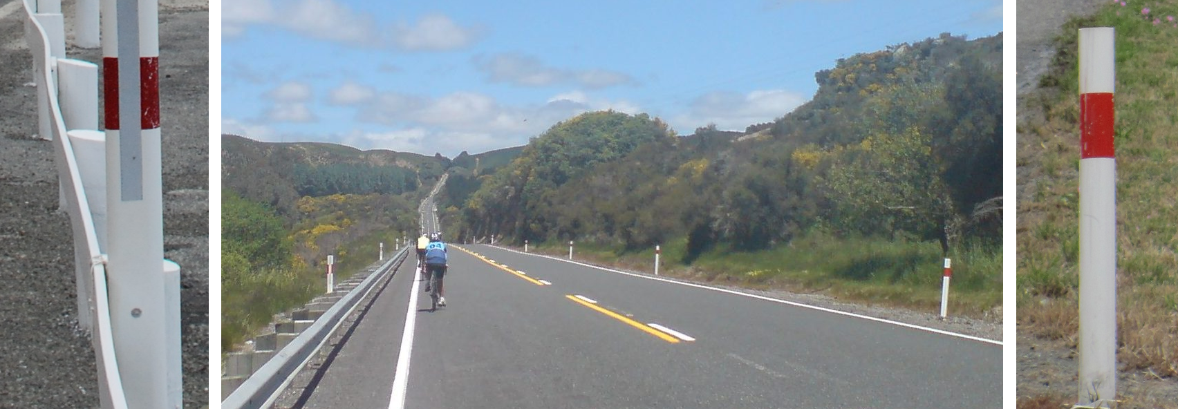
ボラード★★★★★

ボラードは本体も反射板も赤く塗られていて、反射板は表裏の両面にある。

注意オーストラリアのボラードは反射板が片面だけだったり丸い形だったりするので、そこで区別できる。
実例1234567
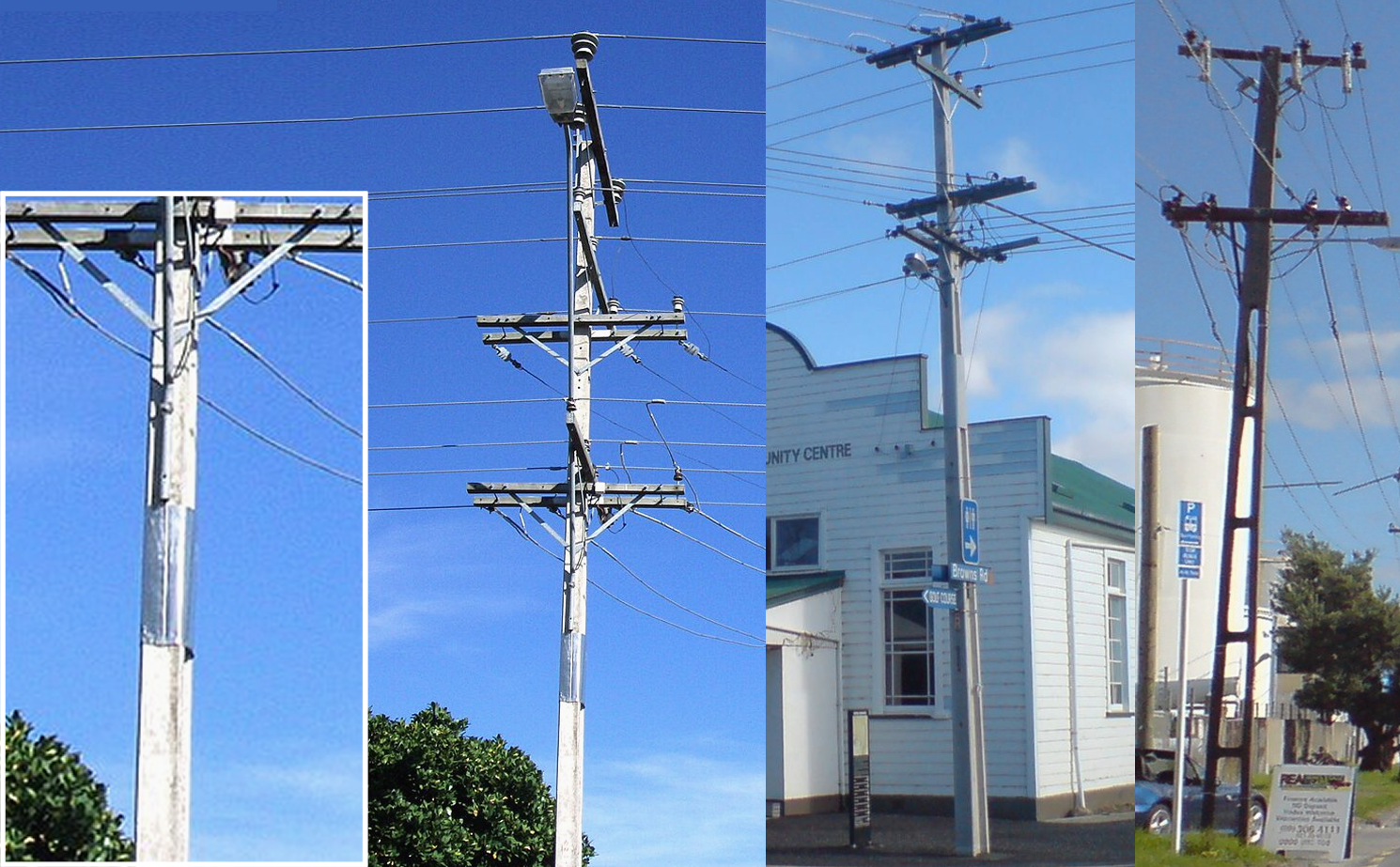
電柱★★★★★

電柱の上のほうに、シルバーの何かが巻かれている。

補足穴の空いた電柱もある。南島の最南端とスチュアート島に多い。12
実例123456789
Street View で見る2
道路★★★★★

道路番号は赤い盾の形の標識に書かれている。

実例12
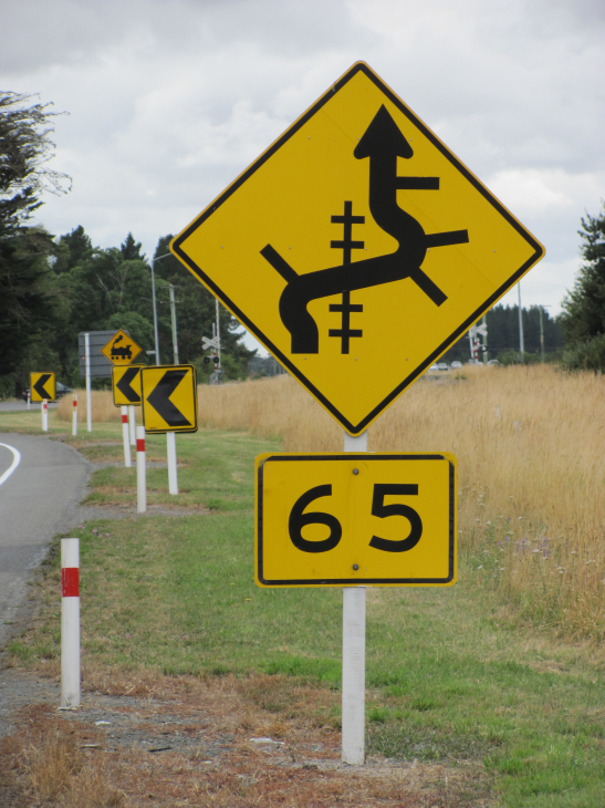
標識★★★★★

黄色の規制標識がある。また、標識やシェブロンは白い角材に付けられている。

実例123
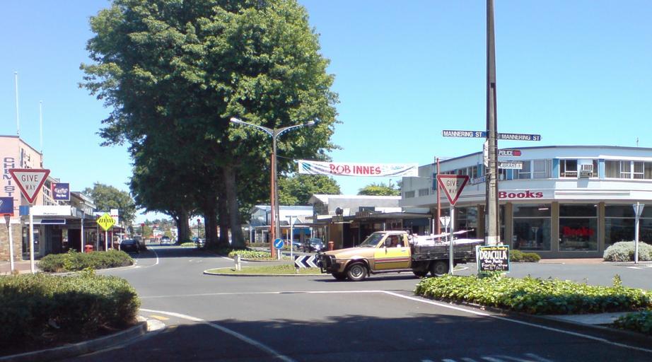
標識★★★

GIVE WAY の標識は文字が赤い。黒い文字ならオーストラリア。

実例123
オーストラリア(黒い文字)
オーストラリア(黒い文字)
ニュージーランド(赤い文字)
ニュージーランド(赤い文字)
標識★★★

速度標識は赤い丸の中に数字。オーストラリアなら細長い白いプレートに書かれていることがある。

注意赤い丸の数字は道路番号ではなく速度表記。道路番号は赤い盾の形(次の項目)。
実例1234
オーストラリア
オーストラリア
ニュージーランド
ニュージーランド
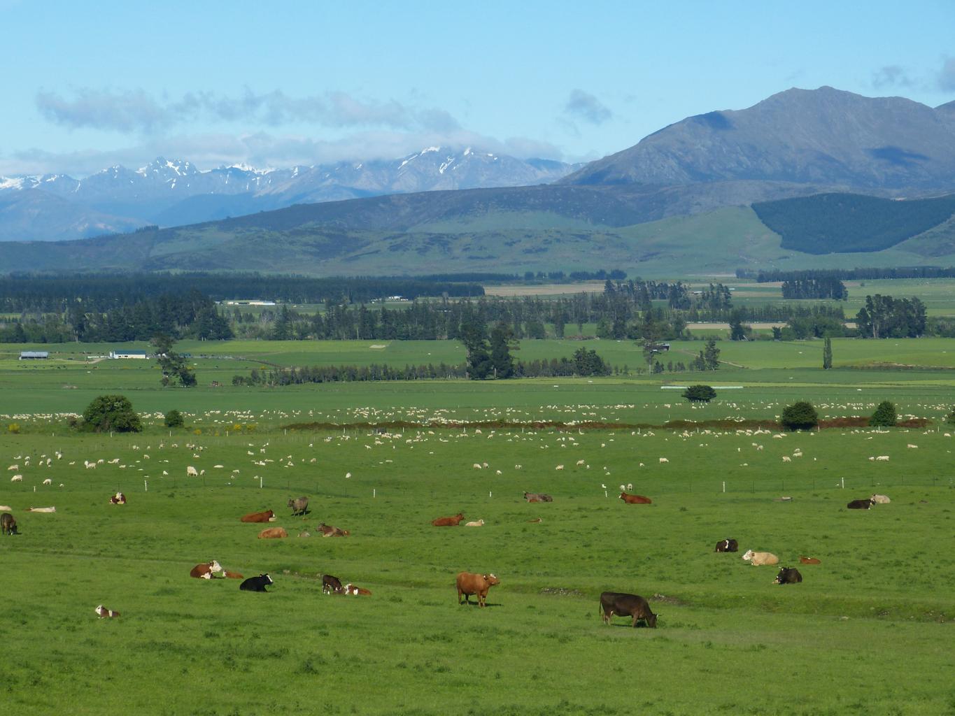
植物・農業★★★

国土の 40% 以上が牧草地。雨が年中適度に降るので牧草が育ちやすく、酪農が盛ん。

実例12

地域の絞り込み14

場所がわかったあと、その中のどの地域かを絞る手がかり

地形・景観★★★

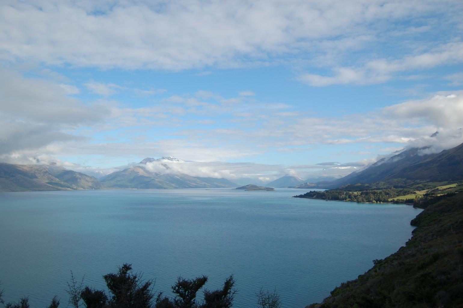
丘が平坦か、雪をかぶった山が見えるか、木の密度はどうか、で北島と南島を見分ける。

コツ画質が悪く砂利道が多いならAucklandの北。雪山や木の電柱が多いなら南島を考える。
コツ穴あき電柱があって羊しか見えないなら、南島の一番南を押す価値がある。羊が多いだけでは確定できない。12
出典【GeoGuessr攻略】ニュージーランド編!現地プロによる徹底解説Part1【翻訳】ニュージーランドの牛肉生産事情~酪農産業の拡大による影響と今後の見通し~

植生

SouthlandMarlborough DistrictNelson CityTasman DistrictWest CoastOtagoCanterburyAucklandWaikatoWellingtonManawatu-WanganuiTaranakiNorthlandBay of PlentyGisborne DistrictHawke's Bay
SouthlandMarlborough DistrictNelson CityTasman DistrictWest CoastOtagoCanterburyAucklandWaikatoWellingtonManawatu-WanganuiTaranakiNorthlandBay of PlentyGisborne DistrictHawke's BayCanterbury平野Canterbury平野
SouthlandMarlborough DistrictNelson CityTasman DistrictWest CoastOtagoCanterburyAucklandWaikatoWellingtonManawatu-WanganuiTaranakiNorthlandBay of PlentyGisborne DistrictHawke's Bay

植生の分布3

クリックで対応するヒントに移動できますタップで範囲を表示、もう一度タップか → でヒントに移動

  1. ラジアータパイン
  2. 防風林
  3. ダンチク
植物・農業★★★★

同じ高さの針葉樹がまっすぐな境界線で区切られ、丸ごと伐り払われた区画と若い苗の区画が隣り合っていたらラジアータパインの人工林。林床に何も生えず、地面が茶色い針葉で覆われる。

なぜここ?カリフォルニア原産だが約28年で伐期になるほど成長が速く、農業に失敗した火山台地のやせた酸性土壌でもよく育つため、20世紀に国策で大規模に植えられた。Wikipedia "Forestry in New Zealand"
出典Kaingaroa Forest - Wikipedia(位置・面積・樹種)
見られる場所
SouthlandMarlborough DistrictNelson CityTasman DistrictWest CoastOtagoCanterburyAucklandWaikatoWellingtonManawatu-WanganuiTaranakiNorthlandBay of PlentyGisborne DistrictHawke's Bay
植物・農業★★★

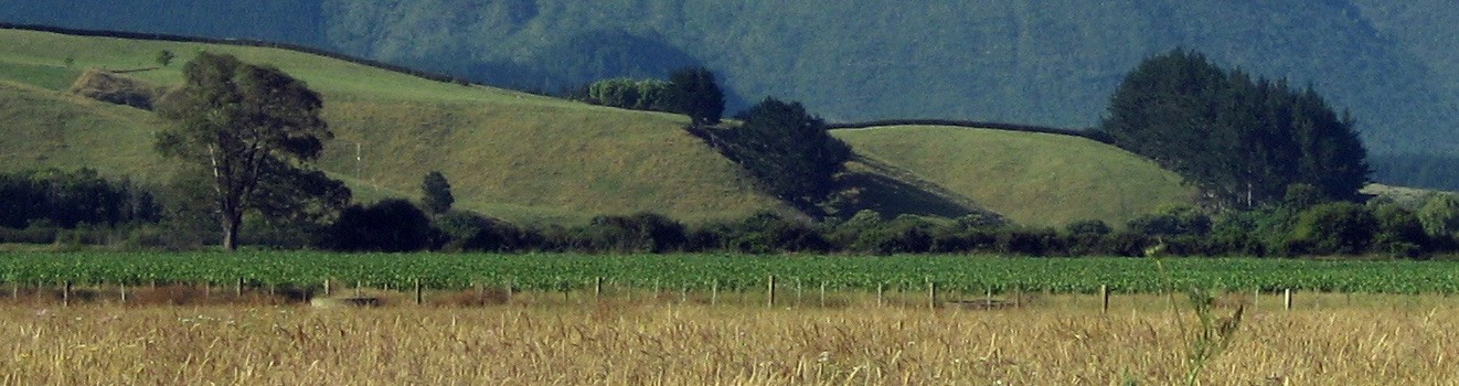
南島のCanterbury平野はChristchurchを中心に平坦で、背の高い防風林が多く、灌漑農業をしている。

なぜここ?Southern Alpsを越えて吹き下ろす乾いた北西風(フェーン)で干ばつになりやすく、年降水量も750mm未満と少ないため、風よけの防風林と灌漑が欠かせない。Britannica "Canterbury Plains"Wikipedia "Climate of New Zealand"
実例1234
見られる場所
SouthlandMarlborough DistrictNelson CityTasman DistrictWest CoastOtagoCanterburyAucklandWaikatoWellingtonManawatu-WanganuiTaranakiNorthlandBay of PlentyGisborne DistrictHawke's BayCanterbury平野Canterbury平野
Windbreak
zbmcfate / All Rights Reserved
植物・農業★★★

ダンチク(地中海周辺に多い植物)は北島の海沿い、特にAuckland周辺に生えている。

実例1
見られる場所
SouthlandMarlborough DistrictNelson CityTasman DistrictWest CoastOtagoCanterburyAucklandWaikatoWellingtonManawatu-WanganuiTaranakiNorthlandBay of PlentyGisborne DistrictHawke's Bay

農業

SouthlandMarlborough DistrictNelson CityTasman DistrictWest CoastOtagoCanterburyAucklandWaikatoWellingtonManawatu-WanganuiTaranakiNorthlandBay of PlentyGisborne DistrictHawke's Bay

農業の分布4

クリックで対応するヒントに移動できますタップで範囲を表示、もう一度タップか → でヒントに移動

  1. キウイ
  2. ぶどう畑
  3. 乳牛
  4. 羊
植物・農業★★★

キウイ農園があるのは北島か、南島の最北端。

なぜここ?キウイには温暖な気候が要る。Bay of Plenty沿岸は国内でも特に温暖で日照が多く、火山灰が風化した水はけのよい土が果樹に向いていた。Te Ara「Bay of Plenty region」Zespri "Top Kiwifruit Growing Regions & Recipes"
実例12出典Kiwifruit - Tupu.nz(地方別の生産の割合)
見られる場所
SouthlandMarlborough DistrictNelson CityTasman DistrictWest CoastOtagoCanterburyAucklandWaikatoWellingtonManawatu-WanganuiTaranakiNorthlandBay of PlentyGisborne DistrictHawke's Bay
植物・農業★★★

ぶどう畑があるのは北島の東海岸側か、南島の最北端。多少起伏のあるエリアにも畑がある。

なぜここ?北島西側の蒸し暑い夏はカビで葉や実が傷むため、1970年代以降、日照が多く雨の少ない東側や南島北部へ産地が移った。Te Ara「Viticulture」New Zealand Winegrowers "Marlborough"
実例12出典Marlborough wine region - Wikipedia(地方別の作付面積の割合 2020)
見られる場所
SouthlandMarlborough DistrictNelson CityTasman DistrictWest CoastOtagoCanterburyAucklandWaikatoWellingtonManawatu-WanganuiTaranakiNorthlandBay of PlentyGisborne DistrictHawke's Bay
植物・農業★★★

平らで真っ青な牧草地に白黒(ホルスタイン)や茶色(ジャージー)の乳牛の群れがいて、電気柵で細かく区切られていたら酪農地帯。北島ではWaikatoやTaranaki、南島ではCanterbury平野やSouthlandに多い。

コツ北島の東側(Gisborne・Hawke's Bay)は乳牛がほとんどいない。同じ緑の牧草地でも、急な丘に羊や肉牛がいるなら東側も考える。
なぜここ?酪農は雨が安定し冬も暖かく、牧草が一年中育つ北島で発達した。近年は灌漑が進み地価も安いCanterbury平野やSouthlandへ広がった。Te Ara「Dairying and dairy products」
出典New Zealand Dairy Statistics 2022-23 - DairyNZ(地域別の乳牛の頭数)
見られる場所
SouthlandMarlborough DistrictNelson CityTasman DistrictWest CoastOtagoCanterburyAucklandWaikatoWellingtonManawatu-WanganuiTaranakiNorthlandBay of PlentyGisborne DistrictHawke's Bay
牧草地で草を食べる牛(写真はスロベニア)
Ajznponar / CC0
植物・農業★★★

木のない急な丘の斜面に羊が点々と散らばり、家畜の踏み跡でできた細い段々(羊道)が斜面を横に走っていたら羊の放牧地。北島なら東側のHawke's Bayなど、南島ならCanterbury・Otago・Southlandに多い。

出典Compendium of New Zealand Farm Facts 2023 - Beef + Lamb New Zealand(地域別の羊の頭数 2022)
見られる場所
SouthlandMarlborough DistrictNelson CityTasman DistrictWest CoastOtagoCanterburyAucklandWaikatoWellingtonManawatu-WanganuiTaranakiNorthlandBay of PlentyGisborne DistrictHawke's Bay
柵で区切られた丘陵の牧場(Wellington近郊のBattle Hill)
Pseudopanax at en.wikipedia / Public domain

離島

SouthlandMarlborough DistrictNelson CityTasman DistrictWest CoastOtagoCanterburyAucklandWaikatoWellingtonManawatu-WanganuiTaranakiNorthlandBay of PlentyGisborne DistrictHawke's Bay
SouthlandMarlborough DistrictNelson CityTasman DistrictWest CoastOtagoCanterburyAucklandWaikatoWellingtonManawatu-WanganuiTaranakiNorthlandBay of PlentyGisborne DistrictHawke's Bayスチュアート島スチュアート島
SouthlandMarlborough DistrictNelson CityTasman DistrictWest CoastOtagoCanterburyAucklandWaikatoWellingtonManawatu-WanganuiTaranakiNorthlandBay of PlentyGisborne DistrictHawke's Bayホワイト島ホワイト島
SouthlandMarlborough DistrictNelson CityTasman DistrictWest CoastOtagoCanterburyAucklandWaikatoWellingtonManawatu-WanganuiTaranakiNorthlandBay of PlentyGisborne DistrictHawke's BayAntipodes諸島Antipodes諸島

離島の分布3

クリックで対応するヒントに移動できますタップで範囲を表示、もう一度タップか → でヒントに移動

  1. スチュアート島
  2. ホワイト島
  3. ペンギン
地形・景観★★★

スチュアート島は人が住む島の中では最も南。森に囲まれた入江と黒っぽい砂浜がある。

実例1234出典スチュアート島
見られる場所
SouthlandMarlborough DistrictNelson CityTasman DistrictWest CoastOtagoCanterburyAucklandWaikatoWellingtonManawatu-WanganuiTaranakiNorthlandBay of PlentyGisborne DistrictHawke's Bayスチュアート島スチュアート島
By Annette Teng, CC BY 3.0
地形・景観★★★

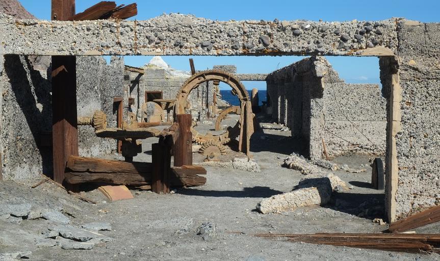
北島の北にあるホワイト島には、火山災害で放棄された硫黄生産の跡地がある。

なぜここ?活火山の硫黄が何度も採掘されたが、1914年に火口縁の一部が崩れた岩屑なだれで作業員10人全員が死亡した。1923年に再開したが硫黄分が少なく1930年代に終わった。Bay of Plenty Regional Council「Whakaari (White Island), Group 1」Wikipedia "Whakaari / White Island"
実例1
見られる場所
SouthlandMarlborough DistrictNelson CityTasman DistrictWest CoastOtagoCanterburyAucklandWaikatoWellingtonManawatu-WanganuiTaranakiNorthlandBay of PlentyGisborne DistrictHawke's Bayホワイト島ホワイト島
地形・景観★★★

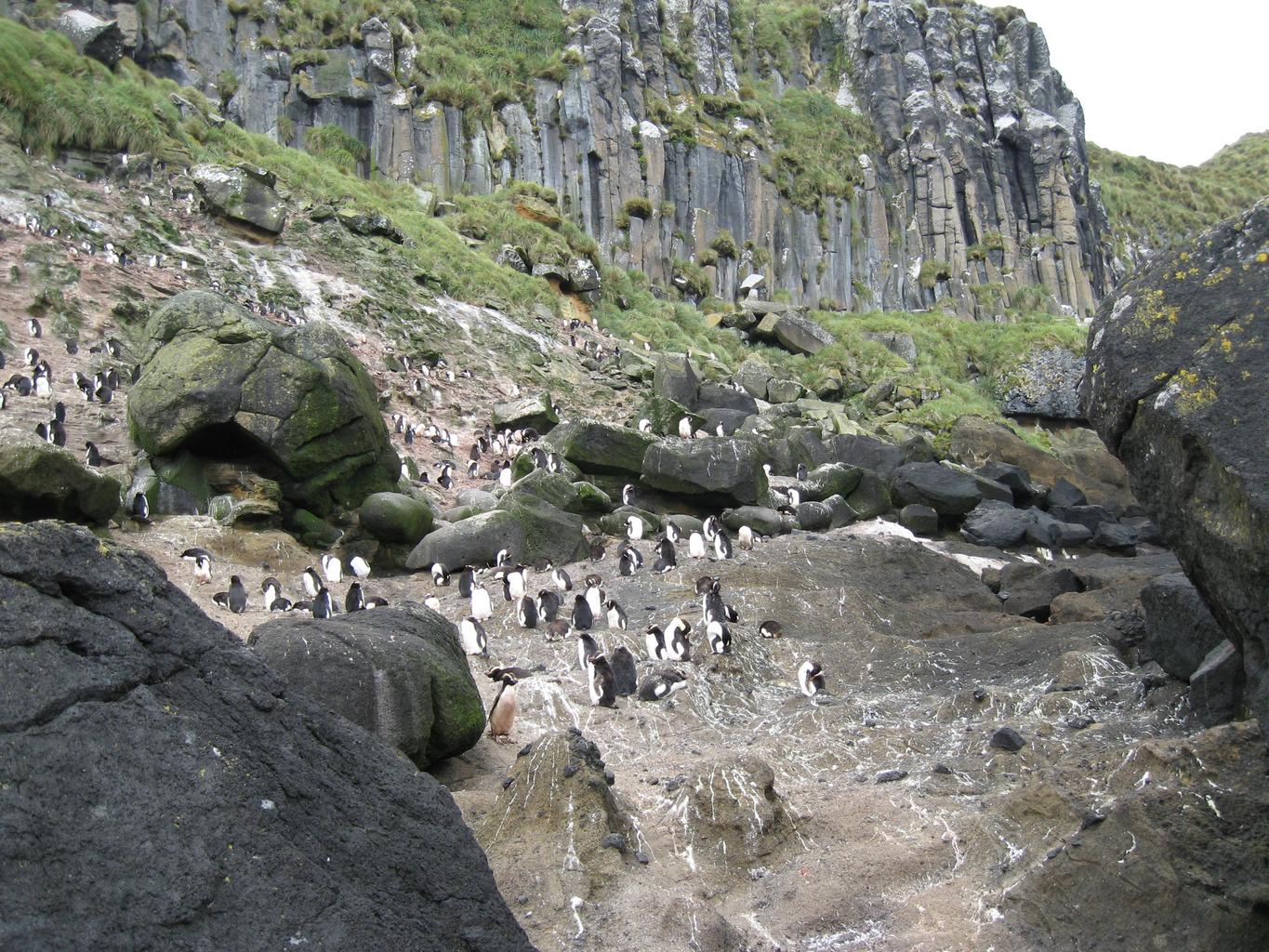
Antipodes諸島にはペンギンのコロニーがあり、オットセイもいる。世界遺産で、一般人は入れないエリア。

実例12
見られる場所
SouthlandMarlborough DistrictNelson CityTasman DistrictWest CoastOtagoCanterburyAucklandWaikatoWellingtonManawatu-WanganuiTaranakiNorthlandBay of PlentyGisborne DistrictHawke's BayAntipodes諸島Antipodes諸島

地形

SouthlandMarlborough DistrictNelson CityTasman DistrictWest CoastOtagoCanterburyAucklandWaikatoWellingtonManawatu-WanganuiTaranakiNorthlandBay of PlentyGisborne DistrictHawke's Bay
SouthlandMarlborough DistrictNelson CityTasman DistrictWest CoastOtagoCanterburyAucklandWaikatoWellingtonManawatu-WanganuiTaranakiNorthlandBay of PlentyGisborne DistrictHawke's BayCentral OtagoMackenzie盆地
SouthlandMarlborough DistrictNelson CityTasman DistrictWest CoastOtagoCanterburyAucklandWaikatoWellingtonManawatu-WanganuiTaranakiNorthlandBay of PlentyGisborne DistrictHawke's Bay

地形の分布2

クリックで対応するヒントに移動できますタップで範囲を表示、もう一度タップか → でヒントに移動

  1. タソック
  2. 地熱
地形・景観★★★★★

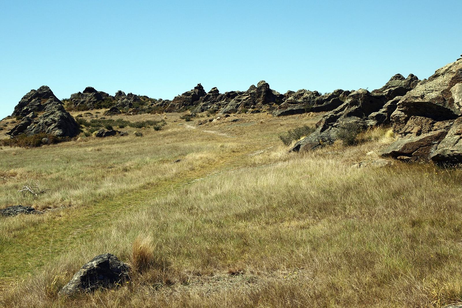
緑の牧草地ではなく、黄褐色の房状の草(タソック)に覆われた丸い丘が続き、そこに灰色の岩がにょきにょき突き出していたら Central Otago。ニュージーランドでもっとも乾燥した地域。

なぜここ?偏西風が運ぶ湿った空気はSouthern Alpsの西側で雨を落とし、山を越えると乾いた風として吹き下ろす。その雨陰にあたるため年降水量が400mm未満と国内で最も少ない。Wikipedia "Climate of New Zealand"Wikipedia "Central Otago"
実例123出典Ecoregions - Central Otago - Te Ara(乾燥と土壌)Grasslands - Types of tussock - Te Ara(短いタソックの草原の分布)
見られる場所
SouthlandMarlborough DistrictNelson CityTasman DistrictWest CoastOtagoCanterburyAucklandWaikatoWellingtonManawatu-WanganuiTaranakiNorthlandBay of PlentyGisborne DistrictHawke's BayCentral OtagoMackenzie盆地
  • Central Otago
  • Mackenzie盆地
黄褐色のタソックと灰色の岩が突き出す丘(Rock and Pillar山地)
Ulrich Lange, Dunedin, New Zealand / CC BY-SA 3.0
地形・景観★★★★★

草地や林の中から白い蒸気が何本も立ちのぼり、銀色の太いパイプが地面の上を曲がりくねって走っていたらTaupō火山帯。

なぜここ?太平洋プレートが斜めに沈み込む背後で、火山弧が年約7mmずつ裂けて広がっている。そこでマグマの熱が浅い所に供給され、多くの地熱地帯ができた。Geothermics「The volcanic, magmatic and tectonic setting of the Taupo Volcanic Zone, New Zealand, reviewed from a geothermal perspective」Wikipedia "Taupō Volcanic Zone"
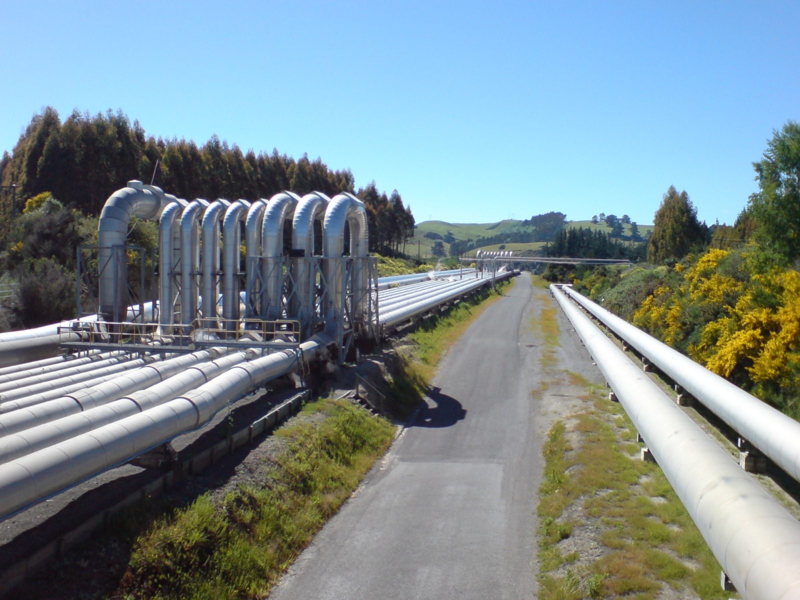
実例1234出典Taupō Volcanic Zone - Wikipedia(範囲と地熱地帯)
見られる場所
SouthlandMarlborough DistrictNelson CityTasman DistrictWest CoastOtagoCanterburyAucklandWaikatoWellingtonManawatu-WanganuiTaranakiNorthlandBay of PlentyGisborne DistrictHawke's Bay
地面の上を走る銀色の蒸気パイプ(Wairakei、Taupō近郊)
Ingolfson / Public domain

Bay of Plenty地方

植物・農業★★★

北島のBay of Plenty地方にも、海風から農作物を守る防風林が散見される。キウイの生産が盛ん。

注意Canterbury平野ほど防風林は多くない。
実例12
見られる場所
SouthlandMarlborough DistrictNelson CityTasman DistrictWest CoastOtagoCanterburyAucklandWaikatoWellingtonManawatu-WanganuiTaranakiNorthlandBay of PlentyGisborne DistrictHawke's Bay

都市・町の絞り込み2

地域までわかったあと、どの都市・町かを特定する手がかり

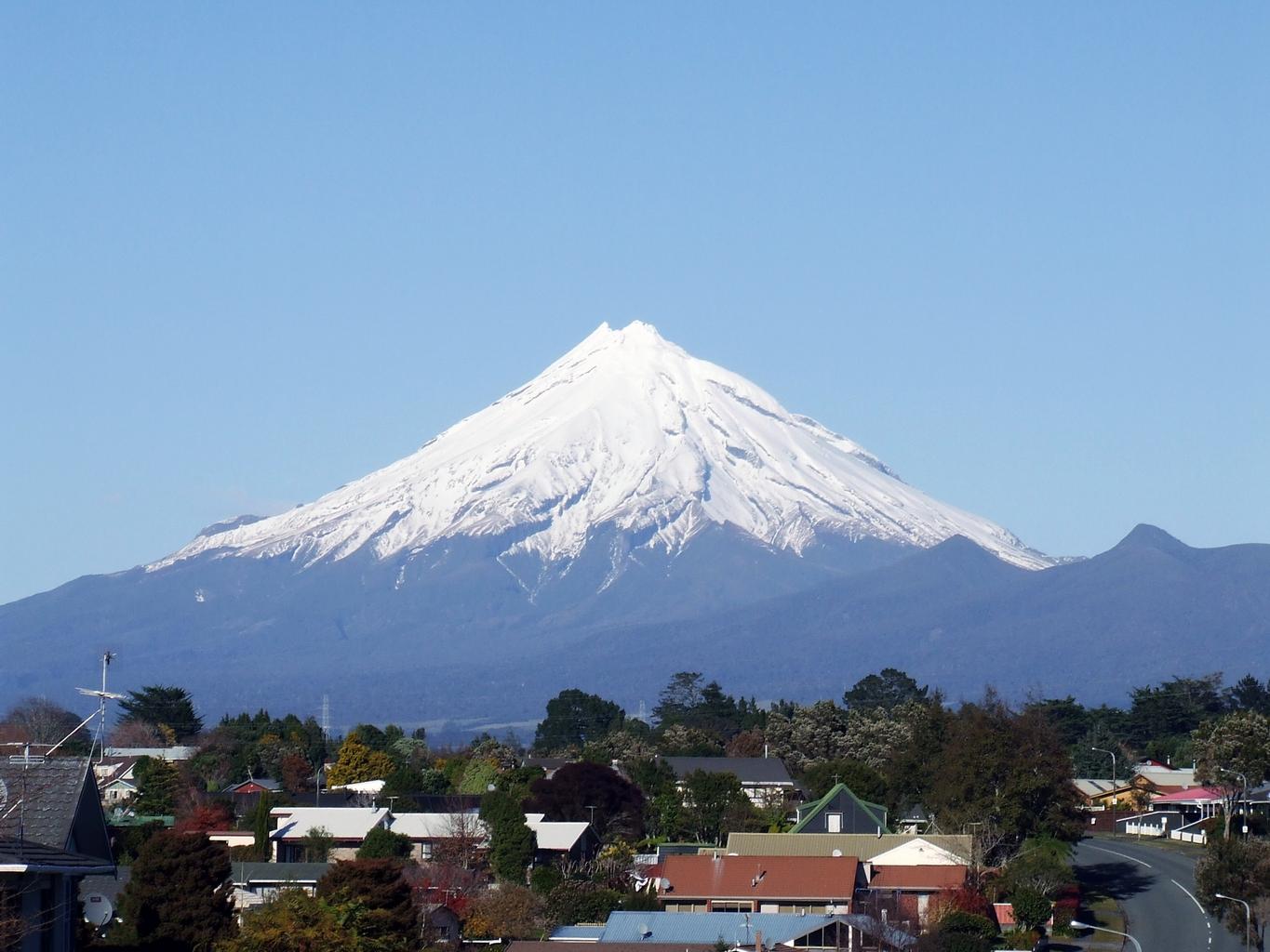
Taranaki山
地形・景観★★★

富士山のような形の山(Taranaki山)が見えたら、北島の南西の角にある国立公園の周辺。

実例12出典Taranaki山
見られる場所
SouthlandMarlborough DistrictNelson CityTasman DistrictWest CoastOtagoCanterburyAucklandWaikatoWellingtonManawatu-WanganuiTaranakiNorthlandBay of PlentyGisborne DistrictHawke's BayTaranaki山Taranaki山

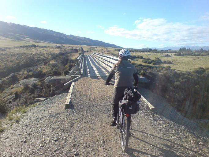
Otago Central Rail Trail

その他★★★

南島の Otago Central Rail Trail は約 150 km のウォーキング・サイクリングロード。道沿いに赤いバッグのようなものが見えることが多い。
実例12出典Otago Central Rail Trail
見られる場所
SouthlandMarlborough DistrictNelson CityTasman DistrictWest CoastOtagoCanterburyAucklandWaikatoWellingtonManawatu-WanganuiTaranakiNorthlandBay of PlentyGisborne DistrictHawke's BayOtago Central Rail TrailOtago Central Rail Trail

地域

地図の区分にカーソルを合わせると名前が出ます
Chatham Islands Territory Southland Marlborough District Nelson City Tasman District West Coast Otago Canterbury Auckland Waikato Wellington Manawatu-Wanganui Taranaki Northland Bay of Plenty Gisborne District Hawke's Bay

基本情報

面積
27万km²
日本の約4分の3※2
人口
536万人
2026年※1
1人あたりGDP
48,621米ドル
2025年※1
時差
+3〜+4時間
標準時は+3。夏時間の期間は+4になる

基礎データ

出典:外務省・JETRO(2026-09時点)
正式名称
ニュージーランド(New Zealand)
首都
Wellington。最大都市は北島のAuckland※2
政治のしくみ
英国王を元首とする立憲君主制。議会は一院制※2
民族
欧州系が約7割、先住民のマオリ系が約2割。アジア系・太平洋島嶼国系も多い※2
言語
英語・マオリ語・手話(いずれも公用語)※2
通貨
NZドル(NZD)。1米ドル=約1.7NZドル(2025年)※1
主要産業
乳製品・肉類・木材・果実・水産品・ワインなど第一次産業が輸出の柱※2
貿易相手
輸出は中国・米国・豪州が上位。日本は4番目の輸出先※2

宗教※2

無宗教
51.5%
キリスト教
32.3%
無宗教と答える人が半数を超える

数字で見る

グラフに触れると各年の値が見られます

人口の推移

1960〜2025年・世界銀行推計※3

532万人0200万400万600万1960198020002025

名目GDPの推移

1960〜2025年・米ドル(世界銀行)※3

2,641億ドル01,000億2,000億3,000億1960198020002025

あゆみ

マオリの島にイギリスが重なった南太平洋の国
  1. 13世紀ごろマオリの祖先が到達

    ポリネシアからカヌーで渡ってきた人々が定住し、マオリの文化が生まれた

  2. 1642タスマンが到達

    オランダ人探検家がヨーロッパ人として初めて確認。国名はオランダの地名Zeelandに由来する

  3. 1769クックが探検

    島々を測量し、イギリスの進出につながった

  4. 1840ワイタンギ条約

    マオリの首長たちとイギリスが結んだ条約でイギリス領に。いまも国の原点とされる

  5. 1893世界で初めて女性参政権を実現
  6. 1907イギリスの自治領になる
  7. 1947ウェストミンスター法を受け入れ独立
  8. 現在酪農と観光の国へ

    乳製品が輸出の3割を占める。人の数より羊の数が多い牧草地の風景が広がる

どんな地域か

ニュージーランドは南太平洋に浮かぶ北島と南島、ふたつの大きな島からなる国。火山と温泉が多い北島、氷河が刻んだ山脈とフィヨルドが連なる南島と、狭い国土に多彩な地形が詰まっている。先住民マオリの文化は国の土台のひとつで、英語と並んでマオリ語が公用語。地名にもマオリ語由来のものが多い。19世紀にイギリスの植民地となった歴史から街並みや制度はイギリス風だが、1893年に世界で初めて女性参政権を実現するなど、独自の道を歩んできた。

経済は牧草地を生かした酪農と牧畜が中心で、乳製品の輸出は世界有数。羊や牛の放牧地がどこまでも続く風景はこの国の代名詞になっている。近年は果実やワインの輸出も伸び、雄大な自然を目当てに世界中から観光客が訪れる。

日本との関係

ワーキング・ホリデーや留学で行き来の多い国
  • 1985日本とのワーキング・ホリデー制度が始まる※2
  • ニュージーランドからは乳製品・果実・アルミニウムなどが日本へ、日本からは自動車や機械が※2

出典

  1. JETRO「ニュージーランド 概況・基本統計」 jetro.go.jp
  2. 外務省「ニュージーランド基礎データ」 mofa.go.jp
  3. World Bank Open Data(SP.POP.TOTL / NY.GDP.MKTP.CD) data.worldbank.org

近くの地域

geoguessr(ジオゲッサー)のプレイログを記録したページです。