国・地域の見分け方
- ドメインは.sz
- 道路番号にはMRが付いている
- 電柱はこげ茶色っぽい細い木でできていることが多い
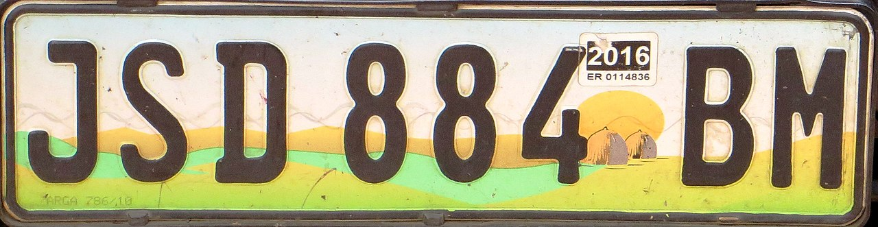
- ナンバープレートの下が黄緑色に見える
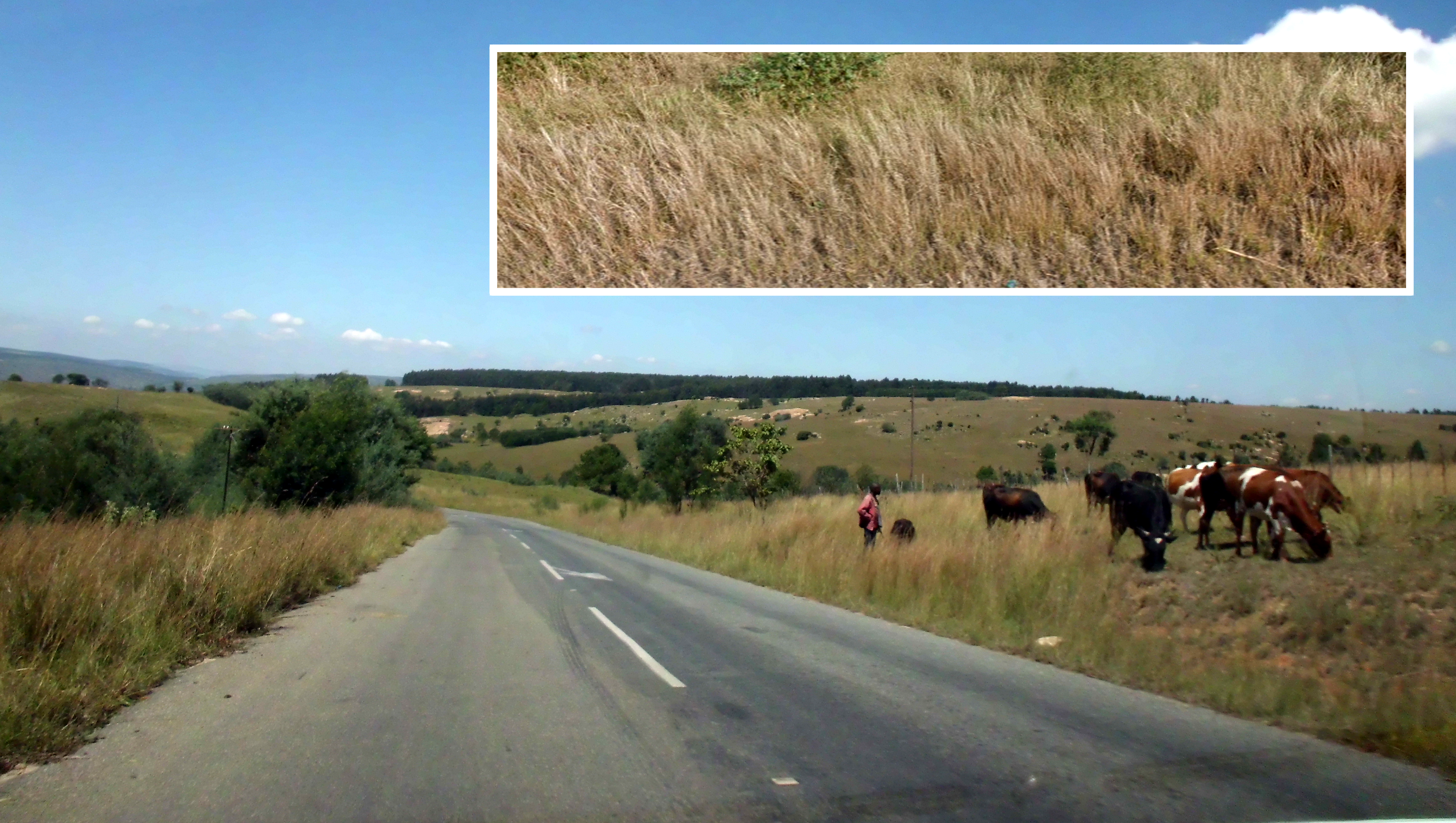
- 標高が低いローベルトは平地が多いかつ国全体が斜めになっているので、ローベルトの道路上にいる時は南北方向は遠くまで景色が見えて東西は遠くまで見えないことが多い
- レソトと異なり標高が高い場所では林業が行われており、同じ種類の木が並んでいる様子が見られるはず
見つかる標識
ナンバープレートが白と黄緑色に見える。南アフリカの中央部で使われるナンバープレートも同じような色に見えるので注意。
州・地域の絞り込み
- 標高によって標高の高いハイベルト・中間のミドルベルト・標高の低いローベルトに分かれていて農業の形態もそれぞれ異なる
- ローベルトではサトウキビが育てられていることがある
- ハイベルトでは松やユーカリの林業が行われており植林による森林が存在する
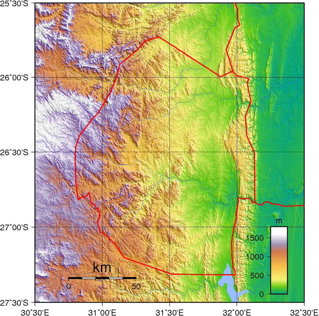
西部は山岳地帯(標高1500m)、東部は低地(標高200m)であり、国土は傾斜している。
ハイベルトでは松やユーカリの林業が行われており、植林による森林が存在する。森林が無くても、森林が伐採された跡があるかも。
ローベルトでは平地が多くサトウキビが育てられていることがある。
Updated on 01 Jul 2023
geoguessr(ジオゲッサー)のプレイログを記録したページです。