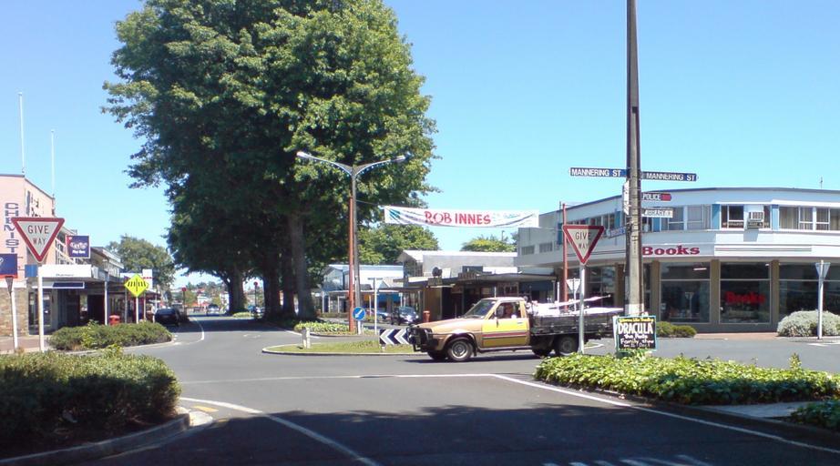
How to Distinguish
- Cars drive on the left side.
- The domain is .nz.
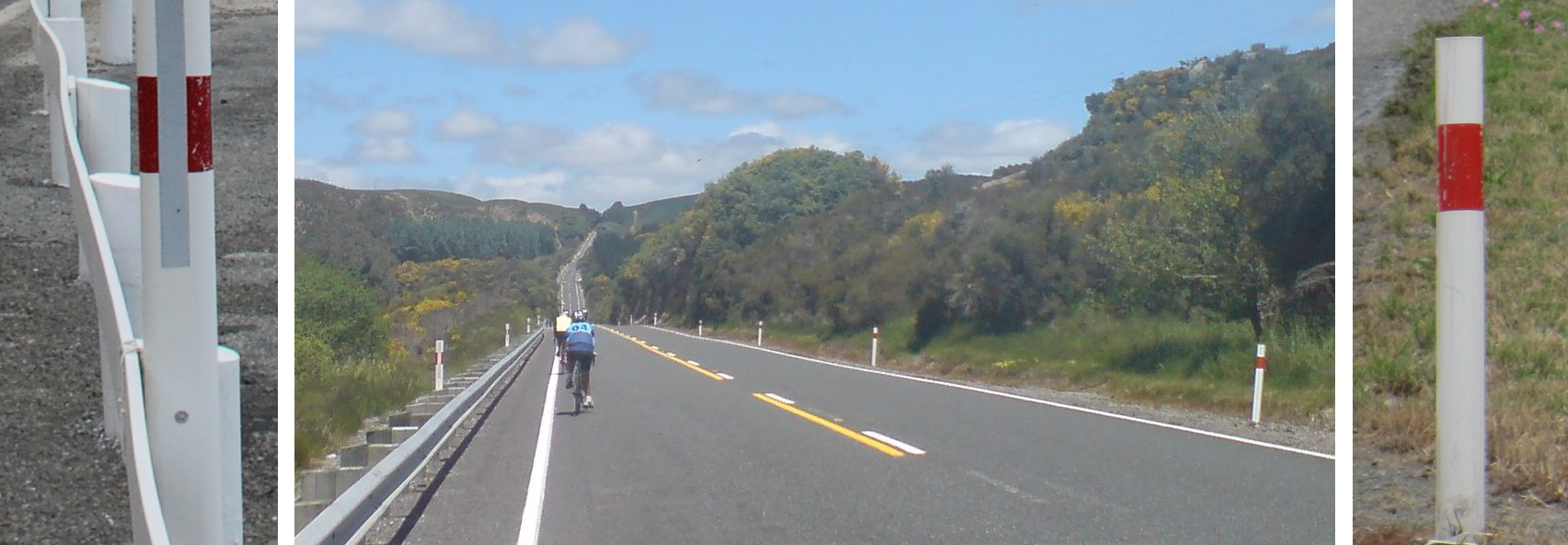
- The bollards have reflective panels that are red. The color is painted on both sides of the bollard. In contrast, Australian bollards often have reflective panels on only one side or are circular in shape, making it easy to distinguish them. (by plonk it )
- If "GIVE WAY" is written in black text, it is Australia. If it is written in red text, it is New Zealand. (by plonk it )
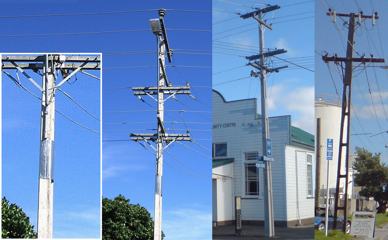
- There is something silver wrapped around the upper parts of utility poles.
Signs you can find
.svg)


.svg)


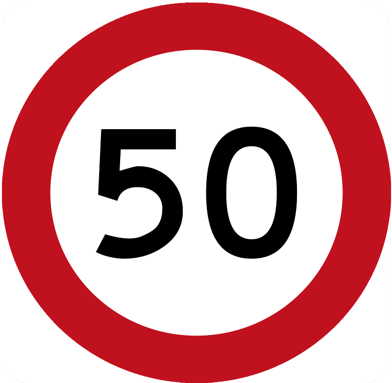
In Australia, speed limits are sometimes displayed on narrow white plates. In the diagram below, the left is Australia, and the right is New Zealand.


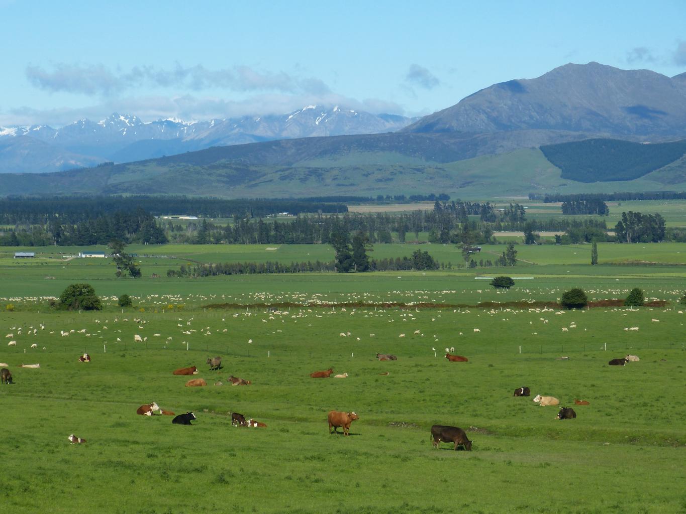
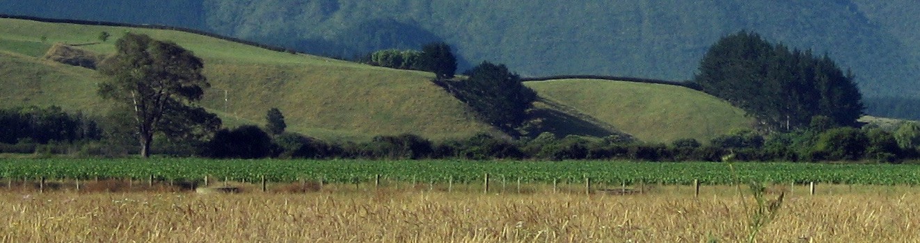
Over 40% of New Zealand’s land area is pasture. Thanks to moderate rainfall throughout the year, grass grows easily. This keeps production costs low for dairy farmers, giving New Zealand dairy products global competitiveness(References Agricultural and Livestock Industries Corporation: New Zealand Dairy).

.svg)


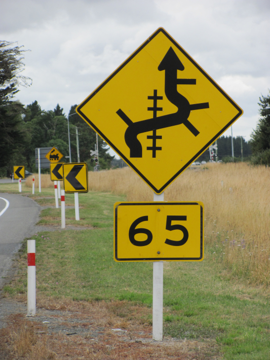
This is a speed sign, not a road number.
Examples of utility poles.
Narrow down state/region
- Observe if the terrain is flat, whether snow-capped mountains are visible, and the density of trees. (from 『【GeoGuessr Guide】New Zealand Edition! In-depth Explanation by a Local Pro Part 1【Translation】』)
- If the image quality is poor and there are many gravel roads, try exploring north of Auckland.
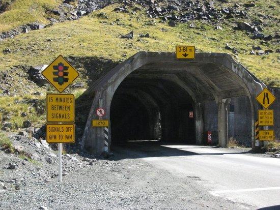
- If there are snowy mountains and many wooden utility poles, consider the South Island.
- Area codes decrease from north to south:
- The southernmost area has many sheep, but this alone is not definitive. (References New Zealand Beef Production: Impact of Dairy Expansion and Future Outlook)
Vegetation
- The Canterbury Plains on the South Island have windbreak forests and are known for irrigated agriculture.
- The Bay of Plenty region on the North Island also has windbreak forests and is a major kiwi fruit production area.
- Giant reed plants are found along the coasts of the North Island, especially around Auckland.
Centered around Christchurch, the terrain is generally flat, and there are many tall windbreak forests. (References University of Canterbury)

Windbreak forests can be seen to protect crops from ocean winds, though they are not as common as in the Canterbury Plains.
A plant commonly found around the Mediterranean, it is also frequently seen along the coasts of the North Island, particularly near Auckland. (References Arundo donax (iNaturalist)). Its southernmost growth is along the coasts of Christchurch.

Narrow down city/town
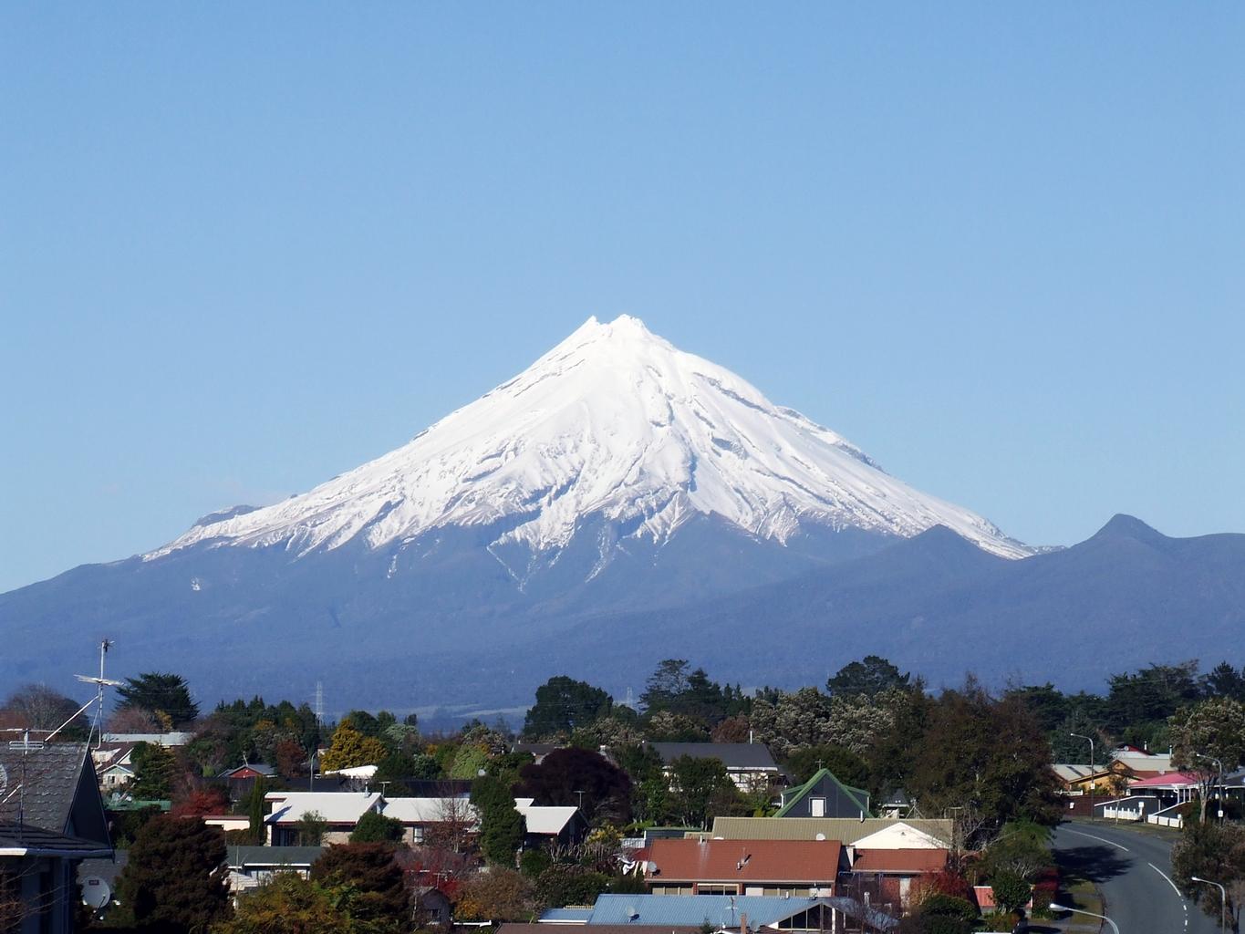
- If you see a mountain resembling Mt. Fuji, you are likely near the national park in the southwestern corner of the North Island. (References Mount Taranaki)
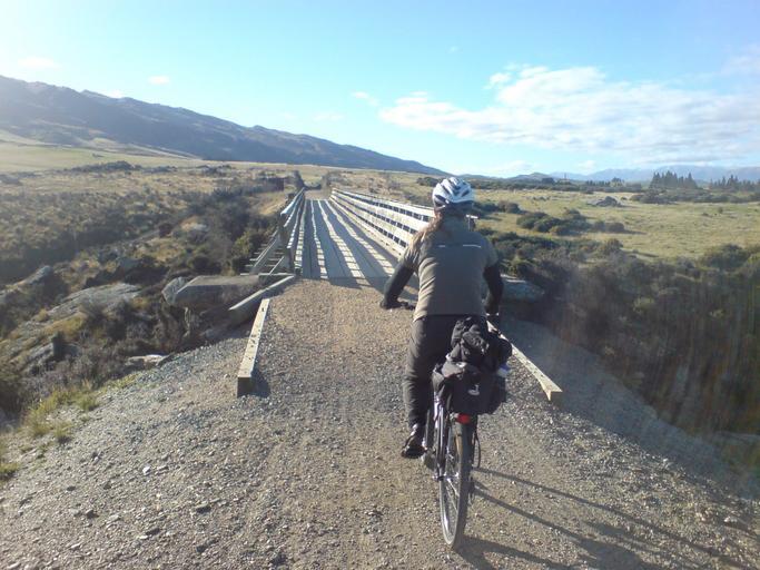
- The South Island has the Otago Central Rail Trail, a walking and cycling trail approximately 150 kilometers long. (References Otago Central Rail Trail) You might see something like a red bag along the trail.
If you see a mountain resembling Mt. Fuji, you are likely near the national park in the southwestern corner of the North Island. (References Mount Taranaki).
Islands
- Stewart Island is the southernmost inhabited island. It has forested coves. (References Stewart Island)
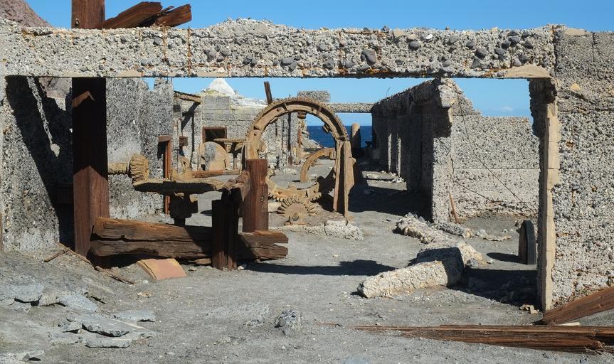
- White Island is an offshore island located north of the North Island.
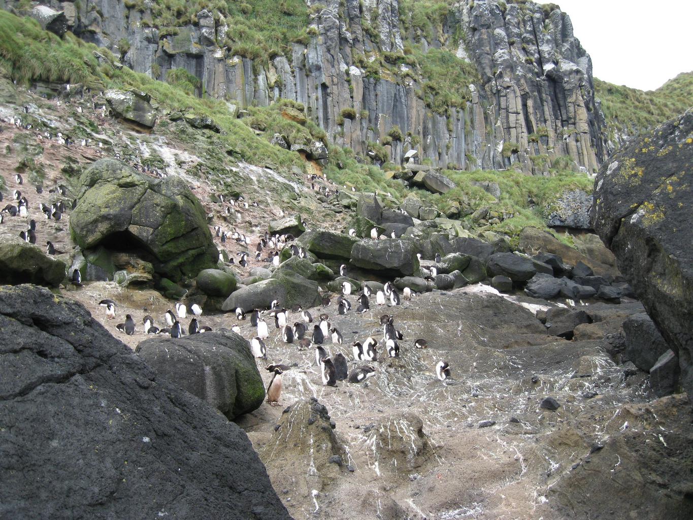
- The Antipodes Islands are home to penguins and seals.

This island features abandoned sulfur production sites due to volcanic disasters. It is currently off-limits. (References White Island)
A UNESCO World Heritage Site with penguin colonies. The area is restricted to the general public.