


How to Distinguish
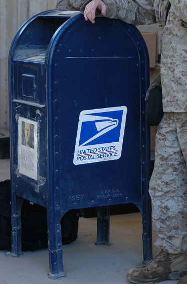
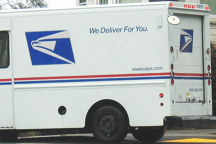
- Blue mailboxes sit on street corners.
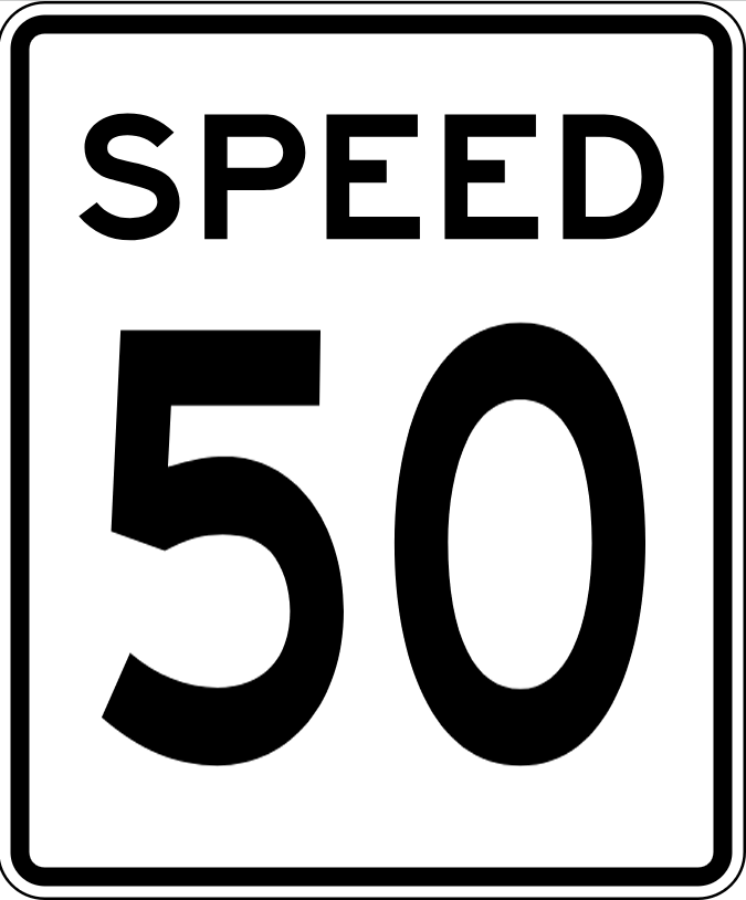
- Speed-limit signs spell out SPEED LIMIT.
- If the inverted triangle sign says YIELD it is the United States; when the text is missing it is usually Canada.
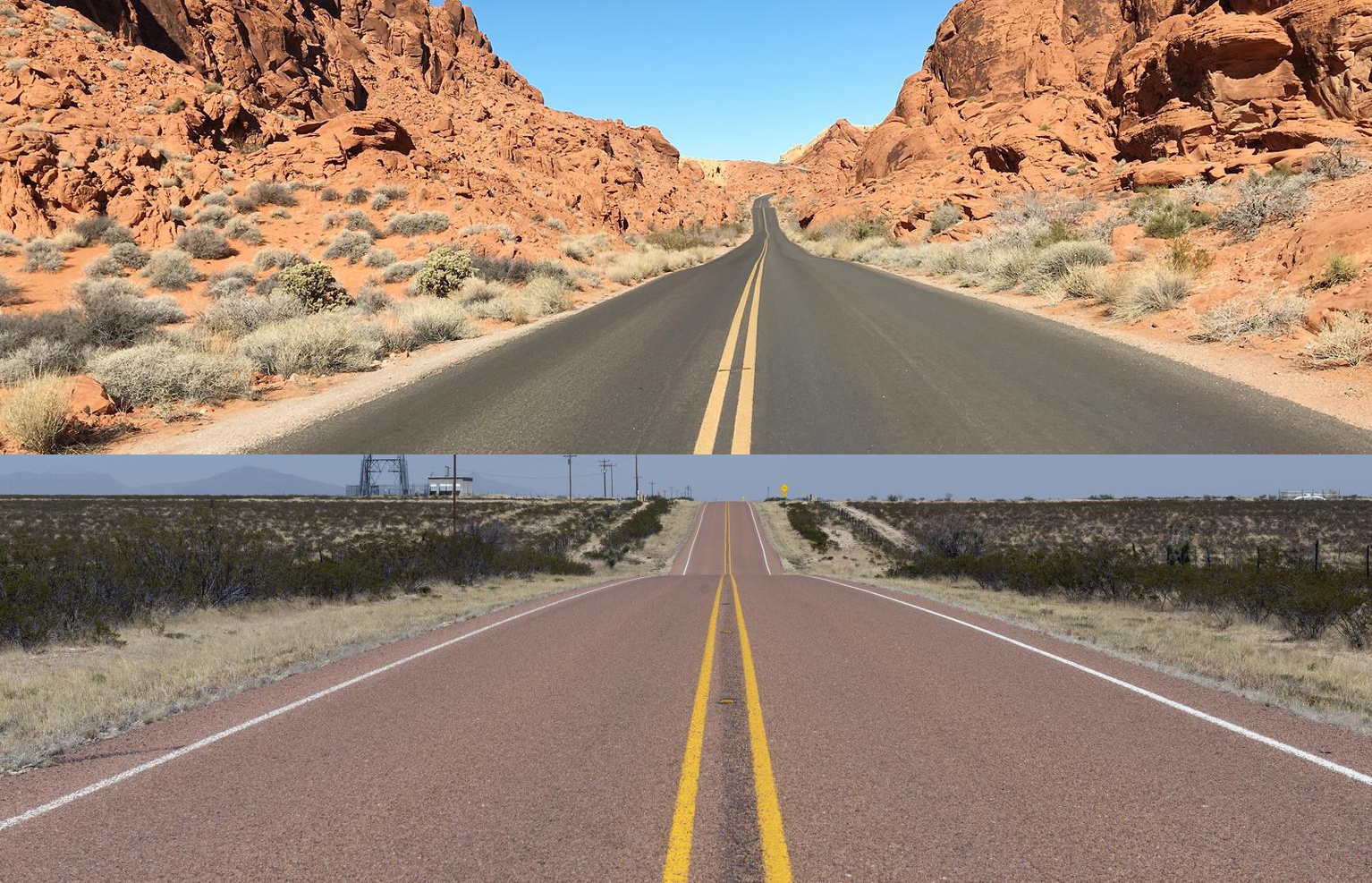
- Double yellow centre lines are standard across both the United States and Canada.
- It is common to see rows of garbage bins set out in front of homes.
- Speed limits may be written in MPH.
Signs you can find


Representative Companies
説明はページ下部。必ずしも道端で見つかるとは限りません。


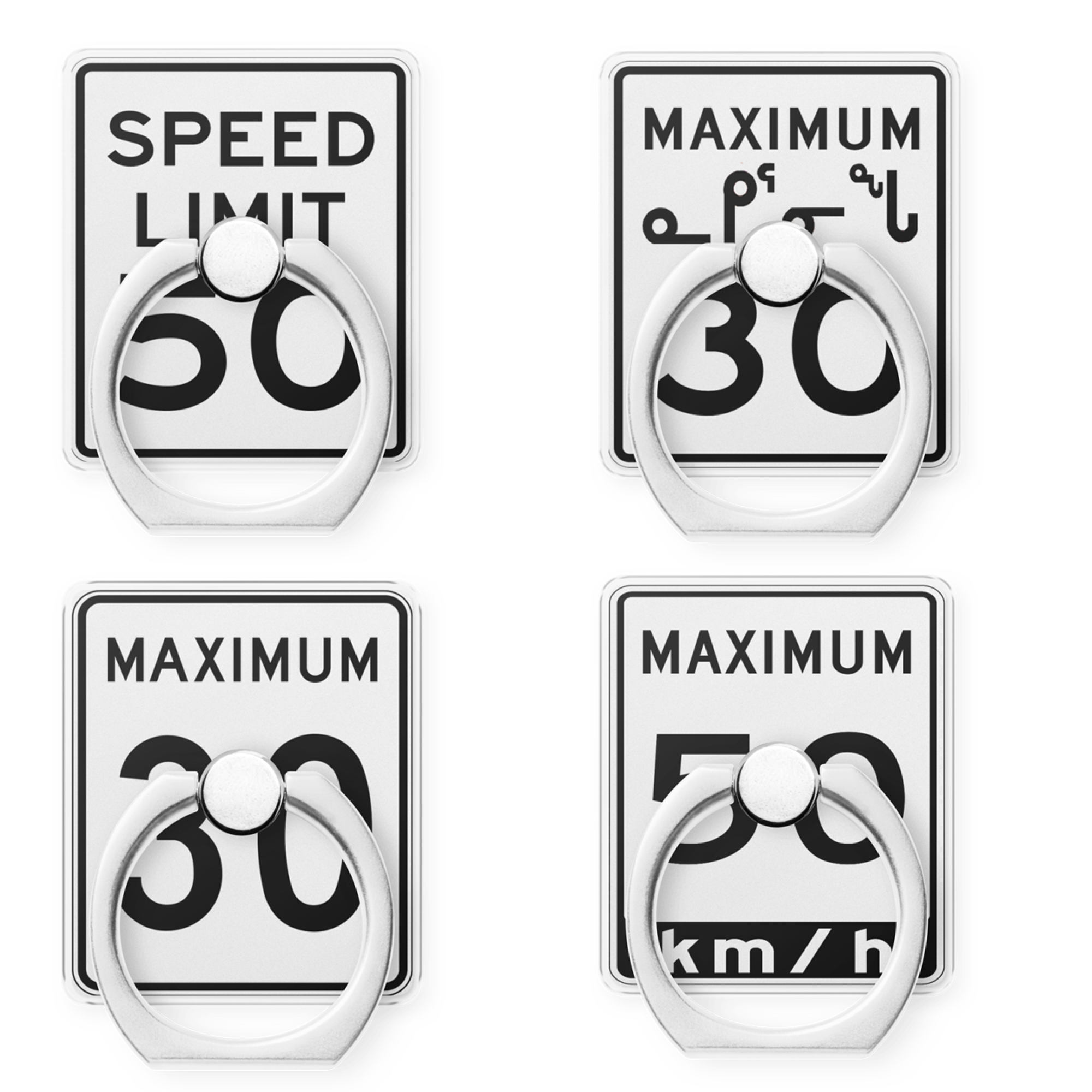
Speed-limit signs show SPEED LIMIT . If the sign only reads SPEED you are probably in Oregon. Canada uses MAXIMUM.


In both the United States and Canada the centre of the road is often marked with double yellow lines .
YIELD and ONEWAY signs in the United States include the word itself . The left-hand examples are United States; the right-hand ones are Canada.


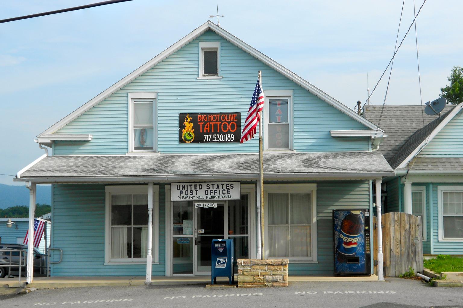
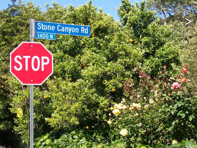
Look for the blue mailbox—Canada’s is red. When you find a post office, the state and city are often written somewhere on the building.
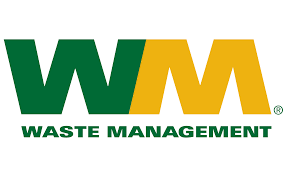
Many large companies are headquartered in the United States. Even utilities such as waste collection, electricity, and water authorities are listed companies, so you will see their logos everywhere. From left to right: Waste Management and Republic Services (waste haulers whose logos appear on bins), Chevron and Citgo (petrol stations), Target (retail) and more.

USA-themed Goods
Narrow down state/region
Islands linked to the United States- The United States governs or is otherwise involved with many islands far from the mainland.
- Hawaii & the Hawaiian Islands
- American Samoa
- U.S. Virgin Islands
- Midway Atoll
- Northern Mariana Islands
- Puerto Rico (an unincorporated territory with self-government)
State-specific micro hints
Clues for narrowing down the state
- Hawaii & the Hawaiian Islands
- American Samoa
- U.S. Virgin Islands
- Midway Atoll
- Northern Mariana Islands
- Puerto Rico (an unincorporated territory with self-government)
Decide first whether you are on an island, then use the licence plates, state-highway shields, the type of mountains and vegetation, how flat the terrain is, and the feel of the houses to narrow down the location. Some states have very distinctive clues.
- ① Whether cars have front plates and the plate colour can narrow down the state[Reference](by rumilb ). Start by memorising which states require a front plate.
- List of US licence plates (Wikipedia)
- States with “new” in the plate name often look yellowish(by niwaisound ).
- Characteristic colours by state
- Mostly black → Delaware
- Mostly green → Vermont
- Deep orange → New York
- All yellow → Alaska
- Pale yellow overall or on both sides → Mississippi
- White background with an orange panel on the right → Utah
- White background with an orange fruit in the centre → Florida / Georgia
- White background with a green tree in the centre → Oregon
- White background with a red stripe along the top → Ohio
- White background with a pale blue top band → Minnesota / Montana / Iowa
- White background with blue at the top and yellow at the bottom → Pennsylvania
- White background with reddish-brown at the top and blue at the bottom → Idaho
- White background with a faint red highlight near the top and a navy serial area → California
- Bright blue upper half and white lower half → Connecticut; Illinois can look similar.
- White top half with a light blue lower half → Kentucky
- Faint yellow on top and pale blue on the bottom → Washington?
- Front plate with a rainbow → Hawaii
- ② Once you spot interstate or state-highway shields you can pinpoint your location.
- State-highway shields often give away the state. In some places the shield outline is the shape of the state itself.
- Interstate shields (blue signs with a red crown) use even numbers for east–west routes and odd numbers for north–south routes, with larger numbers in the northeast.
- Exits are numbered (“Exit 1”, etc.) and become visible when you zoom in.
- ③ The Hawaiian Islands also have Street View, and the soil stands out as dark or reddish
Memorise the states that do not require front plates (highlighted in yellow) before learning the plate colours. Lighting and angles can change the hue, so practice is essential. Vehicles move, so plates alone will not guarantee the state.

By Raccoonny - Own work, CC BY-SA 4.0, Wikimedia Commons
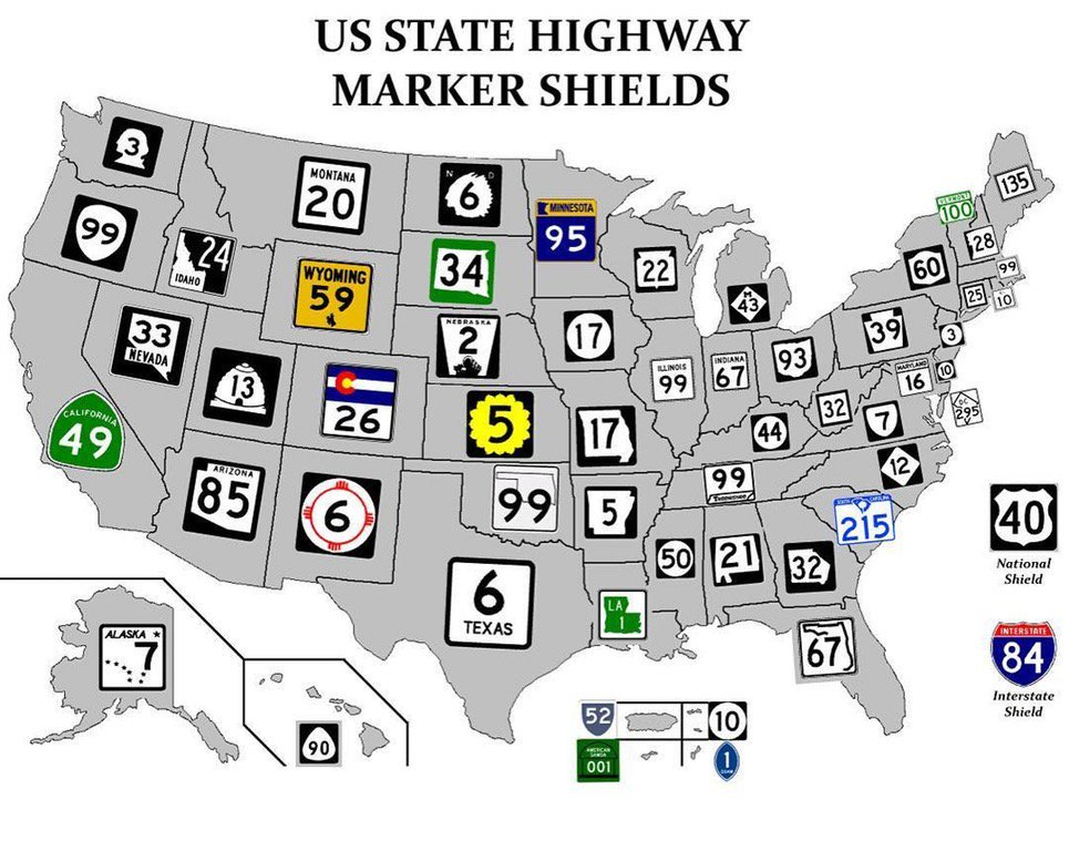
- United States numbered highways
- North–south routes have odd numbers that grow larger from east to west.
- East–west routes have even numbers that grow larger from north to south.
- Dwight D. Eisenhower National System of Interstate and Defense Highways
- North–south interstates use odd numbers that get smaller the farther west you go.
- East–west interstates use even numbers that get smaller the farther south you go.
American Highways 101: Visual Guide to U.S. Road Sign Designs & Numbering Systems
Place names are distinctive, and the soil often looks dark or reddish.
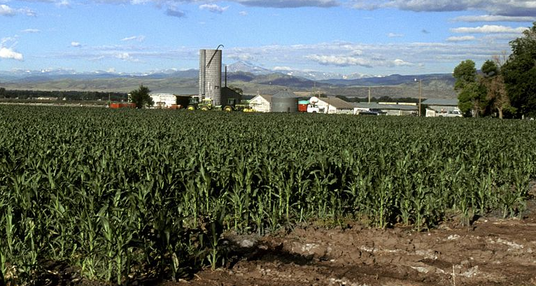
Agricultural distribution
- If you see corn, it is safer to look east of the Plains.
- Paddy fields with yellow warning stripes on utility poles point to northern California; without the stripes they are usually along the Mississippi River.
- Data source: U.S. Department of Agriculture
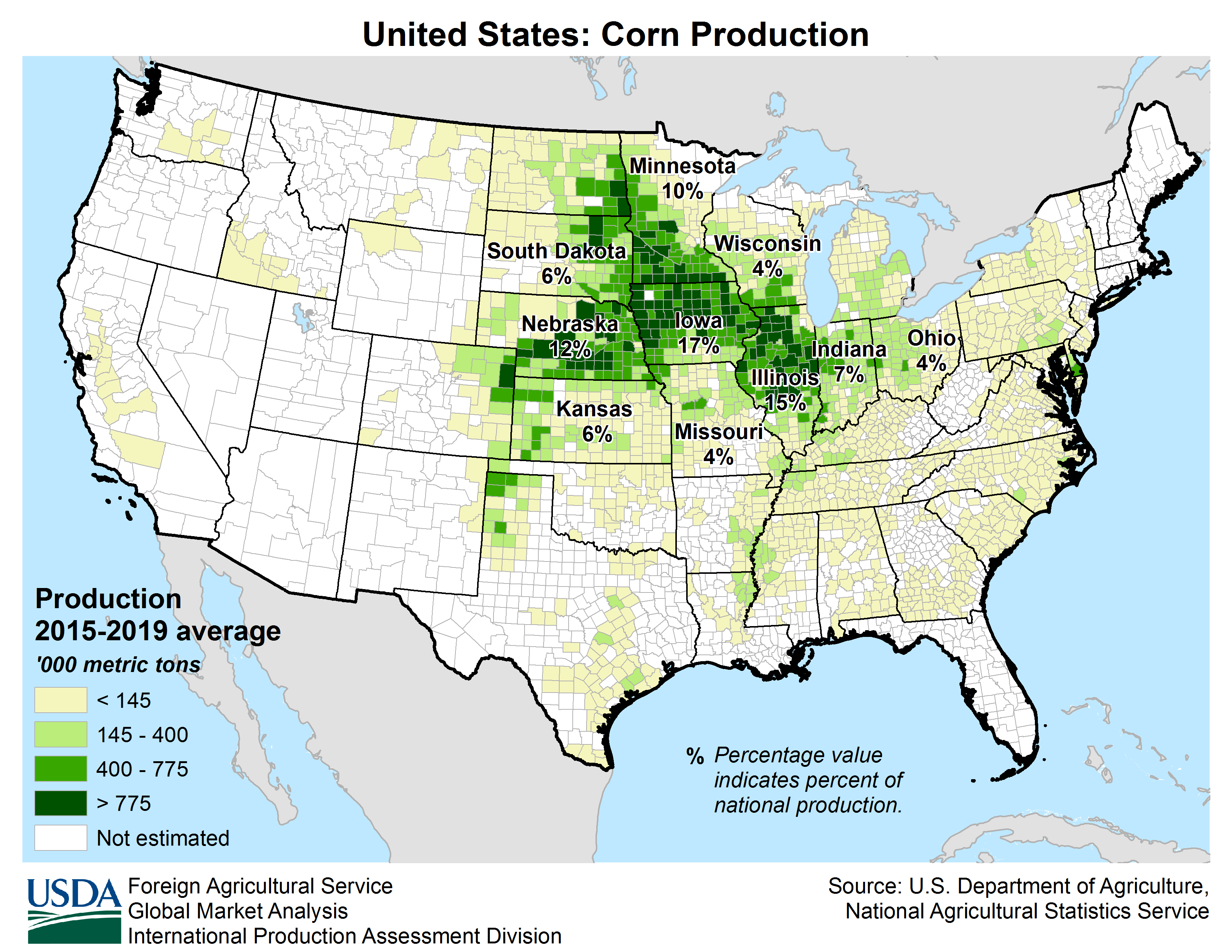
Corn production is concentrated along the Corn Belt(参考文献 Corn: Production Acreage by County (USDA)). It is still grown nationwide, so corn alone does not guarantee the Midwest.
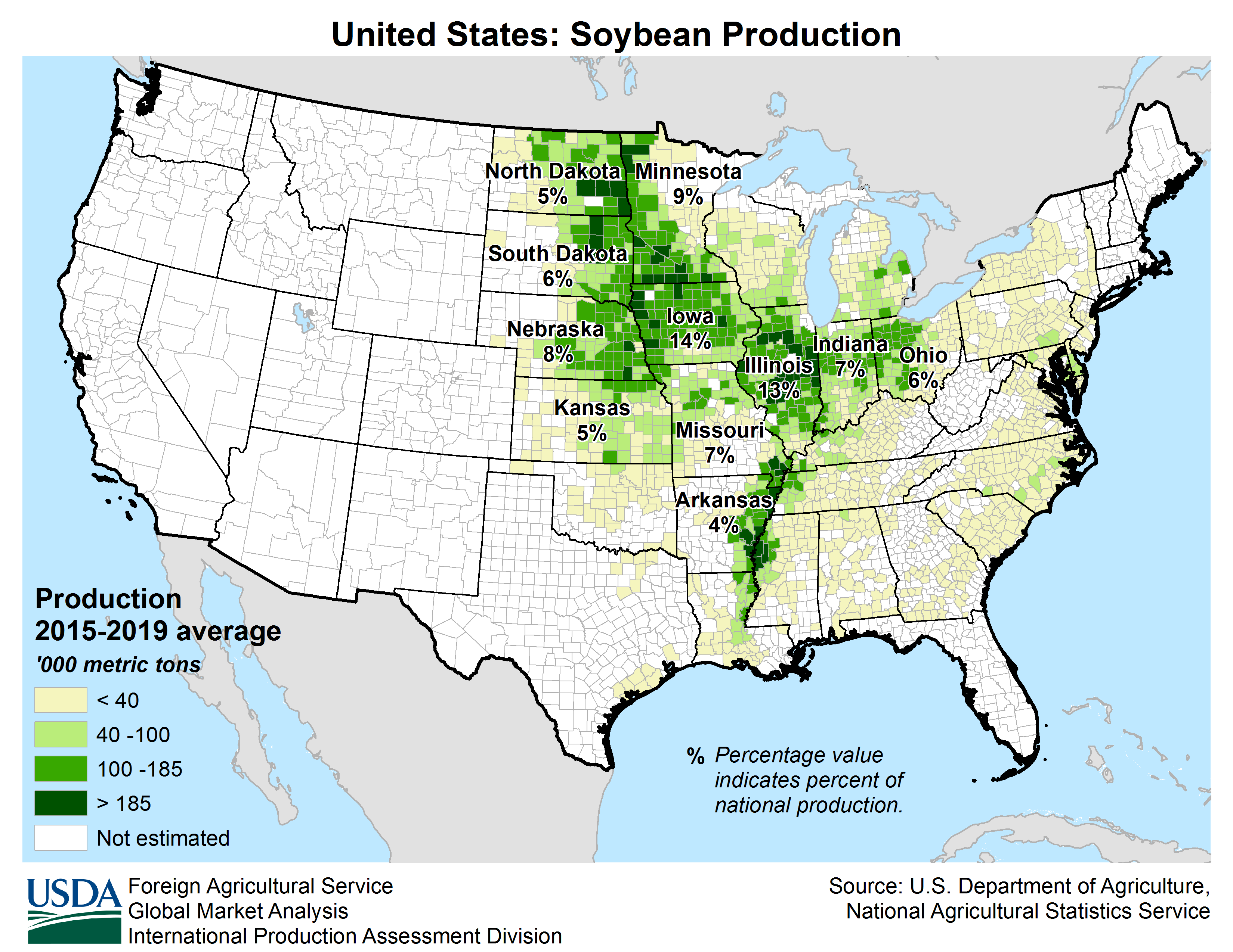
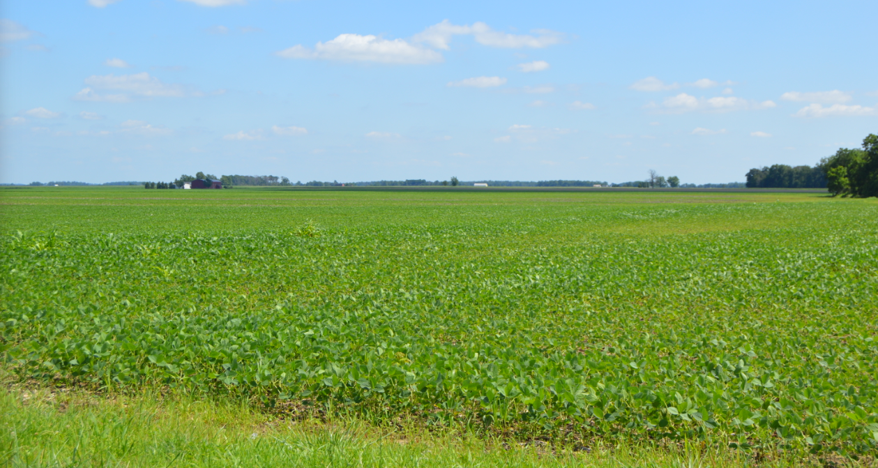
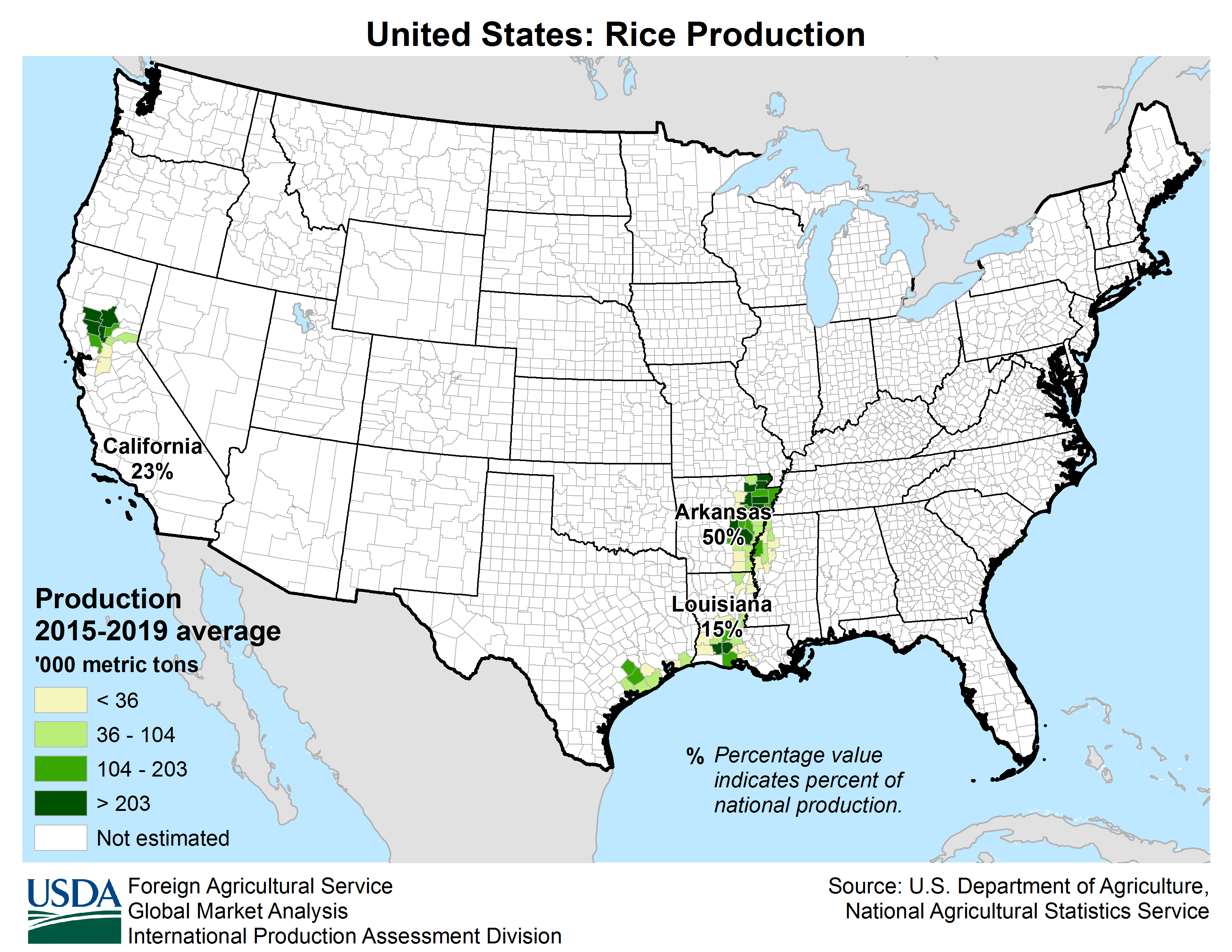
Rice fields cluster in specific parts of northern California and along the rivers and coast of Arkansas(参考文献 Crop Production Maps (USDA)).
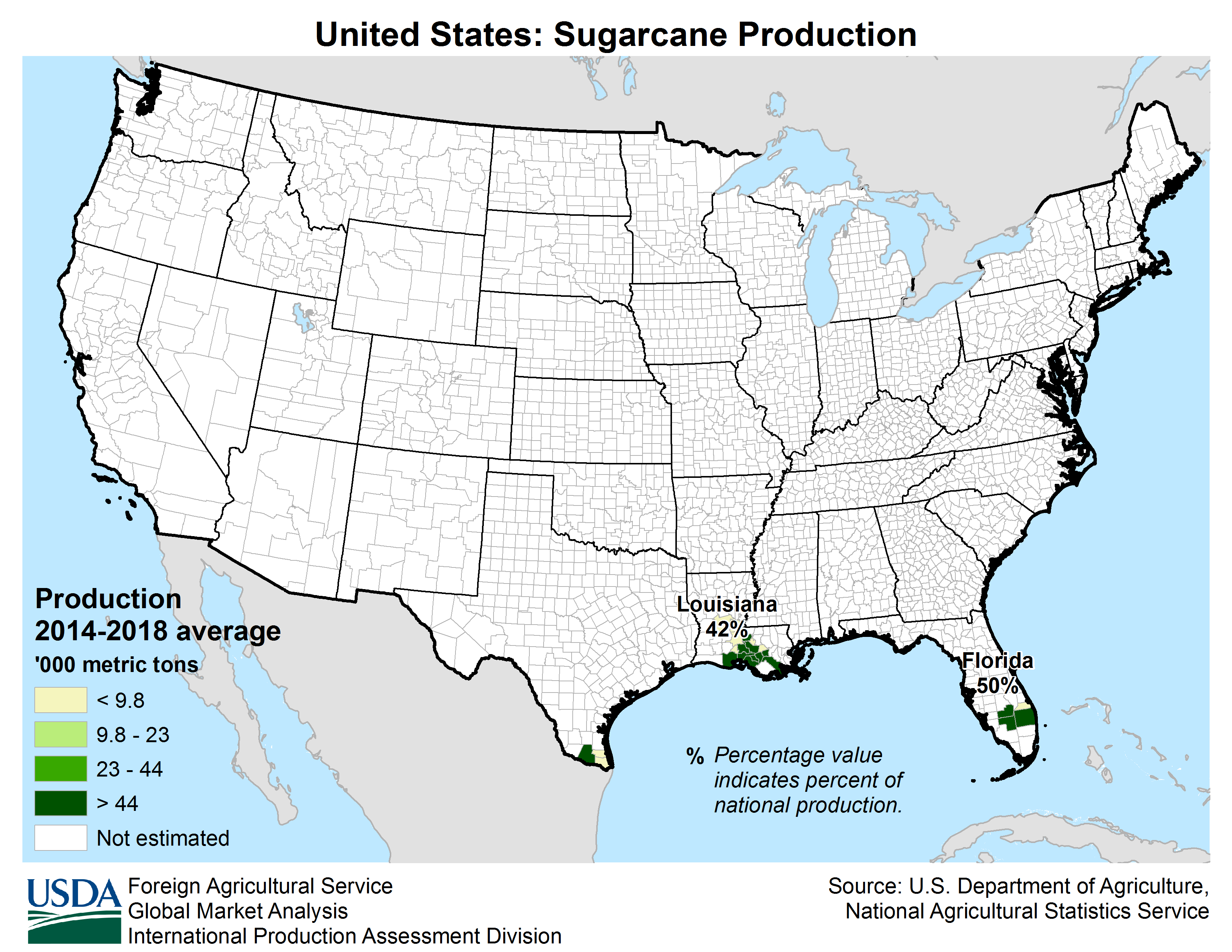
Sugar cane grows in limited pockets around Florida; Louisiana has few roads through the cane fields(参考文献 Crop Production Maps (USDA)).
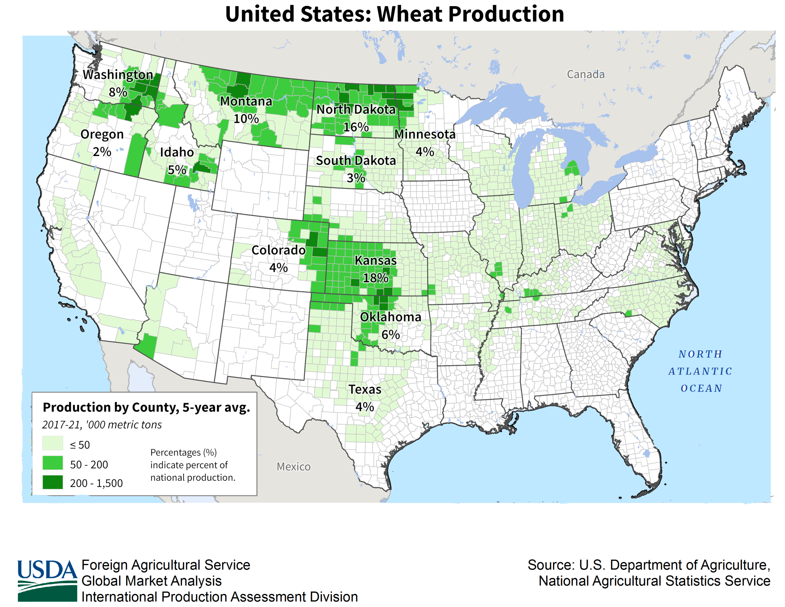
Wheat production does not overlap perfectly with corn or soybeans. The maps were adjusted so that the scales and colours match the other datasets.
Other tips
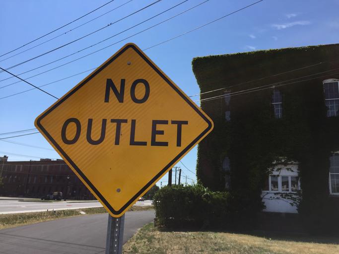
- When you spawn inside a maze-like subdivision, avoid streets where you can see the back of a STOP sign—the larger road is usually the direction where the front of the sign faces
(参考文献 First GeoGuessr Pinpoint Symposium – Dash techniques, memorising US state shields, CoopAOW 25k speedrun)
- Example You can see the backside of STOP or “NO OUTLET” signs in all directions except southwest. Head southwest and you will soon see the front of a STOP sign to the east, guiding you towards a larger road.
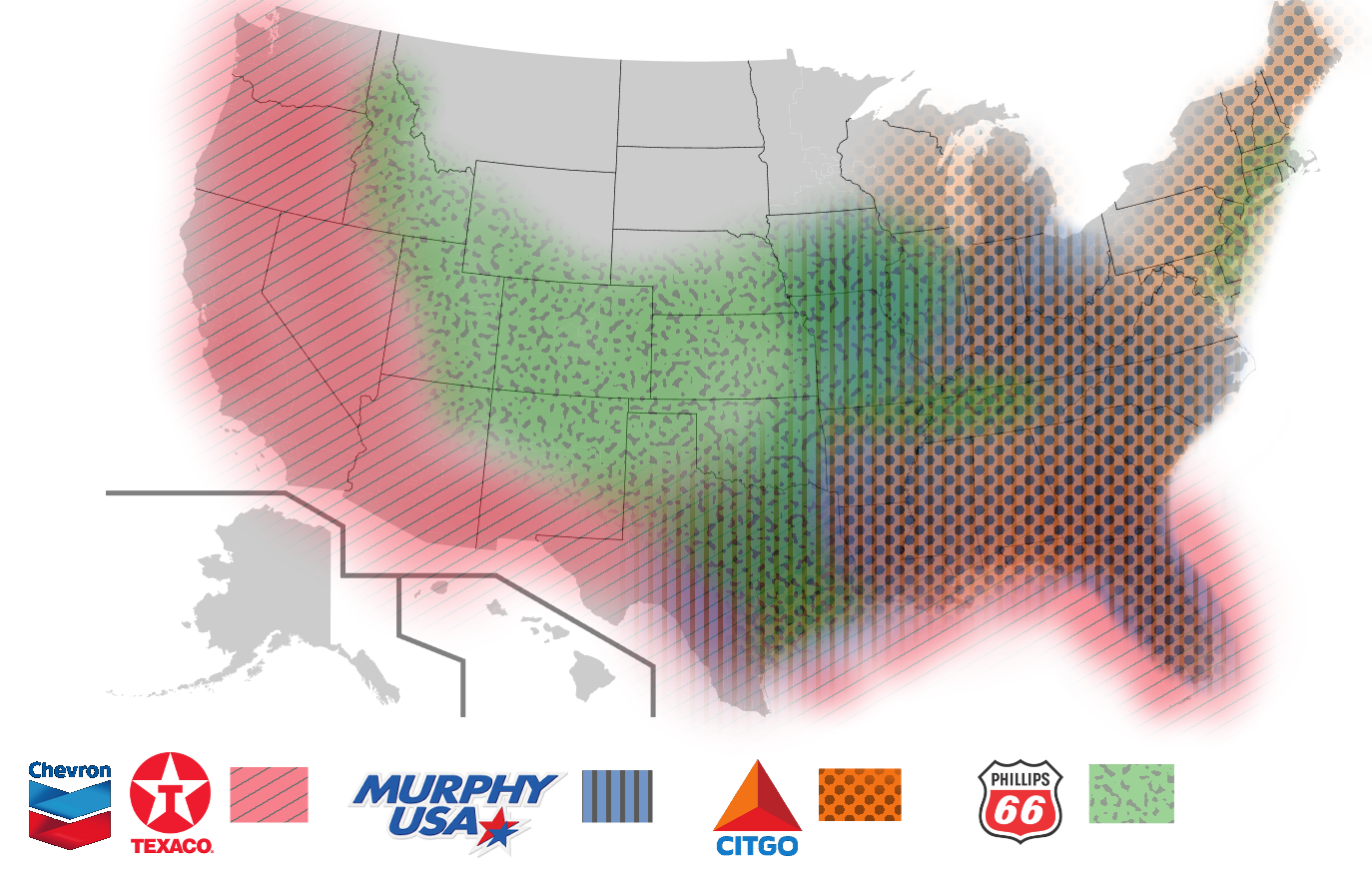
- Petrol stations have different regional footprints
(参考文献 10 Largest Gas Stations in the United States in 2023)
- Chevron → Gulf Coast or West Coast states
- Citgo → Eastern states
- Phillips 66 → Inland states
- Murphy USA → Eastern states
- Texaco → Gulf Coast or West Coast states
- Some states can be identified from vehicle inspection stickers.
A STOP sign is usually placed where a narrow street meets a wider one. If you can see the back of the sign you are heading towards a smaller road; seeing the front means you are approaching a larger road.
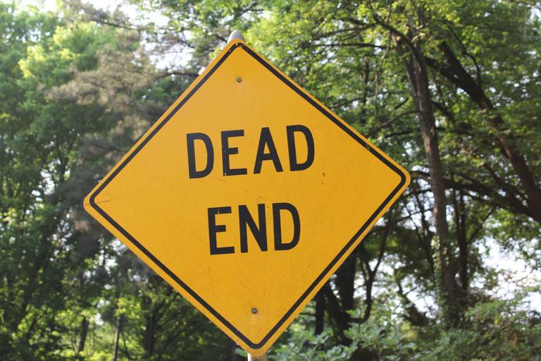
Avoid streets marked with NO OUTLET or DEAD END.
Hand-drawn map—treat as a rough guide only.
Some states can be recognised by the inspection sticker on the windscreen.
Representative companies
| Company | Ticker | Overview | IR | Dividend history |
|---|---|---|---|---|
| Waste Management | WM | Major waste processor active in the United States, Canada, and Puerto Rico. Together with Republic Services it handles roughly half of America’s rubbish. | ||
| NextEra Energy | NEE | Leading renewable-energy utility and the world’s largest generator of wind and solar power. | ||
| Exxon Mobil | XOM | One of the supermajors among the international oil companies (参考文献 International petroleum majors). | ||
| NVIDIA | NVDA | - | ||
| Microsoft | MSFT | - | ||
| S&P Global | SPGI | The company behind the S&P 500 and the Dow Jones Industrial Average—benchmarks well known in Japan. | ||
| FactSet Research Systems | FDS | Provides financial-market data and related software. Publishes market-wide reports on FactSet Insight. |