


How to Distinguish
- The language is Spanish
- Country-code top-level domain is .gt
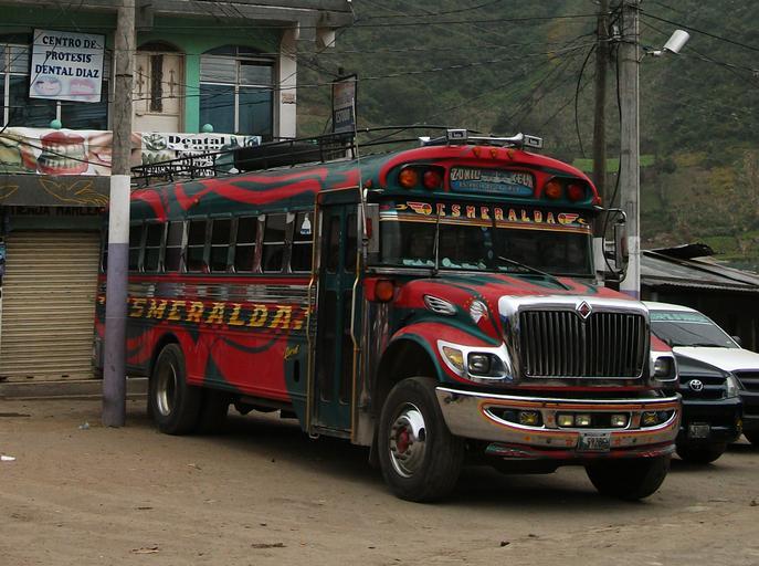
- Buses are brightly decorated; many have roof racks for luggage
- The Google Car is distinctive
- Stop signs read ALTO—shared with Mexico, Panama, and Costa Rica
The “chicken buses” are colorful and roof-racked for cargo. Locally they’re called la camioneta, la burra, or simply el bus. They sometimes carry livestock—hence the nickname—and may have extra space for baggage on top. (参考文献 A Traveler’s Guide to the Chicken Bus in Guatemala)
Narrow down state/region
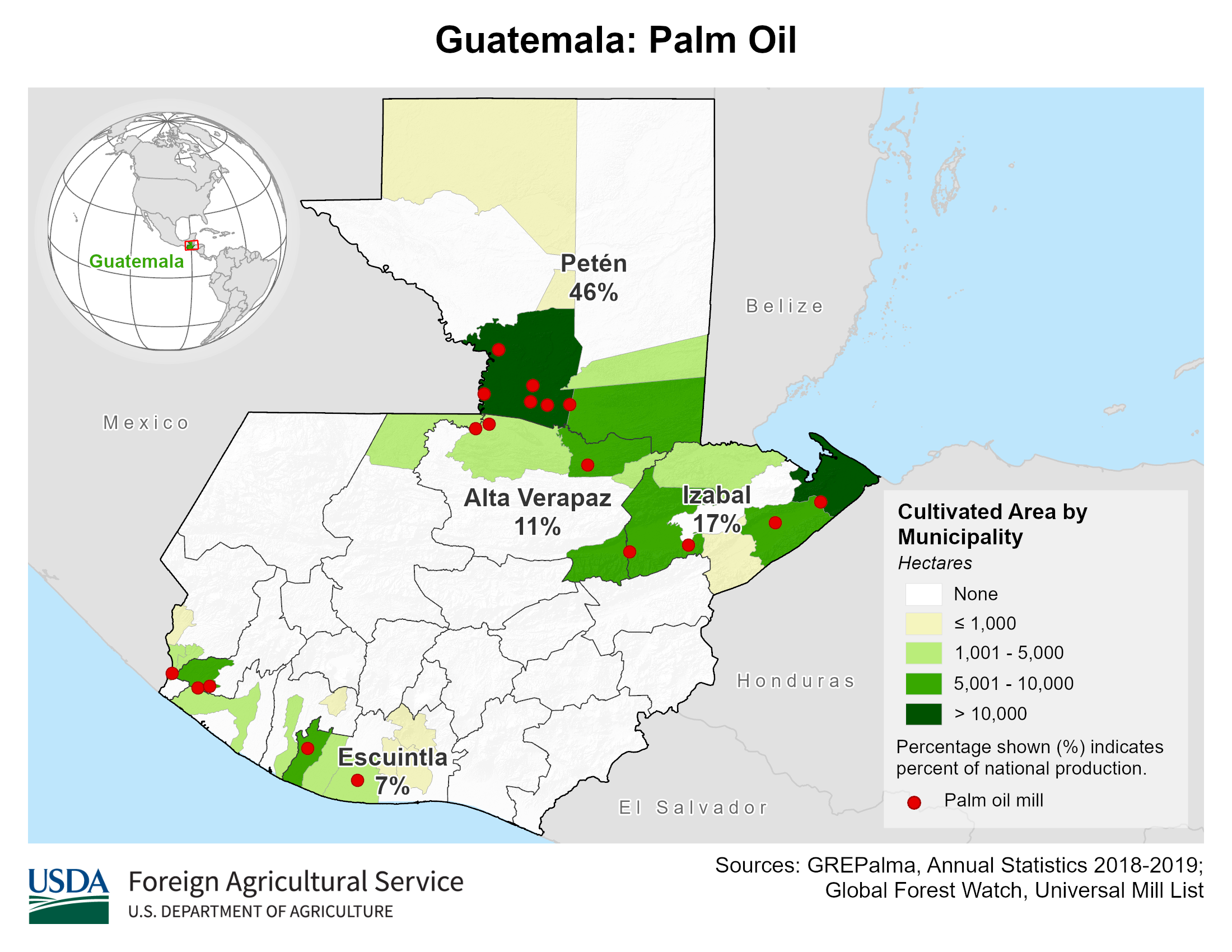
- Flatter terrain lines the northern coast
- Oil-palm plantations appear in several regions
- Crop data source: Guatemala Production – USDA

By Виктор В – based on Guatemala location map.svg and ETOPO1-SRTM30, CC BY-SA 2.0, Link
Narrow down city/town
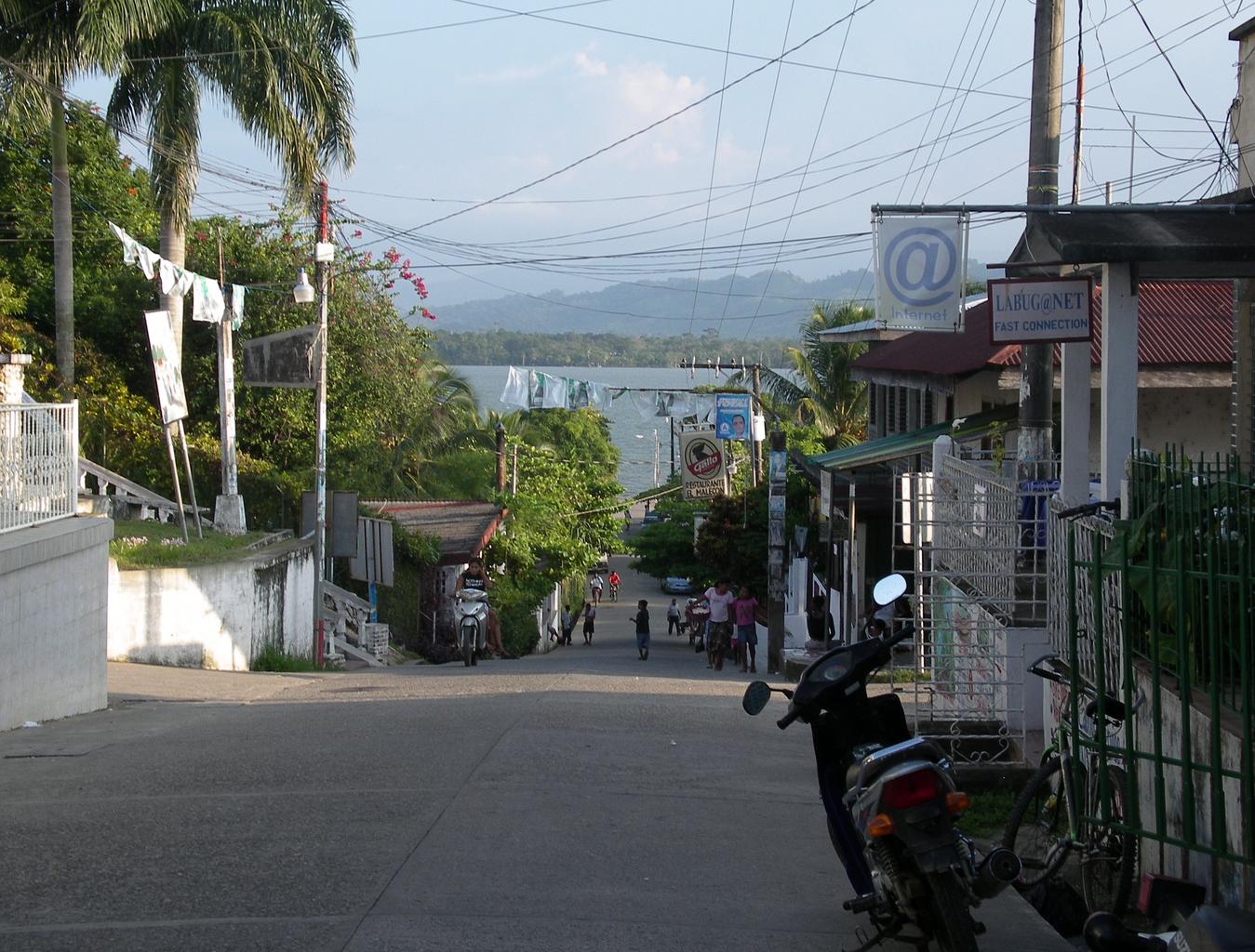
- Lívingston retains strong Garifuna influences; the town feels distinct from the rest of the country (参考文献 Lívingston)
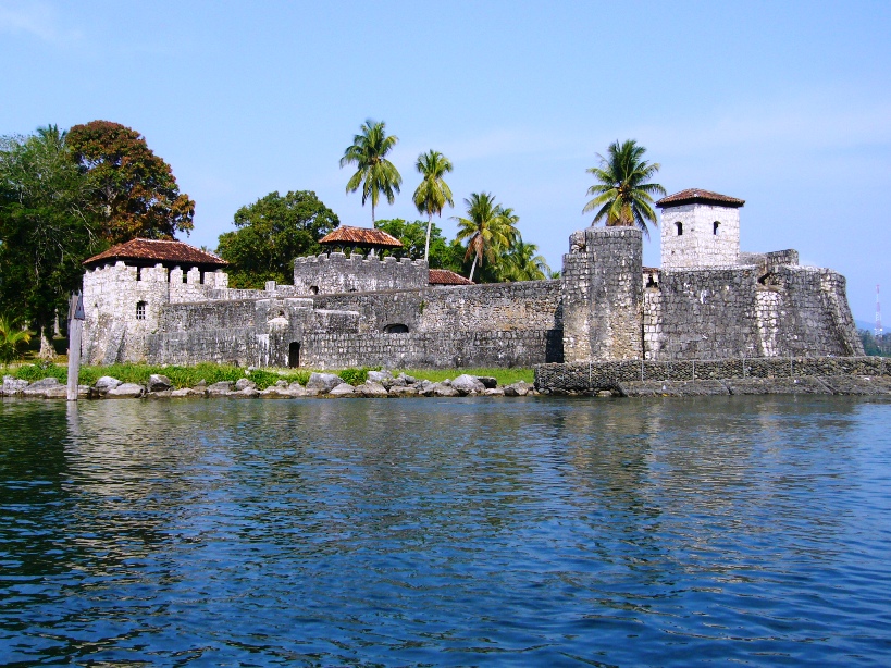
- A dedicated road leads to Castillo de San Felipe de Lara
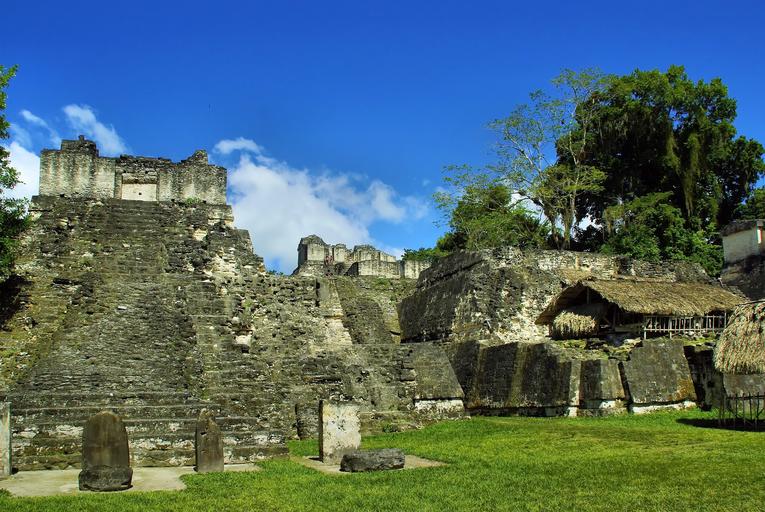
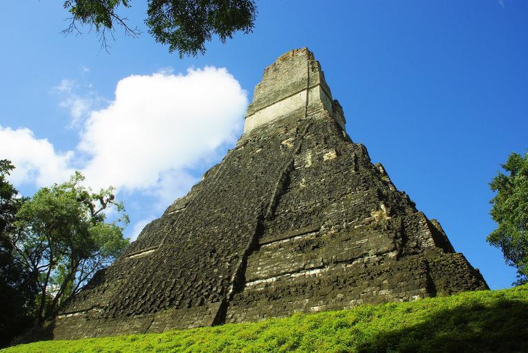
- Tikal preserves monumental Maya ruins
Lívingston is only accessible by boat; expect palm trees and ocean views to the north. Red tuk-tuks are common. Chicken buses are rarely seen here.
A 17th-century Spanish fortress guarding the lake. (参考文献 Castillo de San Felipe de Lara)