


How to Distinguish
- The domain is .ro
- The official language is Romanian Latin use characters
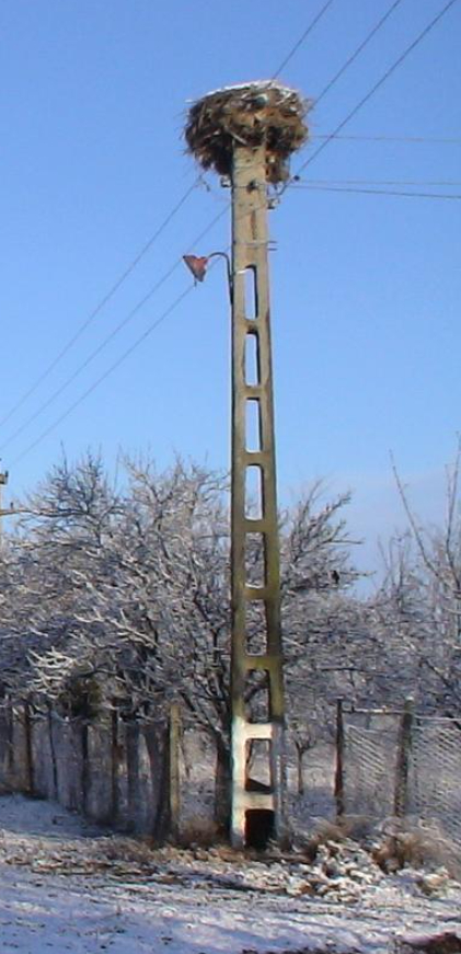
- There is a hole at the bottom of the telephone pole vacant often yellow May have colored markers(by Geotips )
- "Ș・ș"・"Ț・ț” is used in Romania and Moldova
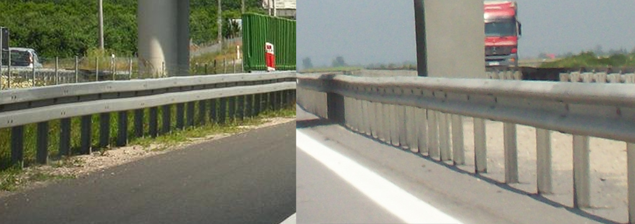
- Guardrails in Romania are square not present
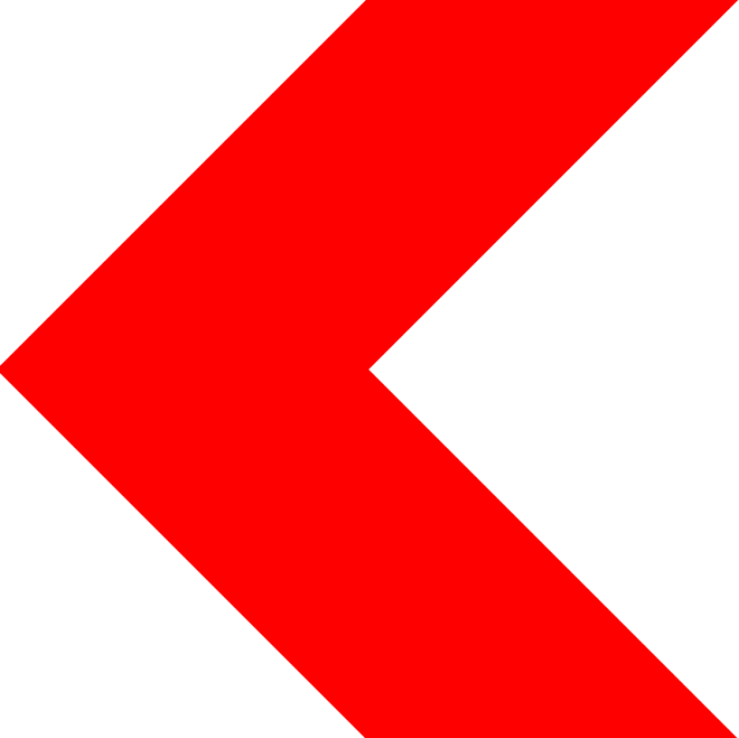
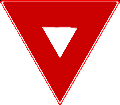
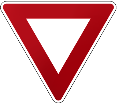
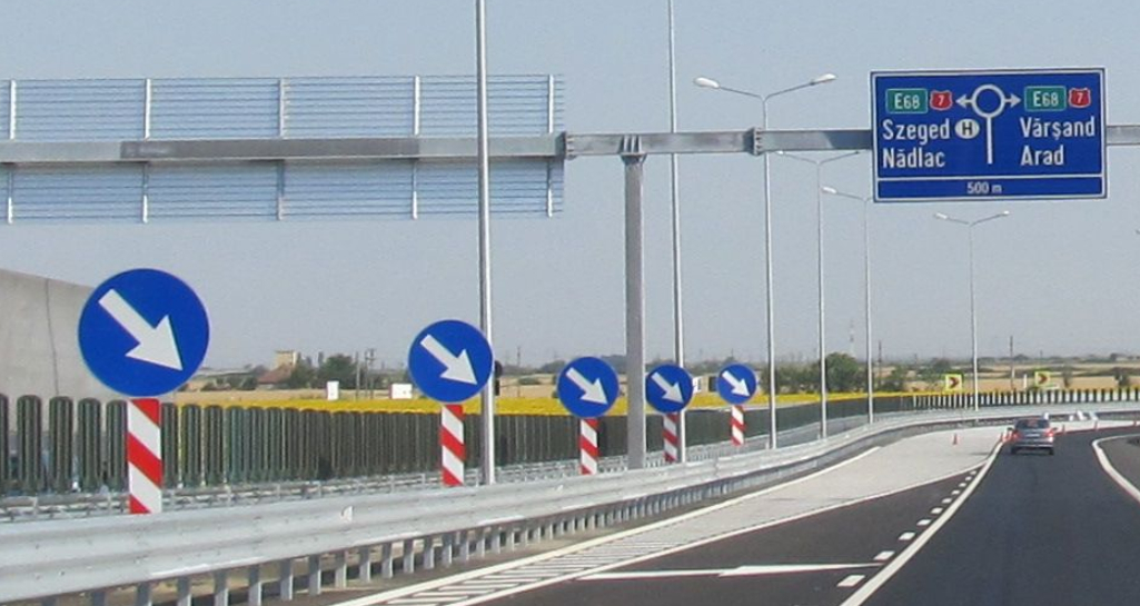
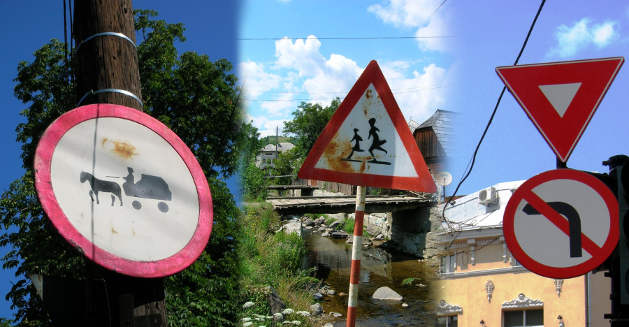
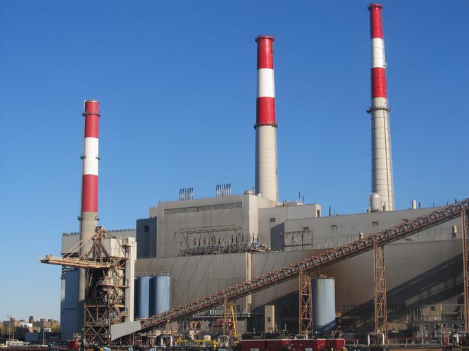
- By far the largest in Europe ▽ There is a sign of
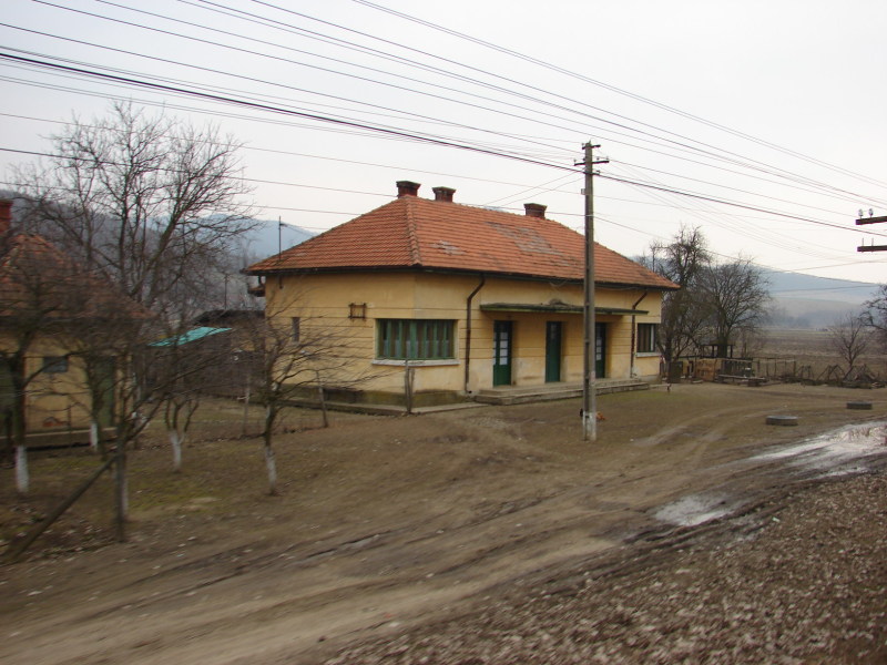
- There is a box in front of the house with a yellow pipe extending out.
- sunflower seeds It seems that the surrounding areas of Serbia, Ukraine, Bulgaria, and Hungary are also close to Romania and have many sunflower fields. Agricultural distribution in Europe
Signs you can find


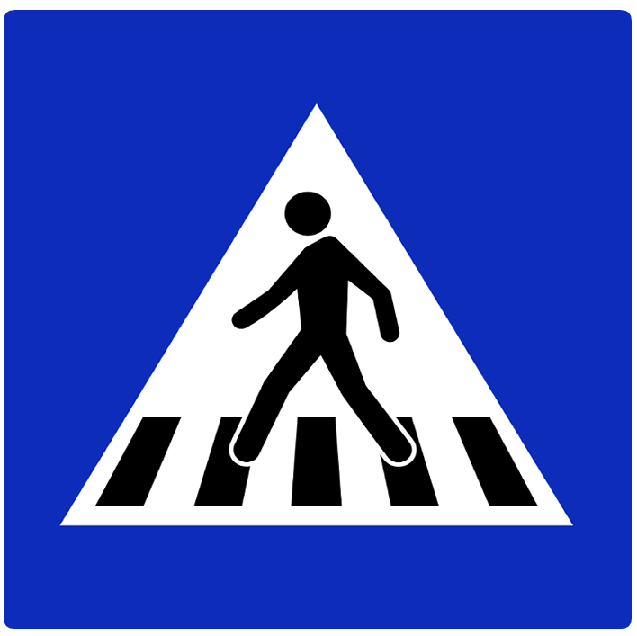
Crosswalk sign: By Gigillo83 - own work, CC BY-SA 4.0, Link
There is a large hole in the telephone pole all the way to the bottom.There is often may appear to be filled in on only one side at the bottom. .If it’s empty all the way to the bottom, it’s Romania. Hungary, if the bottom is not empty PolandMaybe.Often marked with a yellow marker.

By far the largest in Europe ▽ .The thinnest from the left Poland, seems to be fairly thick France, and Romania (参考文献 Comparison of European road signs).


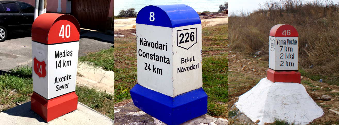
Bollards in Romania have many hints for locating them. (Image Source) .There is also a smaller version .
“Ș・ș"・"Ț・ț S and T with a comma below are used in Romania and Moldova, but Moldova does not have Street View.If “Ļ・ļ” latvia.

By Nenea hartia - own work, CC BY-SA 4.0, Link


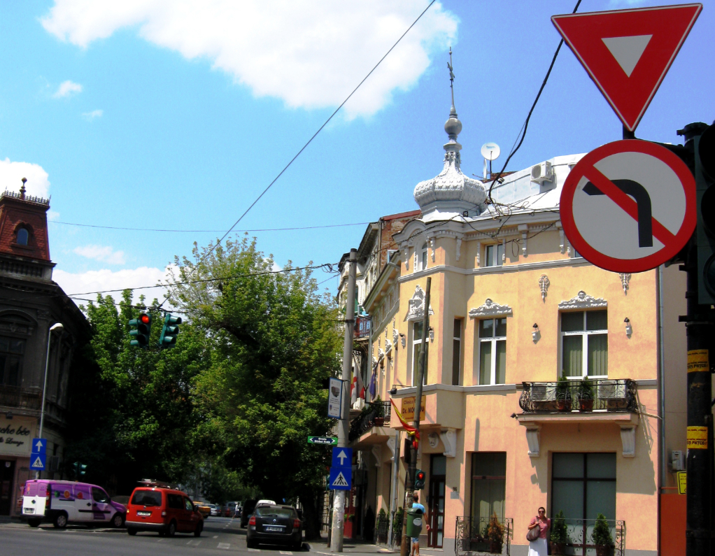
In Romania, the back side of signs is often black. .Also, crosswalk signs may be surrounded by yellow lines. .
Elsewhere in Europe Albania・ north macedonia・ Italy・ san marino・ GermanyThe back side is often black.


Unlike neighboring countries, there is no connection to the signs.The same goes for blue signs and square signs.
The left is Poland, the right is Romania guardrail.Poland Although the guardrail is square,Romania are often not angular (参考文献 European Guardrails).
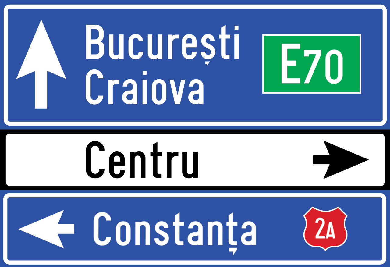
Street names are often written, like in England.
Bollards similar to those in Türkiye and Italy can also be found, although in small numbers.
Narrow down state/region
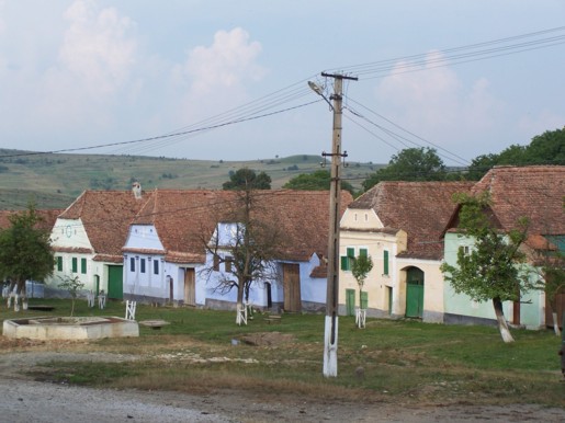
- Roughly speaking, the further you go to the northwest, the more affluent and traditional houses can be found in each region.
(参考文献 Romanian architecture)
(参考文献 Roofing in Romania, Part II: Past as Prologue)
- northwest ■■:The area northwest of the mountain range is richer than the rest, with many orange roofs.
- northeast ■:It has a Ukrainian atmosphere.
- south ■■■:It feels like Bulgaria except for the area around the capital.
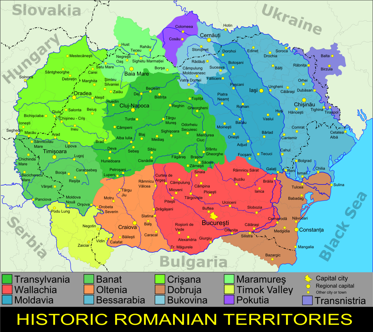
The purple areas have more toilets outdoors.In general, regions with indoor toilets are wealthier.
TODO / Red-brown roof or light blue walls? (参考文献 transylvania).

TODO / Roofs and ducts made of silver material (参考文献 32. to Bucovina).
The high altitude parts are intricate (Image source:https://maps-for-free.com/ ©Openstreetmap contributors)
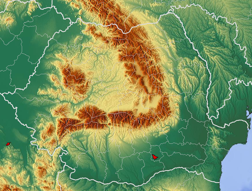
- Areas other than the central mountain range have many flat areas where agriculture is practiced.
- Agricultural distribution in Europe
- Sunflowers are mostly grown in the east.
- Corn and rapeseed are mostly cultivated in the flat areas around Calarasi District.
- Some cities are producing oil and are becoming increasingly industrialized.
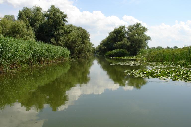
- There is a section where you travel by boat between the delta areas of Europe called the Danube Delta. (参考文献 Danube Delta)
Agriculture is carried out in the orange area.
.jpg)
It is common in the east, but it is not absent in the west either.If there is a sunflower field in the surrounding areas of Bulgaria, Serbia, Hungary, or Ukraine, I feel it would be a good idea to place it near Romania.

.jpg)
Narrow down city/town
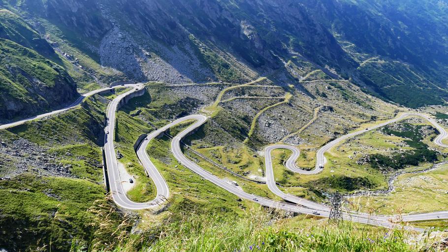
- There is a road that crosses the Fagaras Mountains called Transfăgărășan.
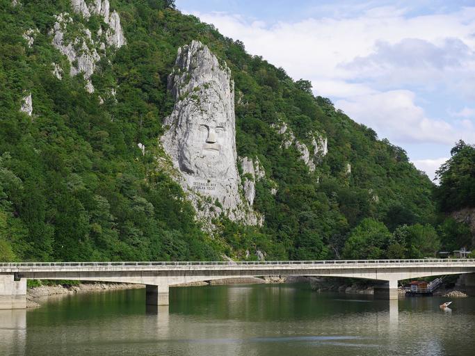
- There is a sculpture of King Decebalus. (参考文献 Rock sculpture of Decebalus)
- The ring road around the capital has "CB" written on the bollards.
If you see “CB”, go around the capital.Since the road is almost circular in shape, in this example the road will either face north or south depending on the angle of the road.From there, you can search for nearby place names and narrow it down to a place on the south side.