


How to Distinguish
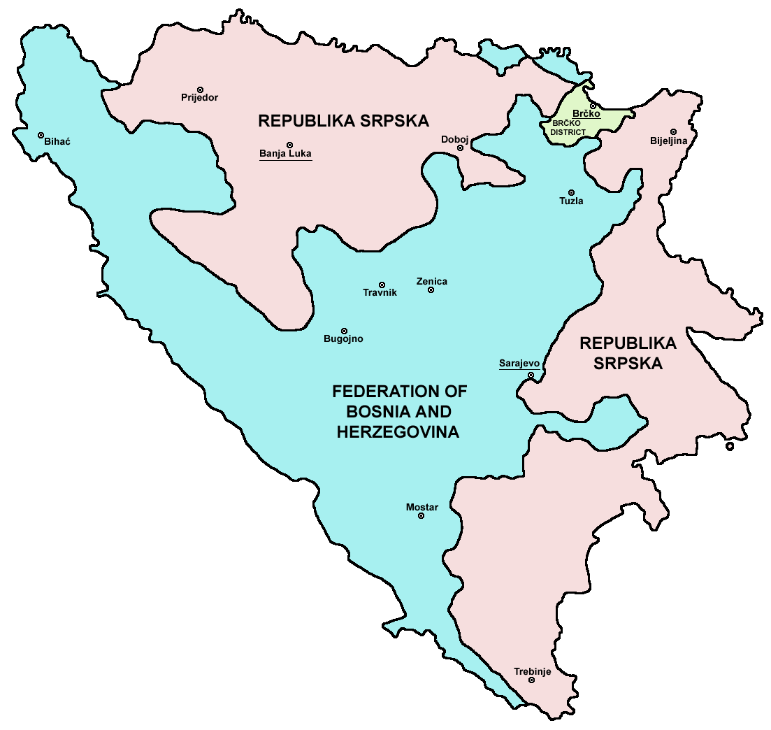
- The country comprises two entities: the Federation of Bosnia and Herzegovina, and Republika Srpska.
- Right-hand traffic.
- The national domain is .ba.
A country of steep karst terrain: towns and roads hug trunk routes, railways, and rivers . Large tunnels for straight highways are costly and tricky, so many roads meander along the valley floor (参考文献 Drina River meanders). You often see beautiful green rivers .

By Darko Gavric - Own work, CC BY-SA 3.0, Link
Boxy guardrails and bollards also appear in neighbouring countries. Because bollards, guardrails, and crosswalk signs from surrounding countries mix together, stay alert.
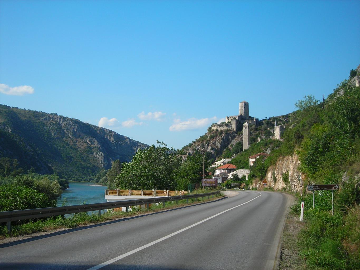
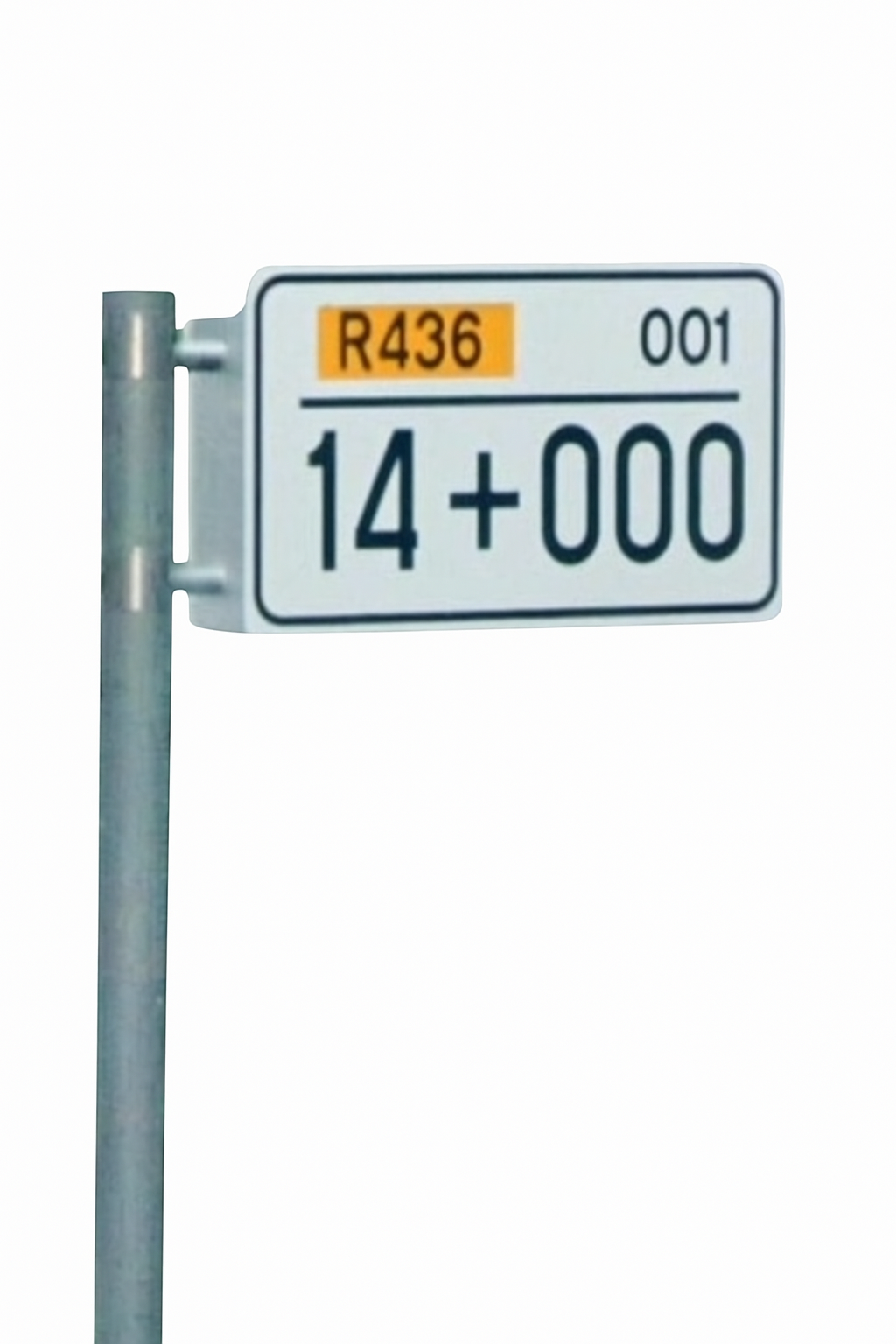
Milepost-style signs similar to Slovenia can be found, and the road number is printed on them .
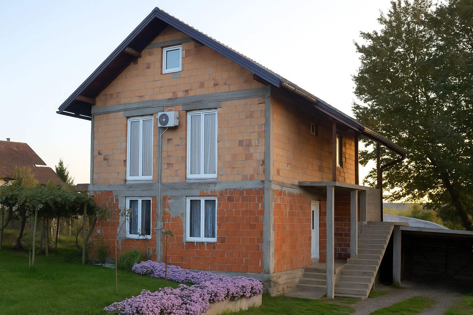
Brick houses like those in the plains of Croatia show up often. Blue fire hydrants are also common, so avoid confusing the two countries.
Narrow down state/region
- The Dayton Agreement (General Framework Agreement for Peace in Bosnia and Herzegovina) defined two administrative entities
- Federation of Bosnia and Herzegovina, where Croats and Bosniaks are the majority
- Republika Srpska, where Serbs are the majority
- Some bilingual signs have one language spray-painted over or vandalized ; a similar phenomenon occurs on Corsica in France.
- The Dinaric Alps cut across the country, giving the south higher and rugged terrain
- Northern plains
- Dinaric Alps
- Southern areas ; near the Neretva river mouth you can feel a Mediterranean climate (参考文献 Neretva River)
- Many railways run along rivers
Languages used and flags flown differ by administrative entity.


The Dinaric Alps spread across the south and include areas over 2,000 m in elevation. The north has a continental climate, while coastal-adjacent southern areas shift toward a Mediterranean climate.

By DzWiki, CC BY-SA 3.0, Link
Rail lines cross the country via Doboj, with many stretches tracking river valleys. For dramatic karst valleys, check the line southwest of Sarajevo.

Narrow down city/town
- Bjelašnica mountain has a tree line around 1,500 m with barren upper slopes.
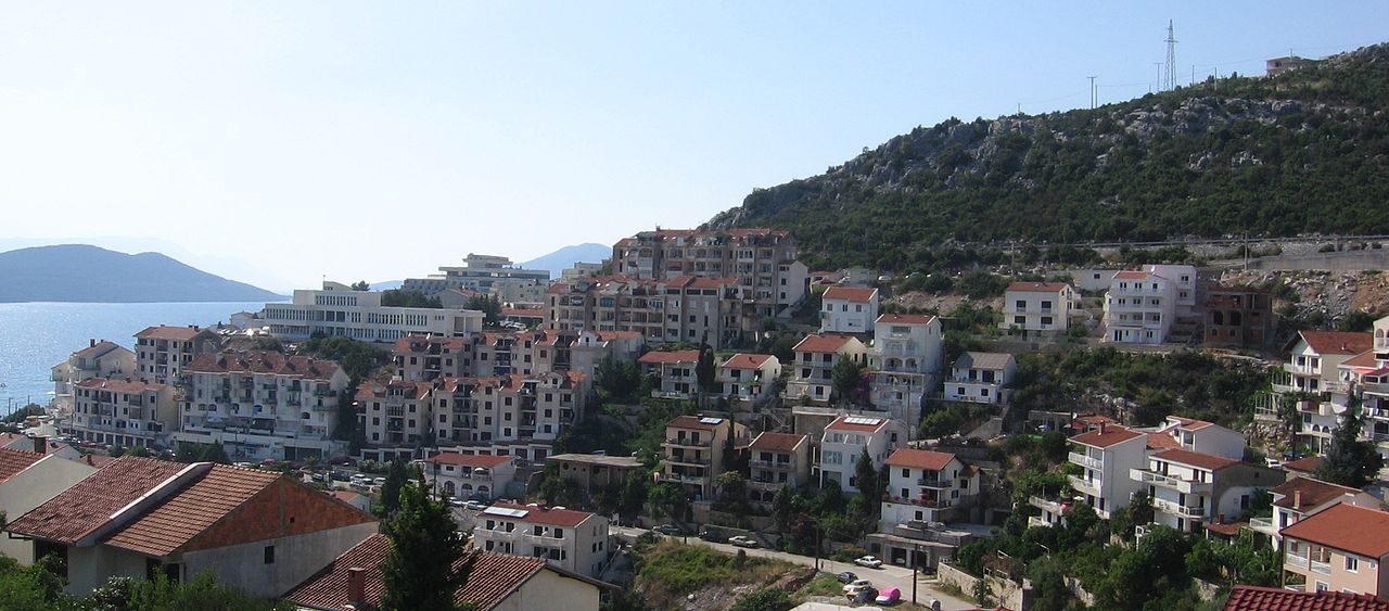
- Neum is the country’s only municipality on the Adriatic Sea.
Bjelašnica’s tree line sits around 1,500 m, so higher elevations lack trees (参考文献 Bjelašnica). Climatically it belongs to the alpine tundra zone (ET).
