

How to Distinguish
- The domain is .vn
- Traffic moves on the right side
- The red national flag is displayed
- Sign poles are red and white striped
- There are red and white bollards
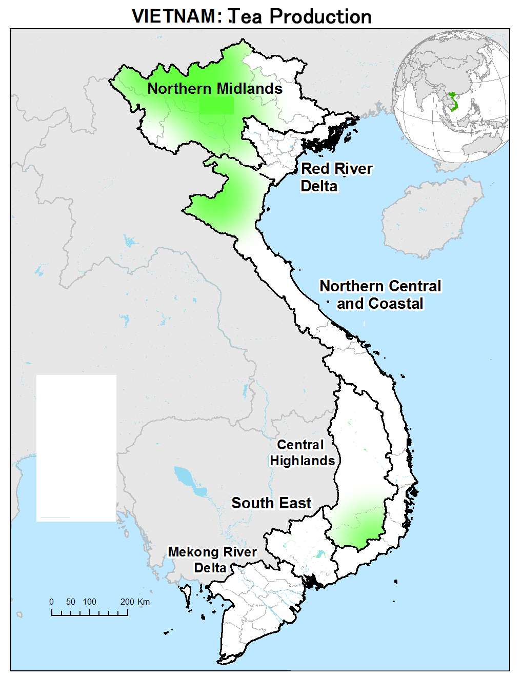
The red national flag is displayed in front of homes or on the street . Traffic moves on the right side.


By Y Kpia Mlo - Own work, CC BY-SA 3.0, Link
Narrow down state/region
Topography
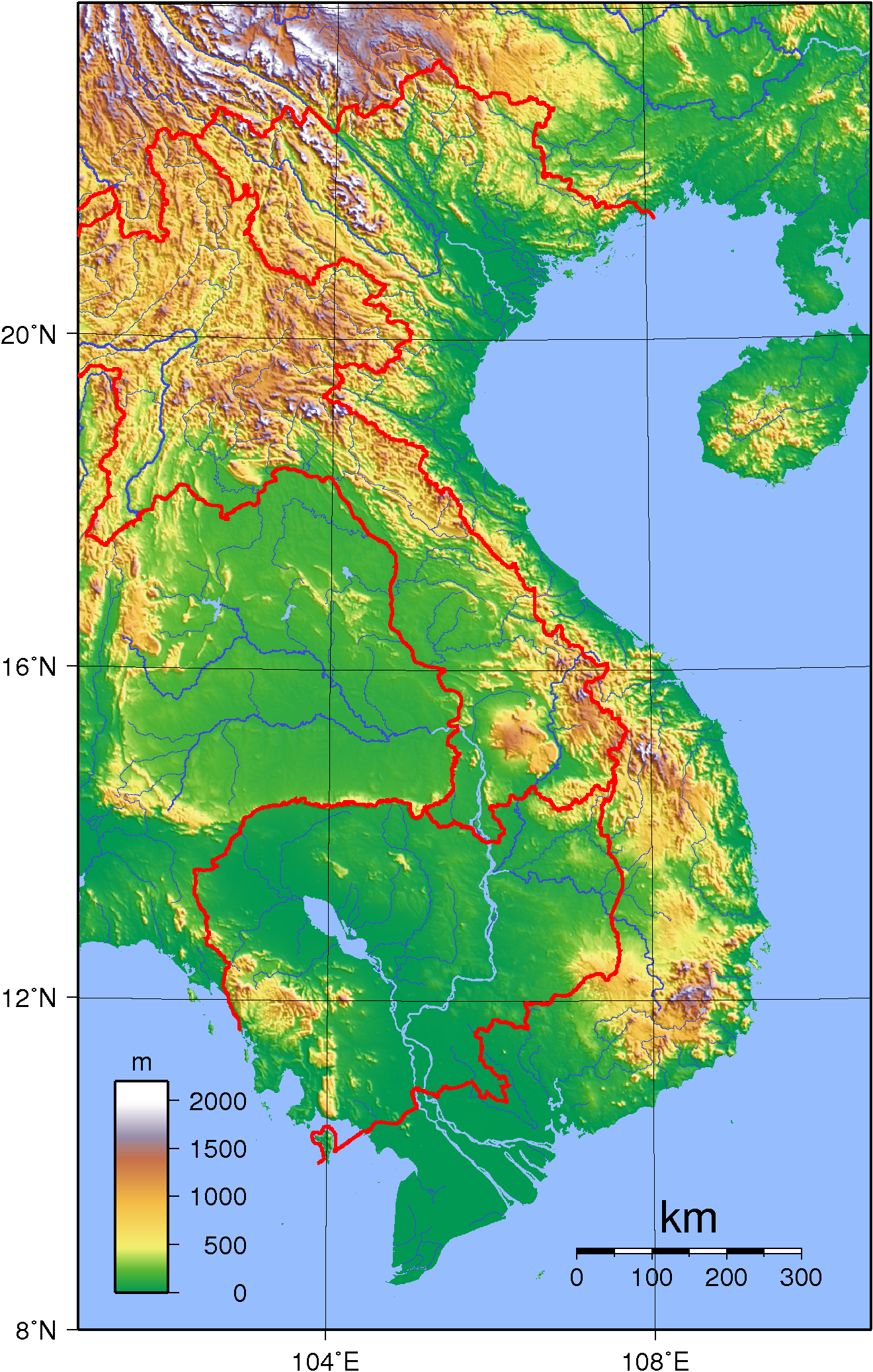
- Mountain ranges extend near the borders, while the Mekong River basin forms a flat plain.
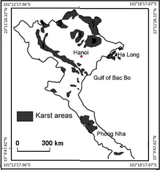
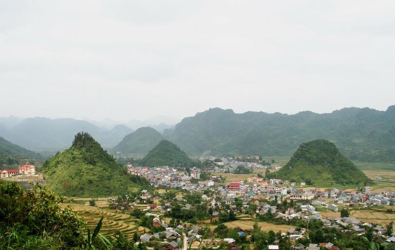
- Karst topography spreads in specific areas of the northern and central regions
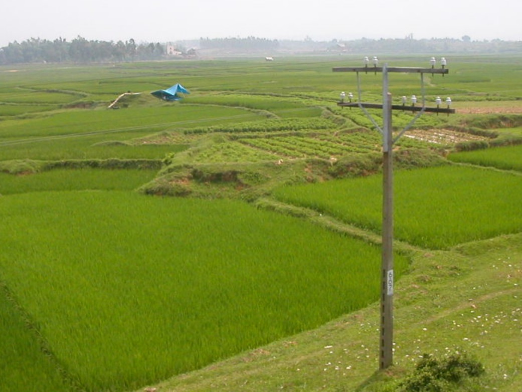
- The Mekong and Red River deltas are active in agriculture and fishing, with a dense network of waterways
- A highland region called Tây Nguyên, about 700m above sea level, stretches across the center. It's known for producing coffee and pepper.
The Annamite Range extends along the border.
The black areas below are believed to feature karst topography (参考文献 Tuan, L. C. 'Characteristics of karst polje in Vietnam and associated geohazards.' Int. J. Sci. Res 9 (2020): 1391-1398.). Many small, sharply pointed irregular mountains can be found, as shown in the photo below.
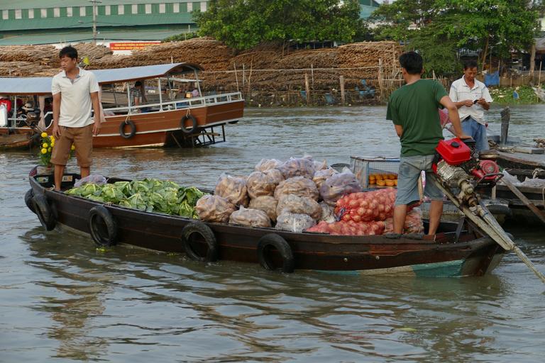
A web-like network of waterways spreads across the area, with many small bridges . Possibly due to geological reasons, there are no railways west of Mỹ Tho City in the Mekong Delta—transport relies on buses and river shipping. Most waterways are surrounded by trees or palm vegetation . A bridge with iron railings + lush vegetation around waterways + inverted triangle utility poles confirms the area (e.g. )?
Like the Mekong Delta, this delta is filled with rice fields and waterways . It has the highest population density in the country. Trees are less densely grown near the waterways .

By An Nguyễn Hải, CC BY-SA 3.0, Link
Unlike the Mekong Delta, there is no dense network of waterways . The area is used for cultivating various crops like coffee and cabbage (参考文献 Tây Nguyên).

By DXLINH - Own work, CC BY-SA 3.0, Link
Buildings
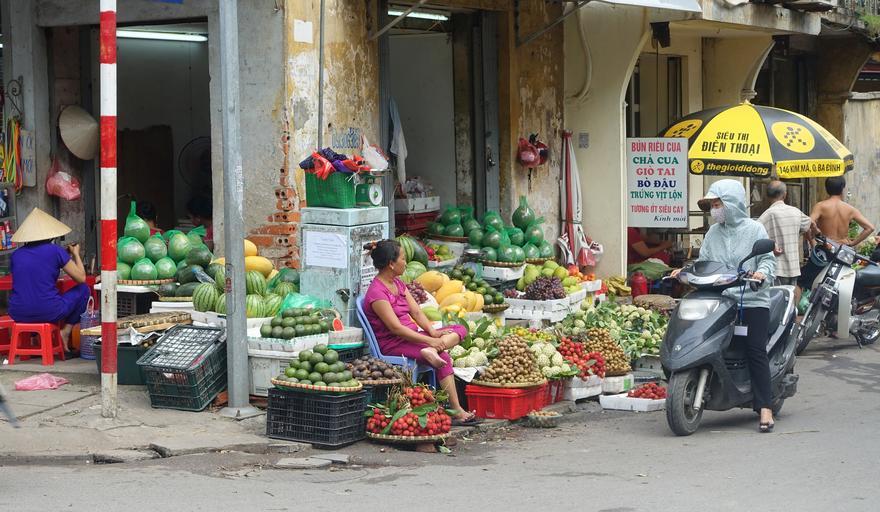
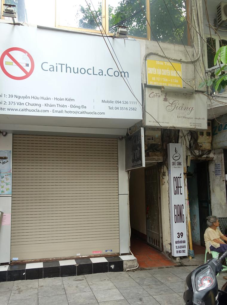
- Addresses are often written on store signs and the like.
- Different companies are responsible for electricity distribution in different regions, and utility poles and equipment may vary accordingly (参考文献 Collaboration Program with the Private Sector for Disseminating Japanese Technology for Electricity Distribution Planning System in Vietnam Final Report)
A major administrative reorganization is planned for 2025, consolidating 6 centrally governed cities and 57 provinces into 6 cities and 28 provinces. Note that this may change what is shown on Google Maps. The map below reflects the pre-reorganization boundaries (please zoom in to check).

Public Domain, Link
Larger administrative areas are typically listed last (though city or province names may be skipped in major cities). The sign shown reads as Khâm Thiên Ward in Đống Đa District.
State-owned electric companies handle distribution regionally, so infrastructure like utility poles may vary (参考文献 【Image Source】Collaboration Program with the Private Sector for Disseminating Japanese Technology for Electricity Distribution Planning System in Vietnam Final Report).
Agriculture
- Rice paddies are mostly found in the Mekong Delta in the south
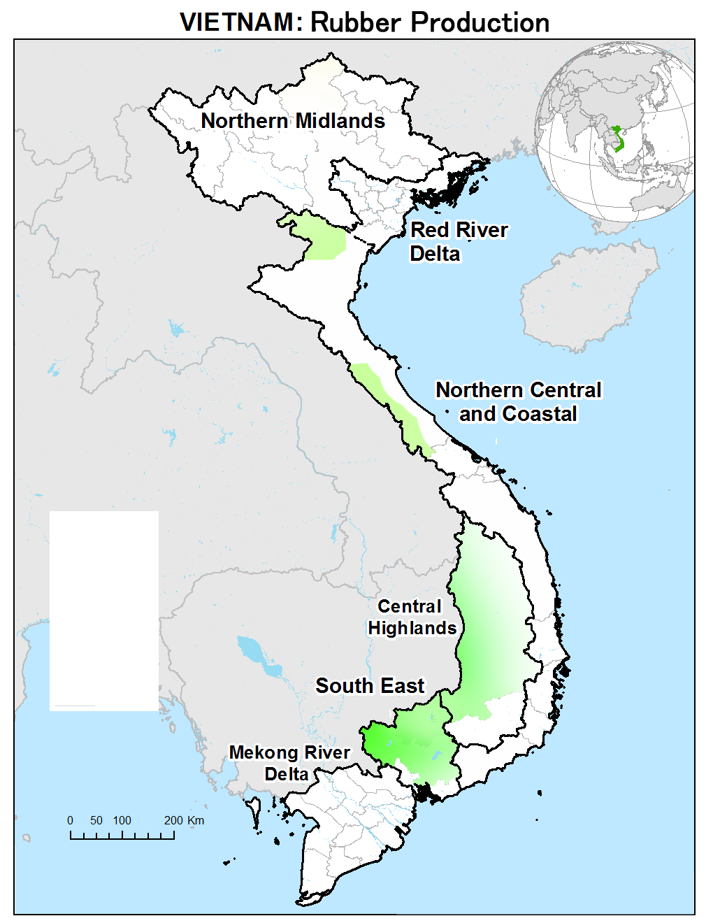
- Rubber plantations are common in inland areas
- Tea plantations are found in the northern and central mountainous regions
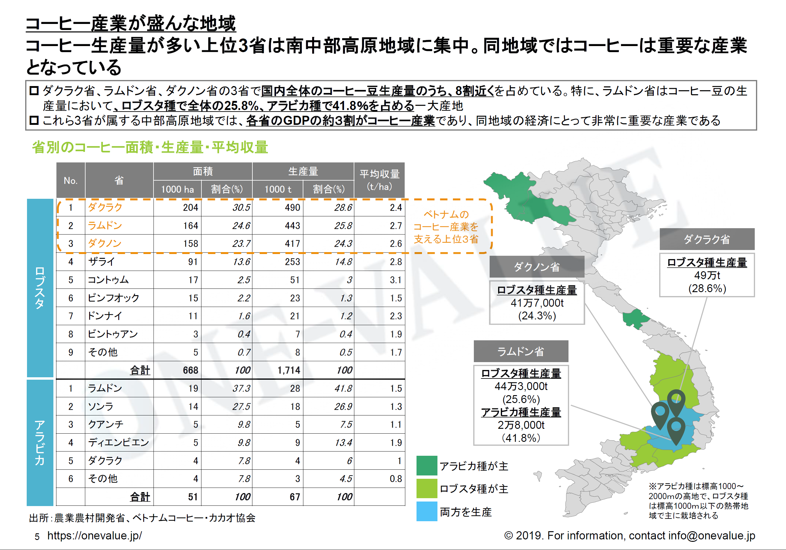
- Coffee production is concentrated in provinces around Tây Nguyên (参考文献 Trends and Potential of Vietnam’s Coffee Industry - VietViz)
- Pepper
- In central regions like Quảng Nam, Quảng Ngãi, and Bình Định, acacia plantations can sometimes be found
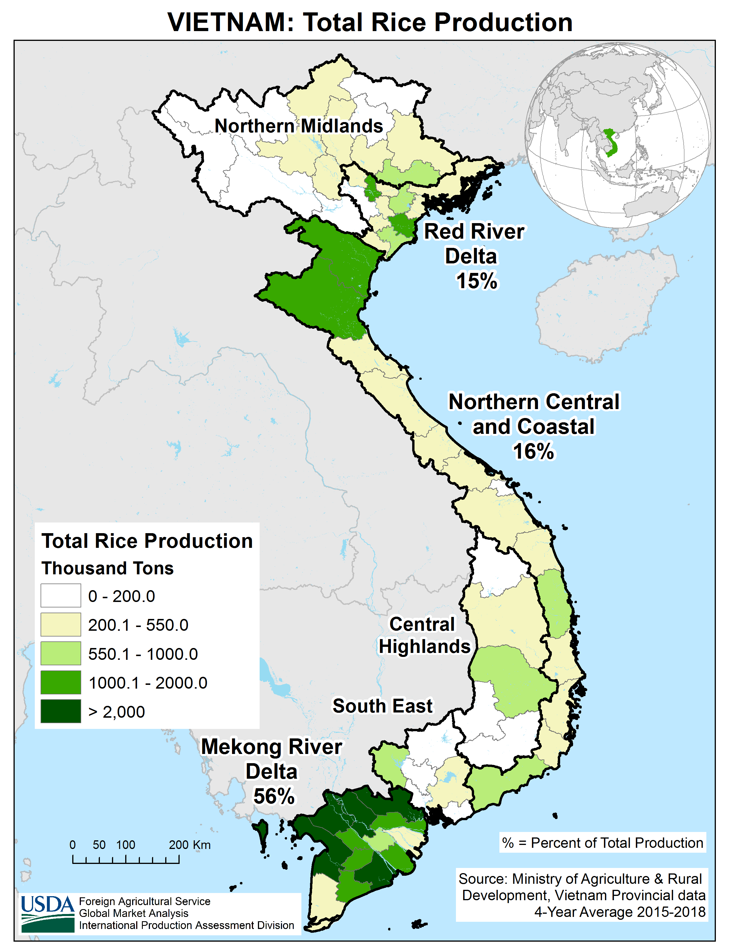
The Mekong River basin accounts for more than half of total rice production , though there are also rice fields in the northern plains . The Red River Delta, while smaller in area than the Mekong Delta, also contains many rice fields (参考文献 Vietnam’s Farmland Policy - Chief Researcher Yasushi Okae).
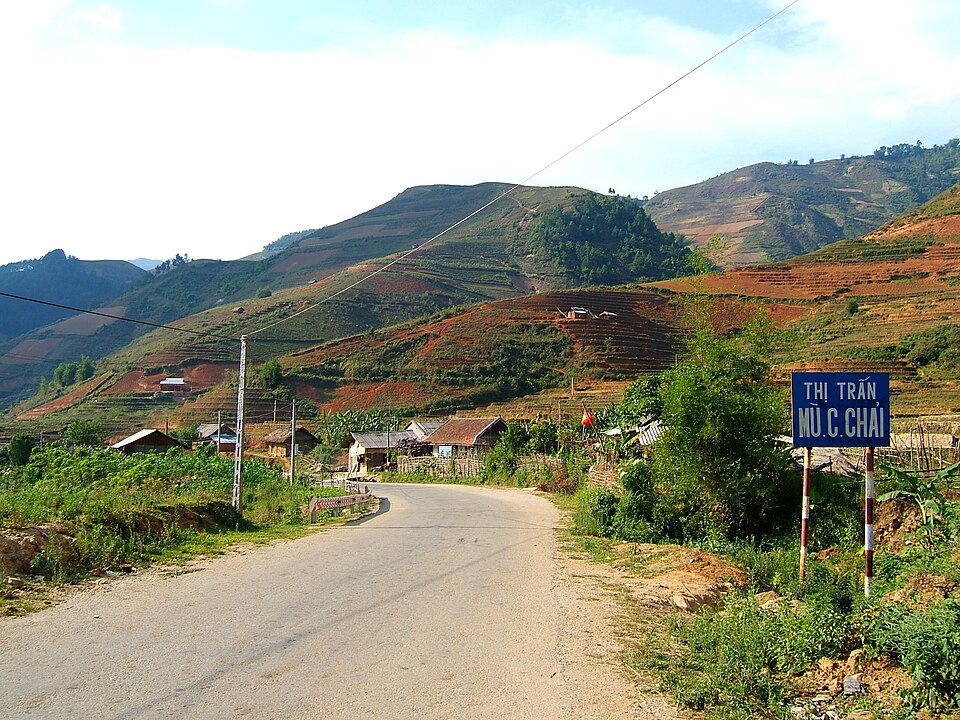
While not high in volume, mountain agriculture centers around tea and rice, and terraced fields can be observed (参考文献 Nghĩa Lộ (xã), Nghĩa Lộ).
Rubber plantations are commonly found in inland areas . Records indicate high concentrations around Gia Lai and Tây Ninh provinces (参考文献 Mapping rubber tree growth in mainland Southeast Asia using time-series MODIS 250 m NDVI and statistical data), although distributions may vary slightly by source.
Tea plantations are distributed in parts of mountainous regions (参考文献 Sustainable tea production through agroecological management practices in Vietnam: a review).
Coffee production thrives in regions with slightly higher elevation (参考文献 【Image Source】Trends and Potential of Vietnam’s Coffee Industry - VietViz).
_(2) (1).jpg)
Detailed distribution is unclear, but it is thought to closely mirror that of coffee and is reportedly nearly absent in the north (参考文献 Main area produce pepper in Vietnam).

By Tonbi ko - Own work, CC BY-SA 4.0, Link
In central Vietnam, acacia plantations are found as a result of a large-scale reforestation project by the Vietnamese government over 30 years ago (参考文献 Mekong Eye: The Acacia Dilemma — Vietnam’s plantations may not be as green as they appear). Vietnam has the largest acacia cultivation area in the world, and it is a key material for flooring.

Narrow down city/town
- Some cities include a city-specific logo on street name signs, which can help identify the city.
- The area along ĐT651 is a resort zone with white sandy beaches along the road.
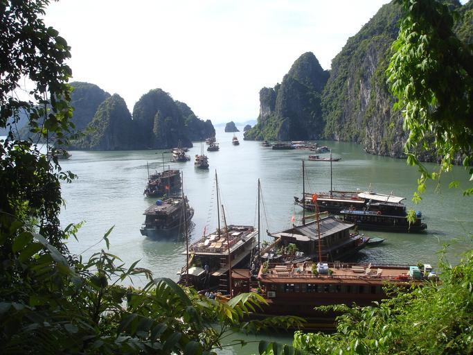
- Hạ Long Bay features submerged karst topography.

Some cities have logos included on street name signs, which can help identify the city. The image shows Hanoi (参考文献 Hanoi).


Although coastal roads are not particularly numerous, unique submerged karst topography—formed by the partial flooding of limestone peaks—spreads along the coastline (参考文献 Submerged Karst Topography of Ha Long Bay – Geological Survey Institute, Sadahisa Sudo).
- Phú Quốc Island, an offshore island near Cambodia, is also covered.
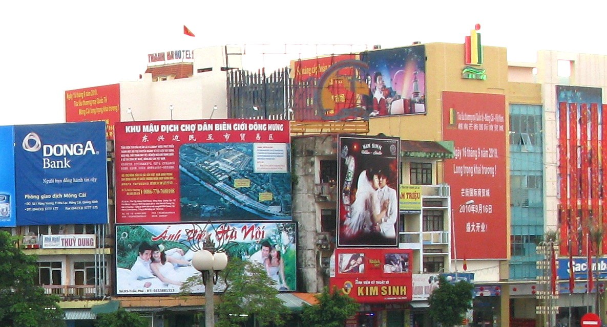
- Móng Cái is a city active in trade with China, where Mandarin and Cantonese are also spoken.