

Agricultural Distribution
- If you see corn, it's safer to head east of the central region.
- Rice fields: if utility poles have yellow markings, it's likely northern California; if not, it's along the Mississippi River.
- Data source: U.S. Department of Agriculture
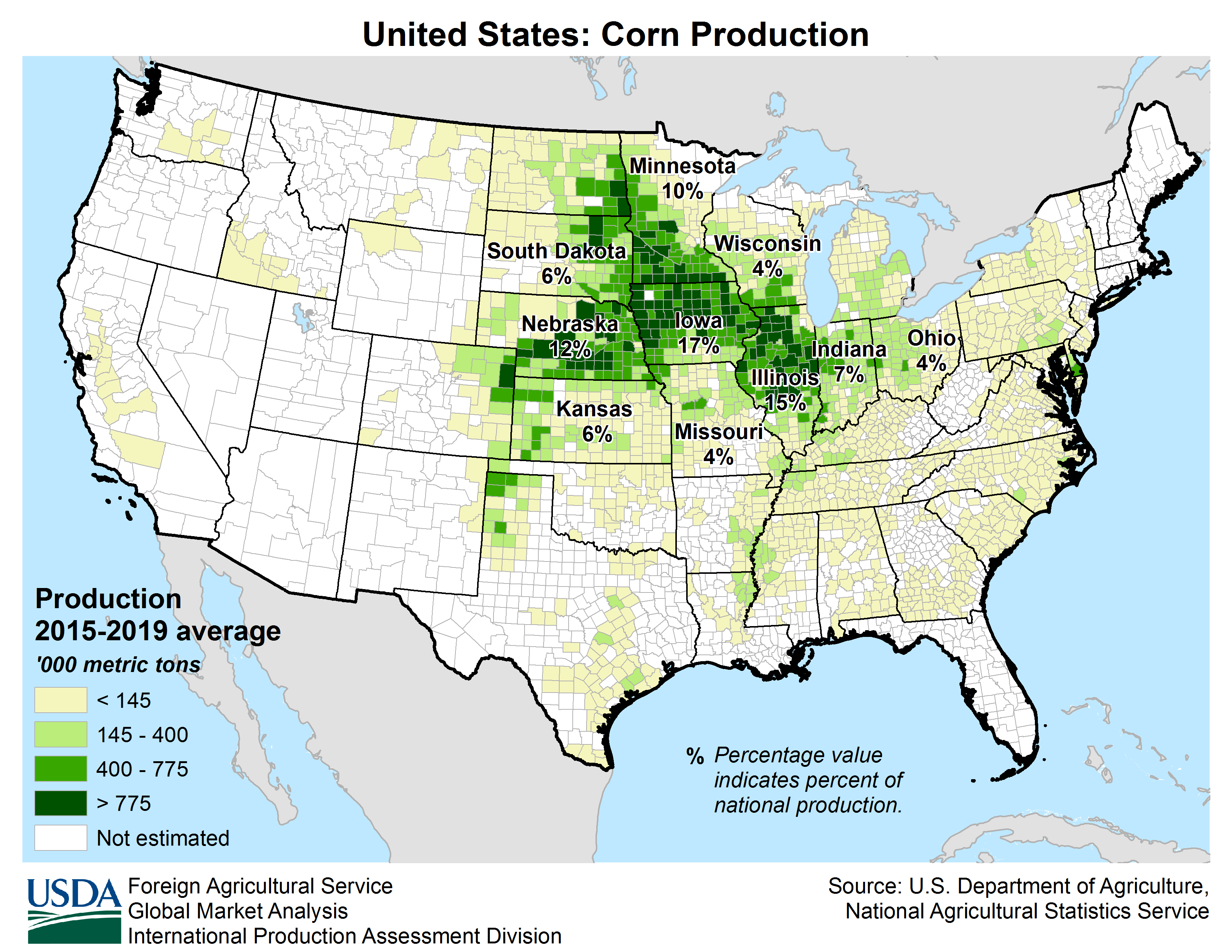
Corn production is concentrated along the Corn Belt (参考文献 Corn: Production Acreage by County(USDA)). However, corn is widely grown across the country, so its presence alone doesn’t guarantee it’s the central region.
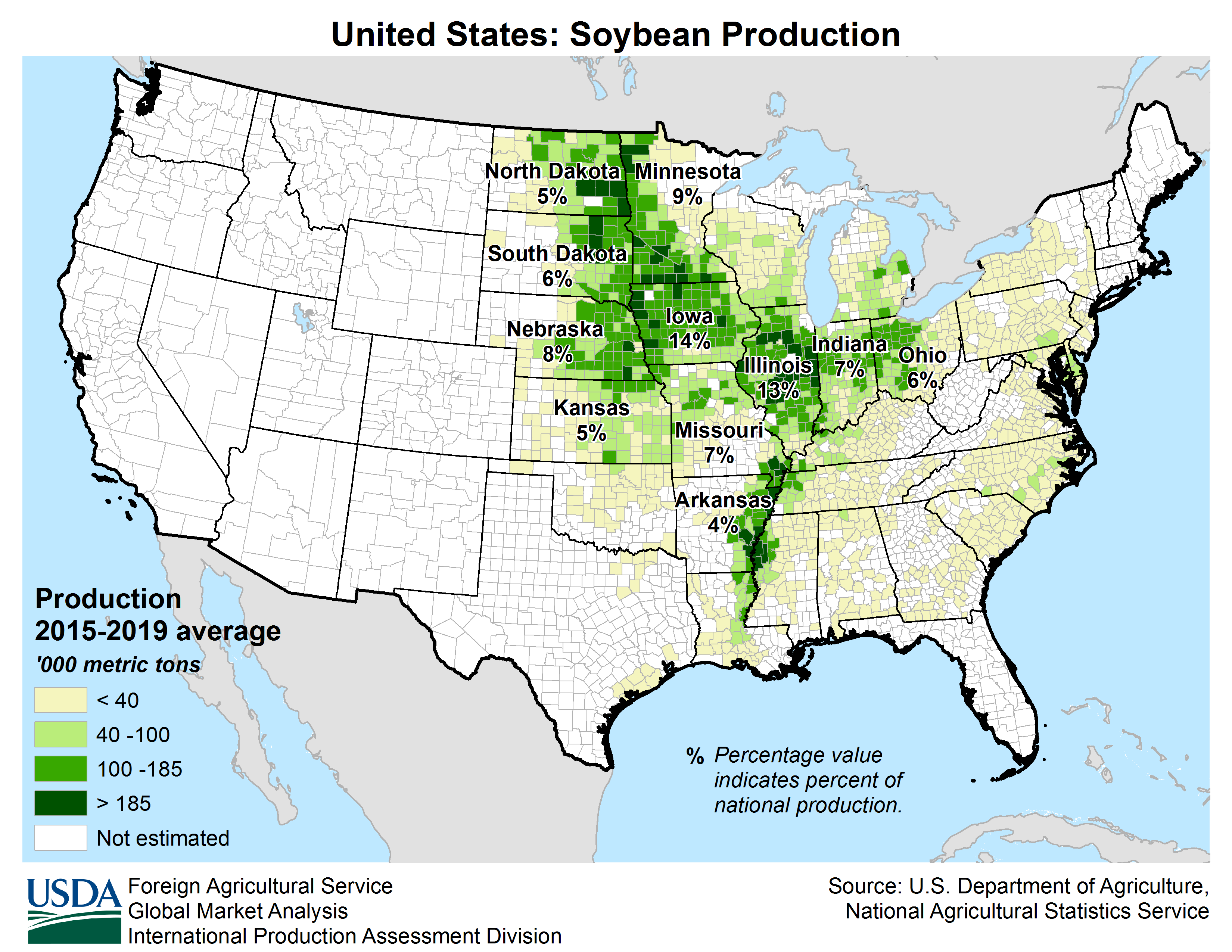
Soybean distribution is similar to corn’s (参考文献 Crop Production Maps(USDA)).
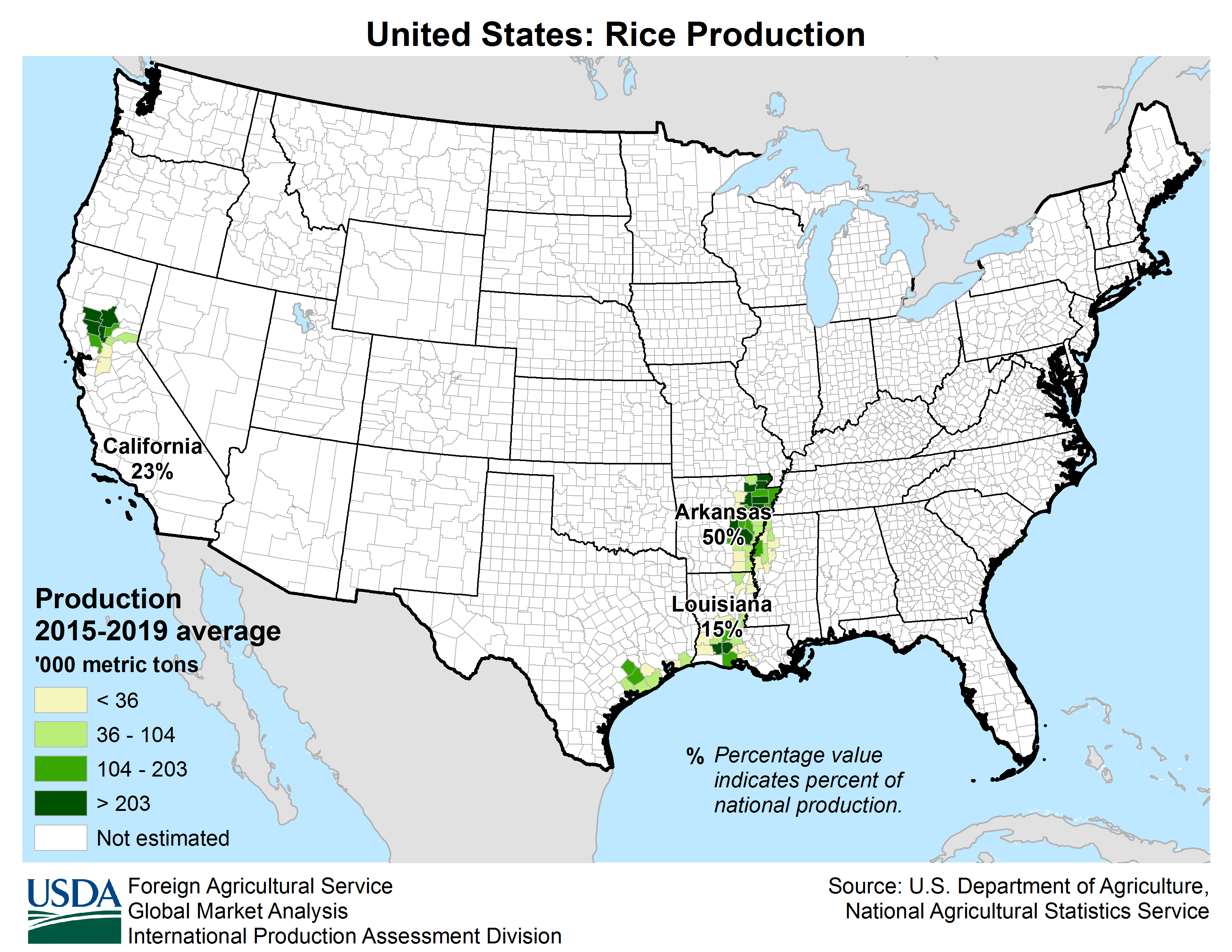
Rice paddies are mostly found in specific regions of California and along the rivers and coastal areas of Arkansas (参考文献 Crop Production Maps(USDA)). Clues from utility poles might help identify California?
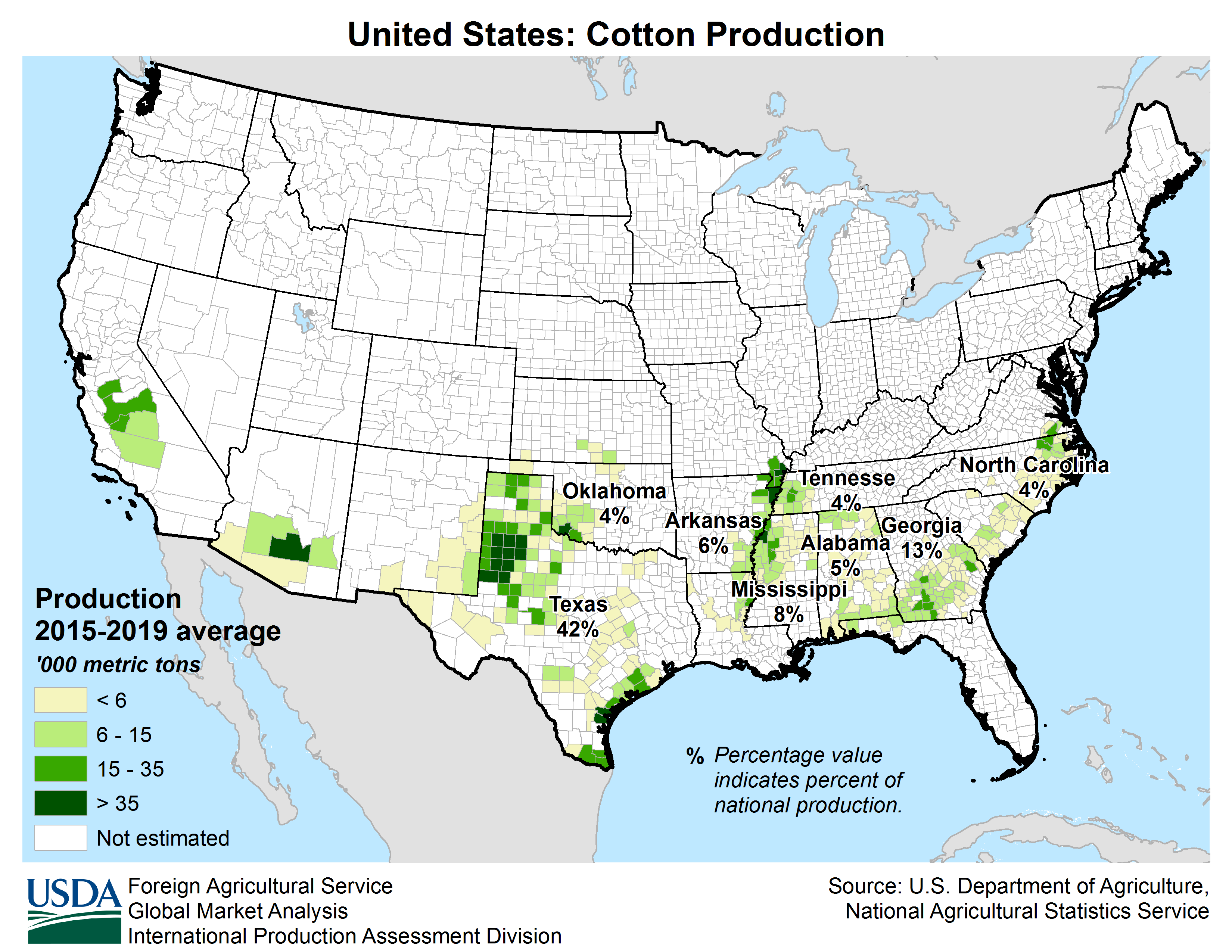
Cotton may not be visually prominent, but you might notice white cotton along the roadside (参考文献 Crop Production Maps(USDA)).
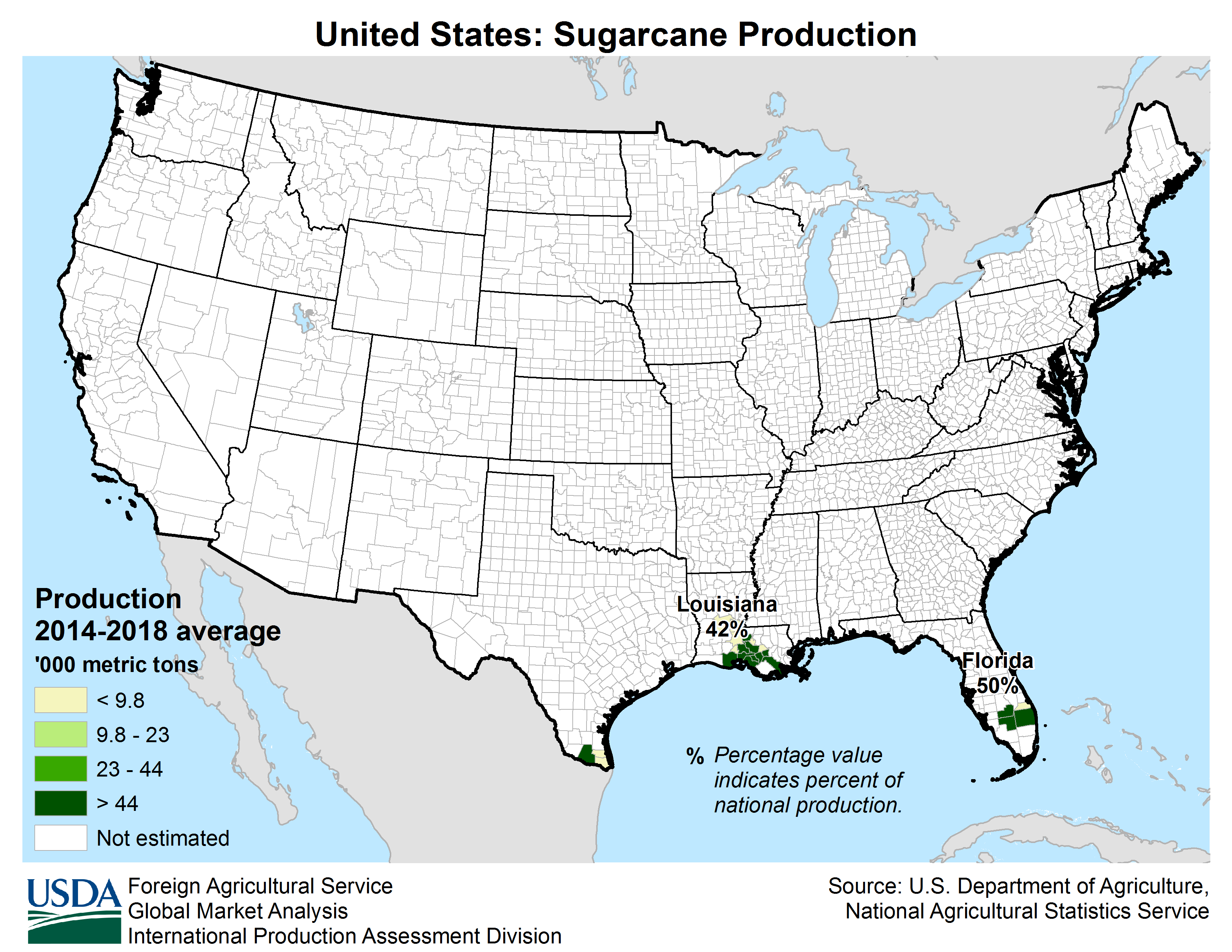
Sugarcane is grown only in specific areas near Florida, with Louisiana having very limited roads (参考文献 Crop Production Maps(USDA)).
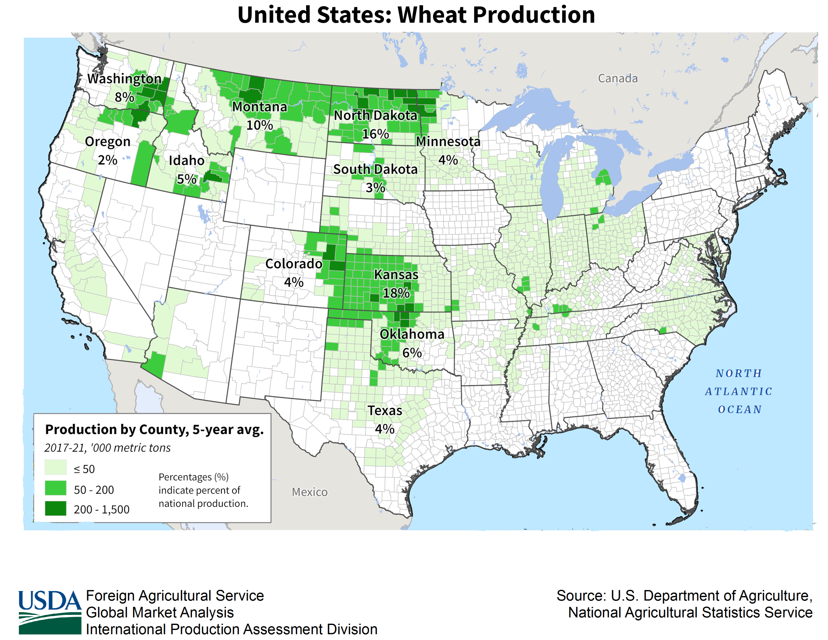
Wheat regions do not overlap with those for corn or soybeans. The wheat map image has been slightly edited to match the shape of maps used for other crops.